 |    |
Interior U.S. Trip Part 1
(March - May 2020)
I finished a contract and decided to explore the interior of the United States. I only made it halfway before the governments started shutting sites. So, I stayed with my brother for a month and a half!This trip page recounts part one of my road trip to explore the interior of our nation. I want to encourage individuals to visit these states instead of flying over or driving through them!
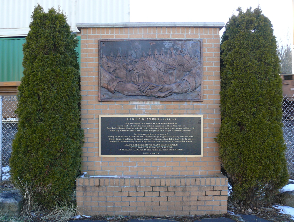
In the small town of Lilly, Pennsylvania, an incredible event took place on the 5th of April, 1924. The Ku Klux Klan sought to demonstrate the dismissal of Klan members from the coal mines. (The mine owners didn't realize that they were KKK members, but fired them when they found out.) Four hundred of the creeps arrived via rail, burned two crosses, and detonated dynamite! The townsfolk weren't going to be frightened. They attacked them and a gun fight began. Three men from the town died; however, the invaders ran back to the train and were never seen again. Amazing story! The other Northeastern states have the folks of this small town to thank. Click for a larger view.
Next stop is a memorial to another group of courageous individuals. Near Shanksville, Pennsylvania, the passenger-airliner-turned-weapon was recovered from hijackers and crashed into a farmer's field. The park is a pleasant place to visit.
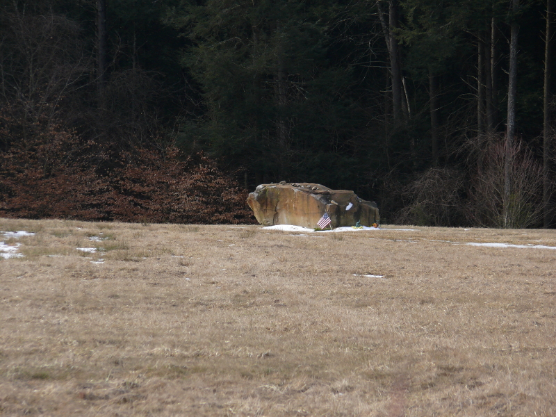
After the crater was filled in, the FBI had a boulder placed at the point of impact. The above photo was taken with 12X zoom.
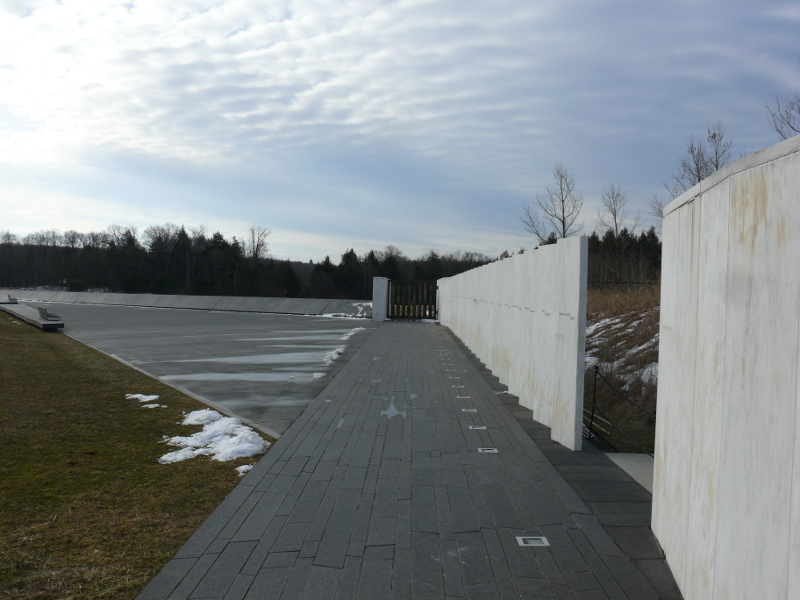
There's a stone tablet for each passenger and crew of Flight 93. They're aligned in a such way to form an arrow, which indicates the flight path.
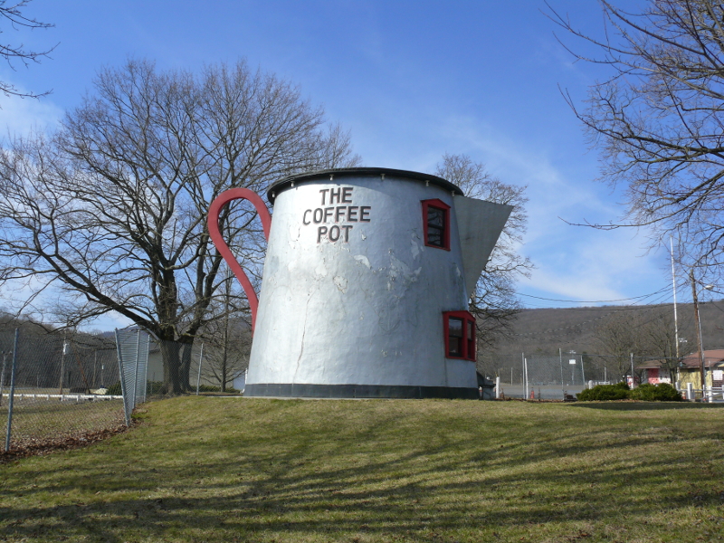
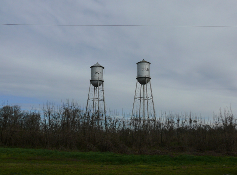
In Bedford, Pennsylvania, there's a giant coffee pot! Its purpose was to attract motorists in the '20s and '30s to patronize a filling station along Lincoln Highway. It was moved to be adjacent to the fairgrounds.
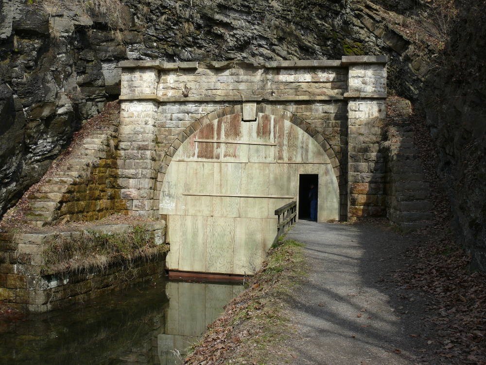
Near Oldtown, Maryland is an unusual tunnel. The Paw Paw Tunnel bypasses the meandering Potomac River. The canal company paid for the tunnel to be dug to compete with the railroad for transportation customers. It's 3,118 feet long. That's nearly six-tenths of a mile! I didn't realize how long it was. Fortunately, I met a kind couple who lent me a flashlight. They were touring sites in their home state of Maryland. We had serveral enjoyable conversations about travel!
You can see that the canal is walled off, leaving only a door to allow pedestrians through. Click for a larger view.
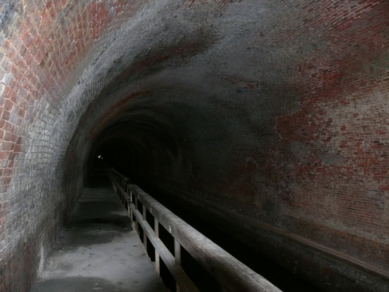
The interior is lined with brick. There are different type of bricks regularly. Maybe they cover air shafts? There are two vertical shafts through which the spoil was removed from the tunnel. 200,000 cubic yards of material was hauled out of the tunnel!
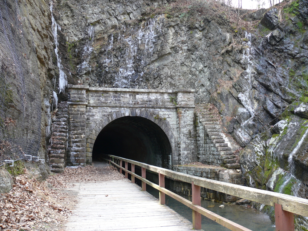
We emerged into the dim light. The structure of the hill was unusual! Click for a larger view.
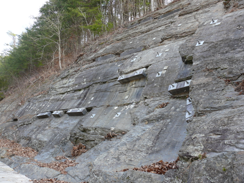
Slate lined the valley of the canal. There are supports to stop the slate from breaking off and sliding down. One of those could kill someone! Need to build a pool table?

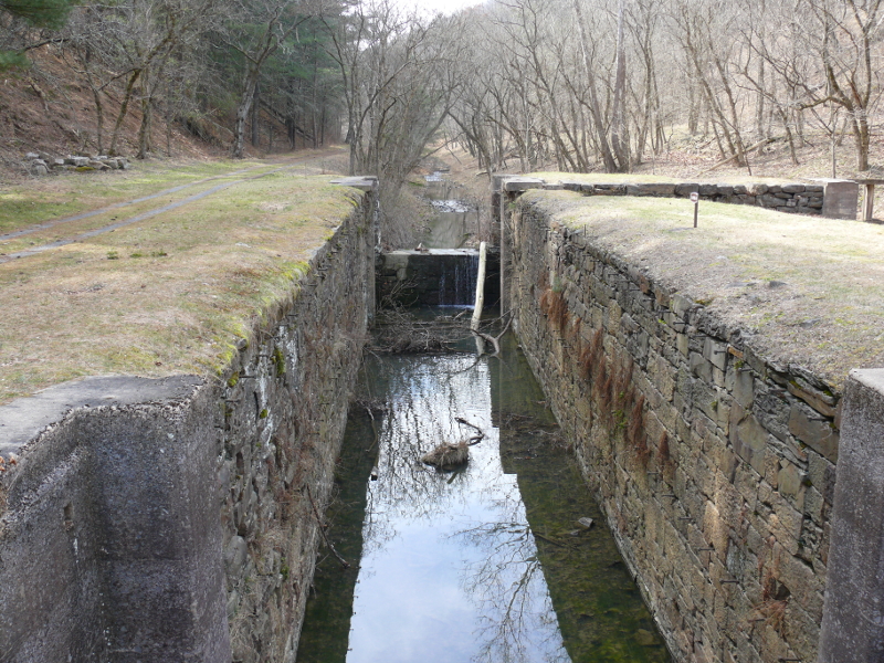
I continued along the canal towards the river. I stopped at the three locks. I returned to the other side of the tunnel by the Hill Trail. It was a good hike of two miles! This trail was used on a daily basis by the workers to dig the tunnel. The workers lived and worked in difficult conditions. They needed the work because they had just arrived from Ireland and Germany. Construction lasted 14 years, finishing in 1850!
I met a park ranger who had visited New Zealand, too. Also, I met an older couple on the trail to the parking lot. They all knew my name! Evidently, my new friends with the spare flashlight had told others to make sure that I got back to my car alright. What kind people!
I took a photo of the Potomac from the hill. It worked out prety well. See it here.
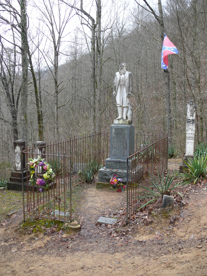
I had to visit some of the sites from the infamous Hatfield-McCoy feud. Up a steep hill is the Hatfield Family Cemetery. "Devil Anse" Hatfield had a statue made of himself out of Italian marble. He also fought in the War Between The States, if you didn't notice the flag. There are many Hatfields buried there. Some of the headstones were overgrown. This area is quite remote. I almost ran off the road trying to drive at the high speed limits!
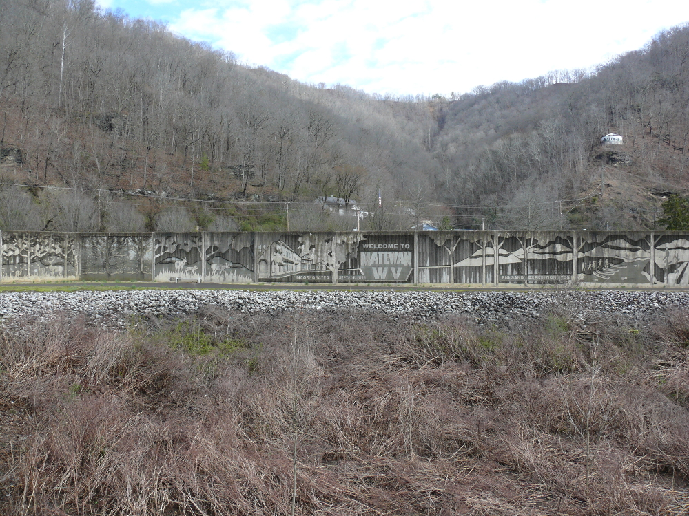
I continued to the river border with Kentucky. There's a border crossing at Matewan, West Virginia. This town is interesting because of its large flood wall and sliding, steel door. The Tug Fork River flooded the town so the Army Corps of Engineers erected this wall to protect the 500 or so inhabitants of the town. Click for a larger view.
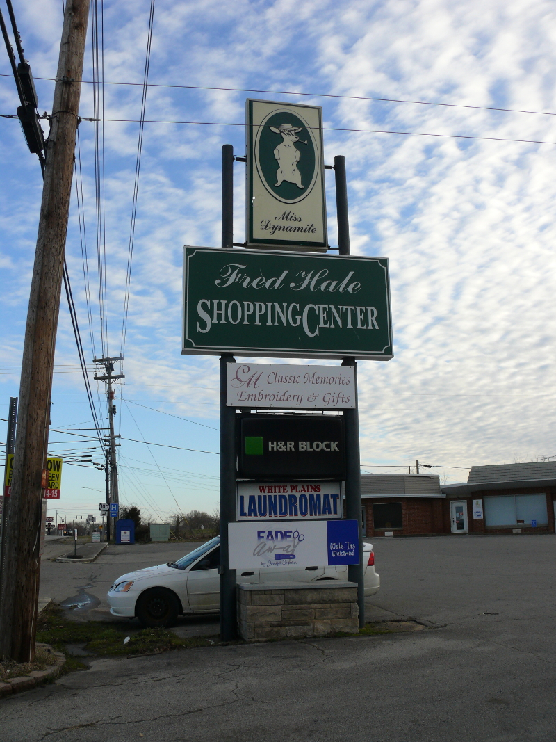
Some people really love their dogs. And then some people really, really love their dogs. Beneath the sign for Fred Hale Shopping Center is a stone tomb for a dog! See the tomb here.
Need I say anything? The farmland around there was well kept and picturesque! Franklin, Kentucky is a neat little city, too.
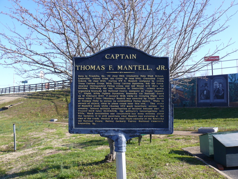
Franklin is also known for where Captain Mantell blacked-out and crashed his P-51 Mustang. He took the plane into a steep climb to pursue an UFO. The Air Force has since excused the accident, stating that he was pursuing a balloon in the top secret Project Skyhook. I listened to an intriguing book about UFOs, and Mantell features quite prominently.
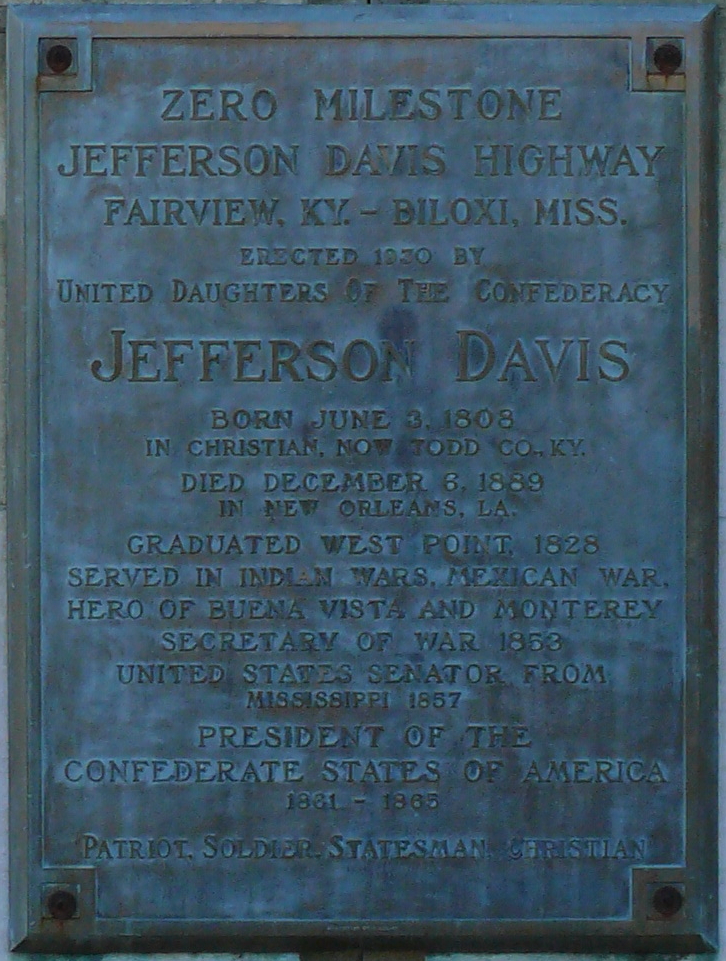
In Fairview, Kentucky is Jefferson Davis State Historic Site. That is where the Jefferson Davis Highway begins. There's a marker signifying the importance. Click to see the inscription.
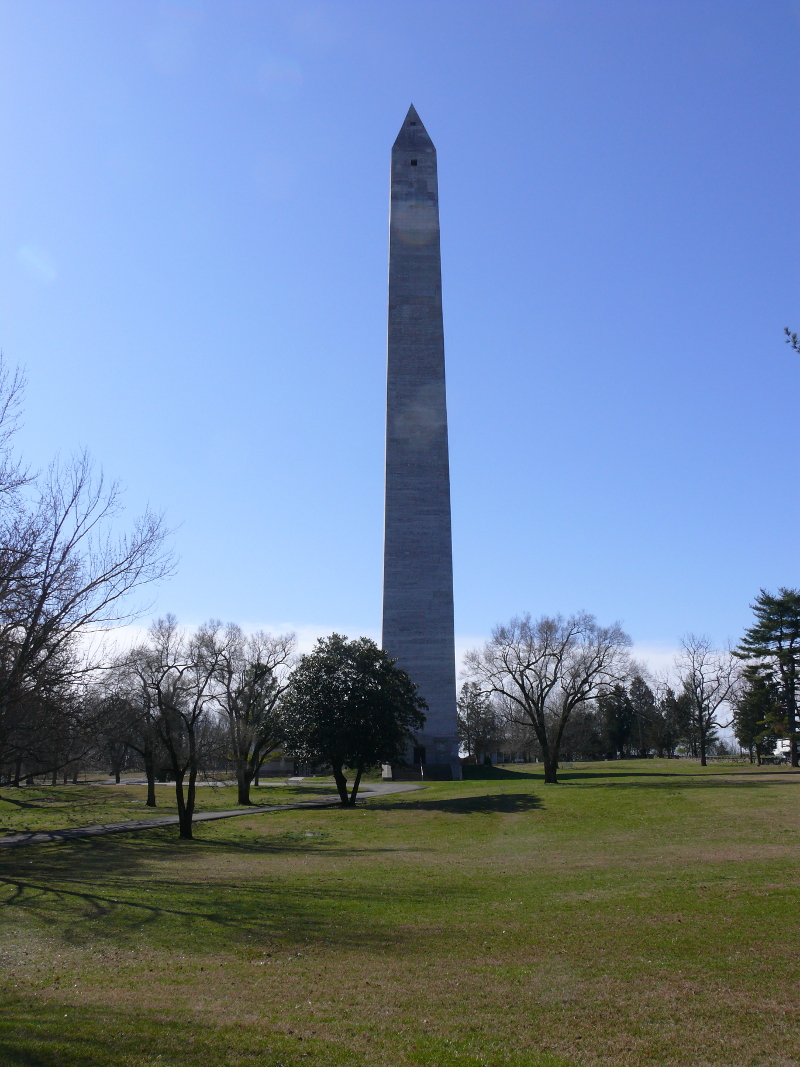
Wait a minute, did Kentucky steal the Washington Monument? Nope, this one is dedicated to Jefferson Davis. Amazing! Jefferson Davis was born in the house at the Site.
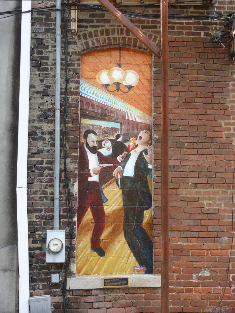
Many states have small towns named after the French capital city. Some even have a back alley filled with murals. However, I think only Tennessee has a mural where a man is shooting another in a bar! The story goes that pictured is a duel, which was elicited by a previous duel in the street. But it all ends well, because the man married the sister of his victim. Small towns, huh!
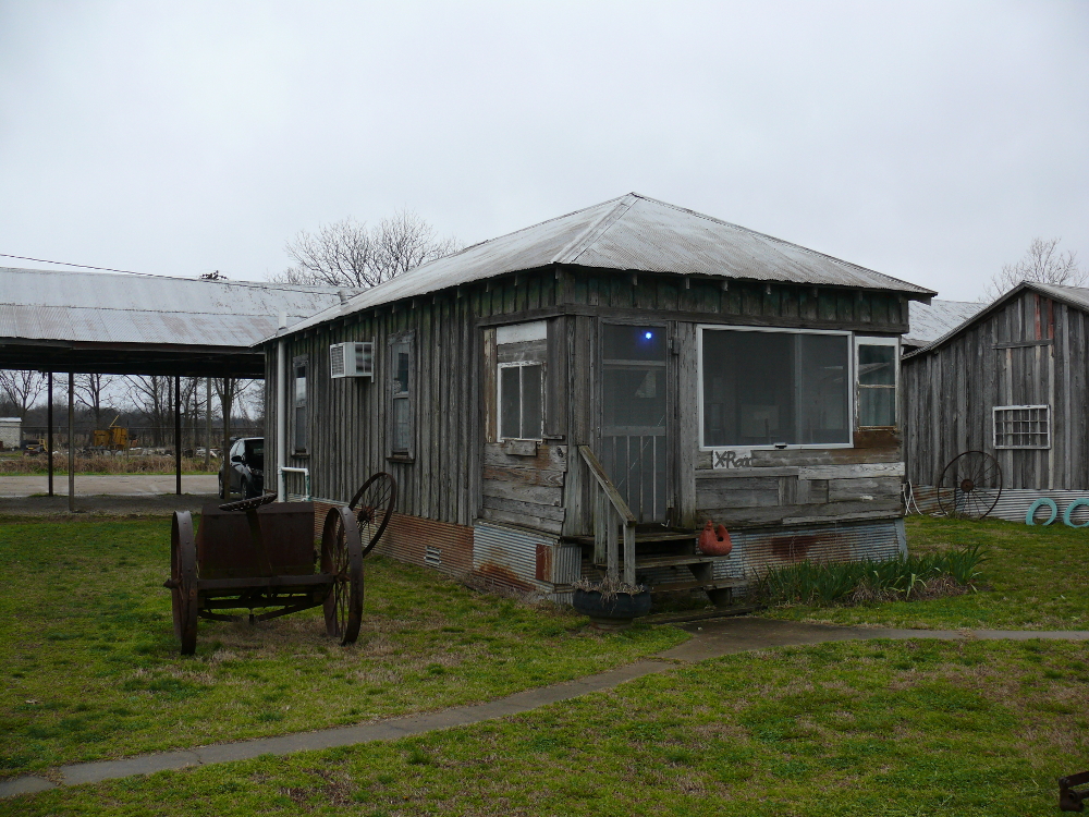
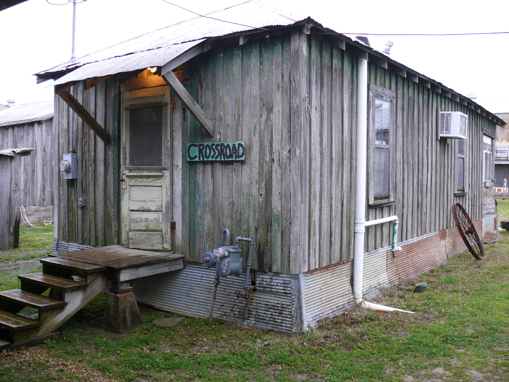
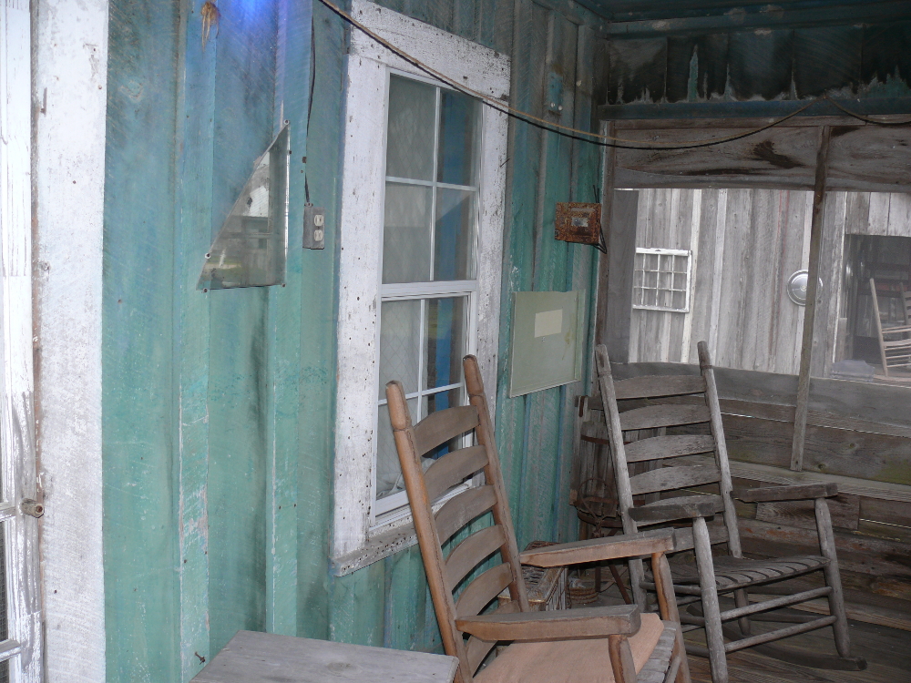
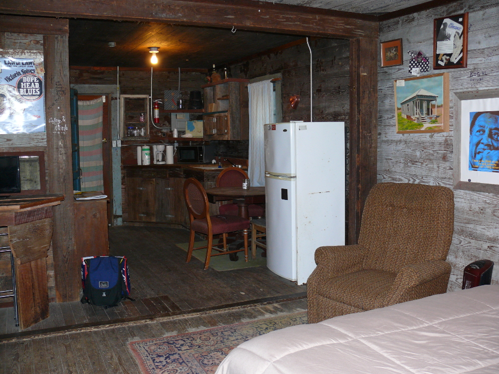
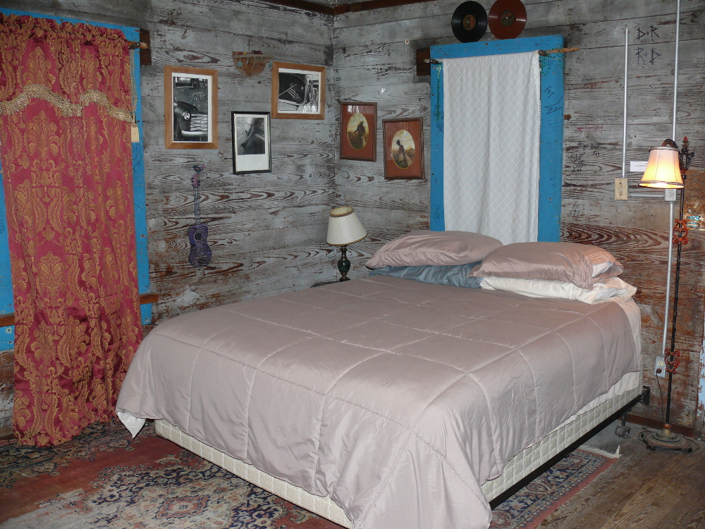
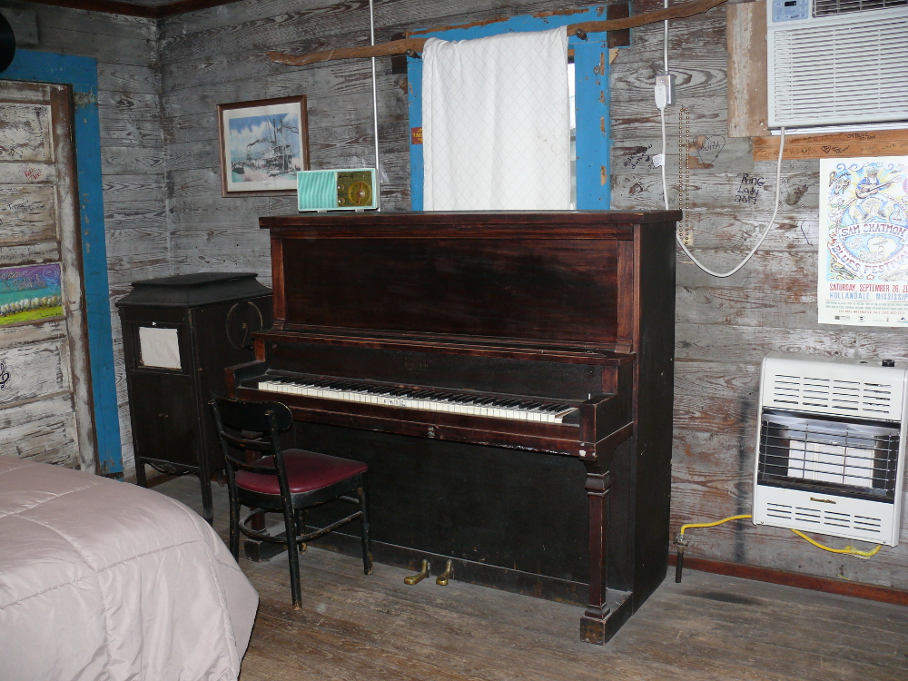
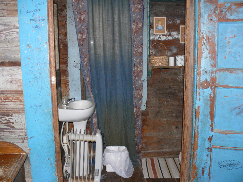
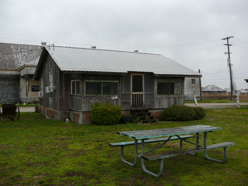
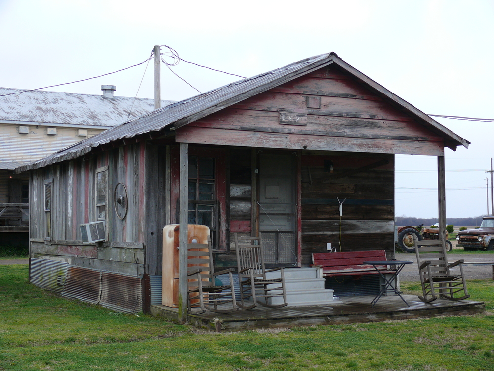
I crossed into Mississippi and into the Mississippi Delta. This area is known for being the best example of Southern culture. This area is low and wet, making it ideal for growing cotton. The laborers of choice originated from Africa. Once freed, they worked the land as sharecroppers. They lived in shacks.
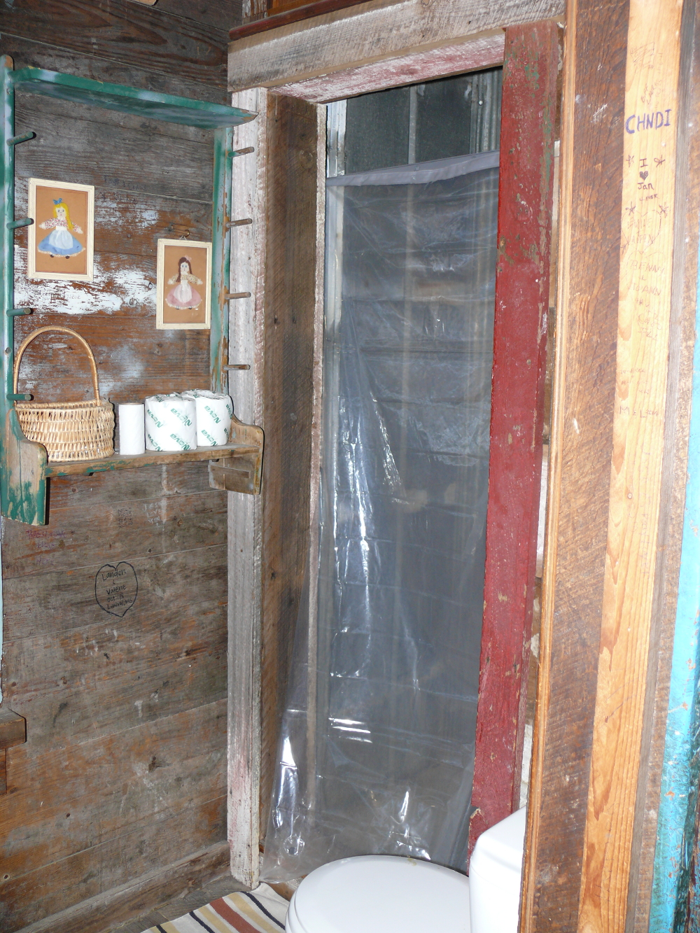
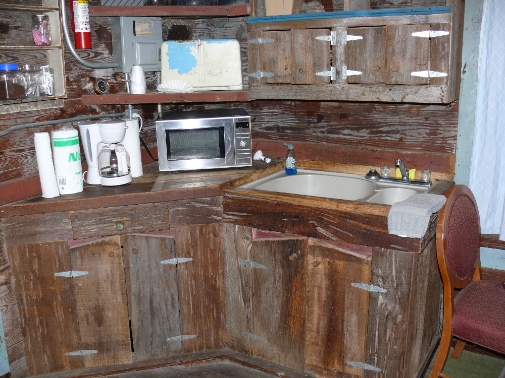
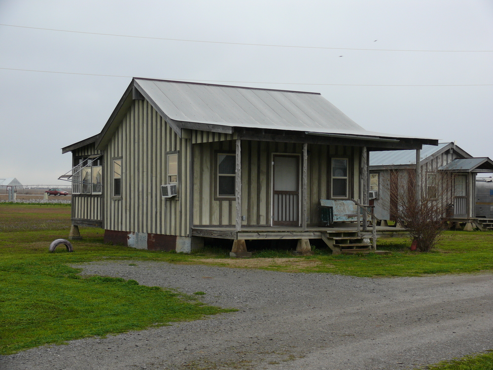
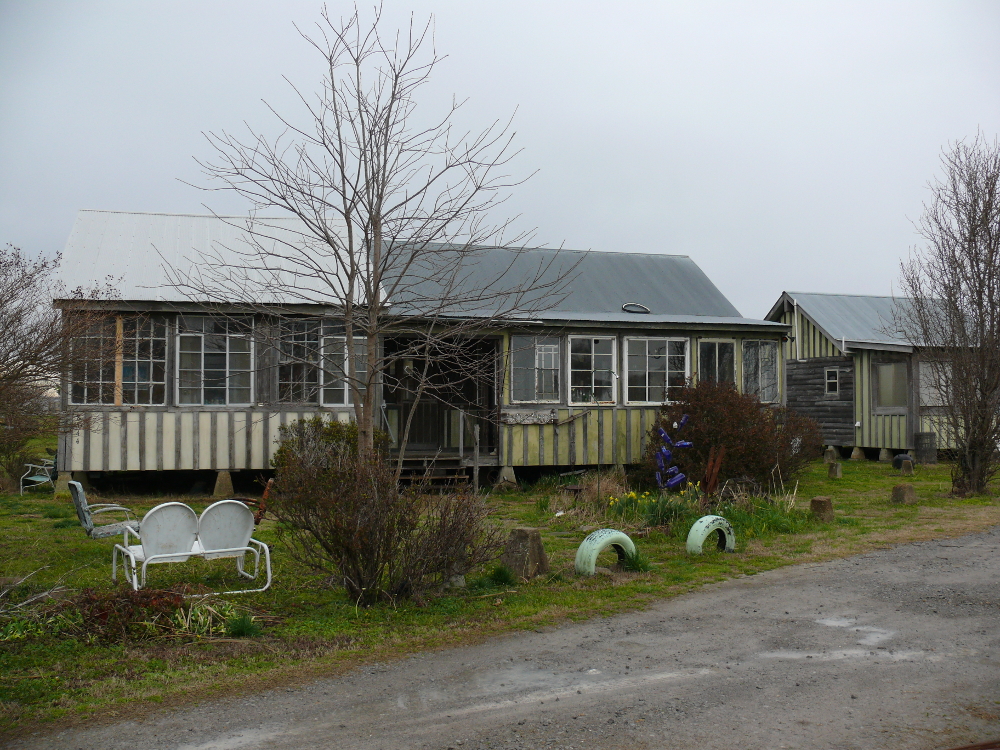
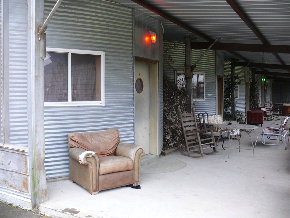
Entrepreneurs have collected such surviving buildings and rent them as motel rooms! I stayed in "Crossroad" at the Shack Up Inn. The inside is equipped with a LPG heater, which was useful, air conditioning, glass windows, a modern bed & fridge; however, it is much the same when vacated in the early part of the Twentieth Century. Below are some additional shots:
 |  |  |  |  |
 |  |  |  |  |
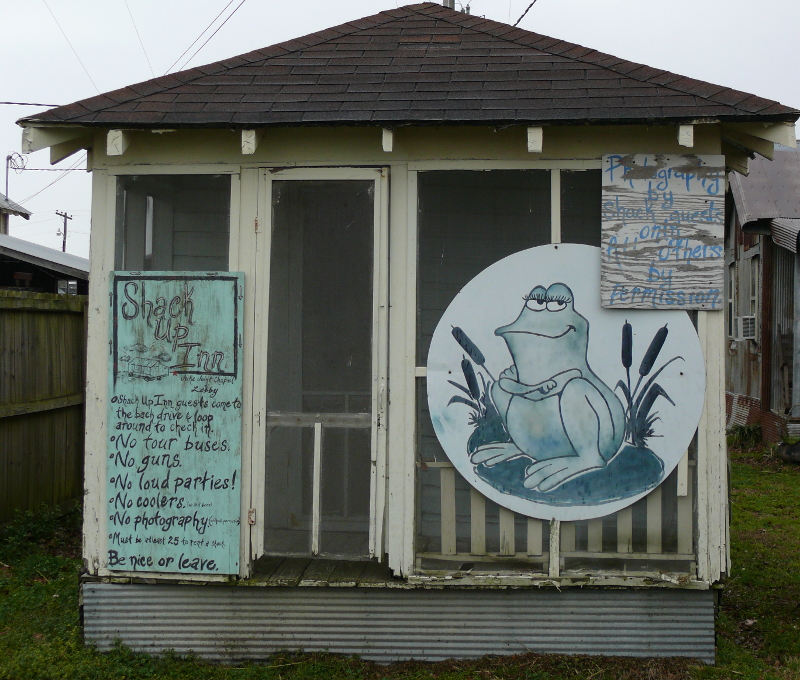
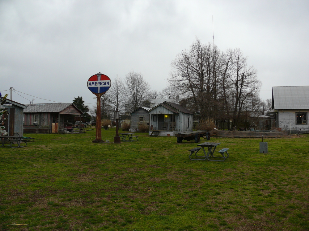
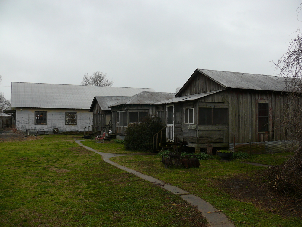
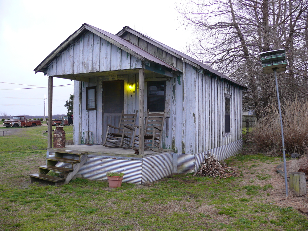
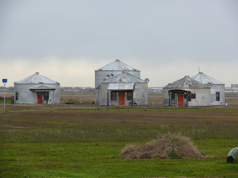
It began to rain; however, I still took a lot of photos of this unusual motel. It was a cool mix of old shacks and vehicles and some newer buildings. One may also stay in a silo, more modern houses, or a luxury room in grain house. Click the photos to see the buildings and vehicles:
 |  |  |  |  |
 |  |  |  |  |
 |  |  |  |  |
Since I was tired of fast food and had a microwave in my shotgun shack, I found a grocery store near downtown Clarksdale. It was dark by then. I walked inside and was part of the small crowd shopping. The eyes of one tall, black went wide for a second when he saw me. I said "good evening" and he returned the greeting and asked how I was doing. I was the only white person in the store, and evidently few shop there!
The next day I stopped where Robert Johnson sold his soul to the devil in order to play the blues. It was difficult to get a good photo, since the sign is located at a busy intersection.
I continued south. Everyone I met was friendly. In Ruleville, someone at the DPW has a great sense of humor!
The town is very poor. The people seemed content, and the area didn't seem stricken with crime. Click here to see a shot of a typical residential street.
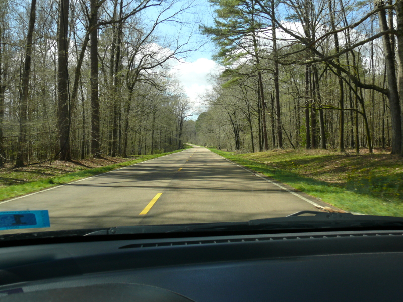
I took the Natchez Trace Parkway. It was scenic, if a bit slow. The police heavily patrol, so don't speed!
I liked Port Gibson, Mississippi. The town was strategic for General Grant's plan to capture the River. The Confederate Army's retreat exposed nearby Vicksburg to the Federal forces. Two months later, Vicksburg fell and the River was under Union control.
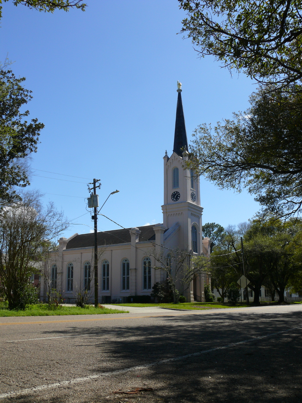
This key battle is why most visitors stop in this town. I enjoyed reading the plaques. However, I stopped to see this unusual church steeple. It's a hand with a finger point upwards. As I was looking at it, a woman greeted me and asked if I was in town to see the historic sites. She thought it odd that I wanted to look at the church steeple! Click for a larger view.
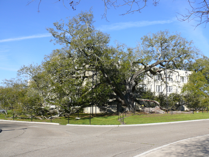
I drove south to the Gulf. Beautiful white sand beaches! On the University of Southern Mississippi--originally Gulf Park College, a school for women--campus is a Southern Live Oak that is older than 500 years! That's older than the one I visited in Florida. This one in Mississippi is named the Friendship Oak, because people who meet in the shadow of the tree will remains friends for life.
This memorial was constructed from a dead oak tree. It helped save the lives of four individuals and a dog. They clung to the tree as Hurricane Katrina tore through Bay St. Louis, Mississippi. The Angel Tree was carved and located on the shore as a tribute. I apologize for the dark photo!
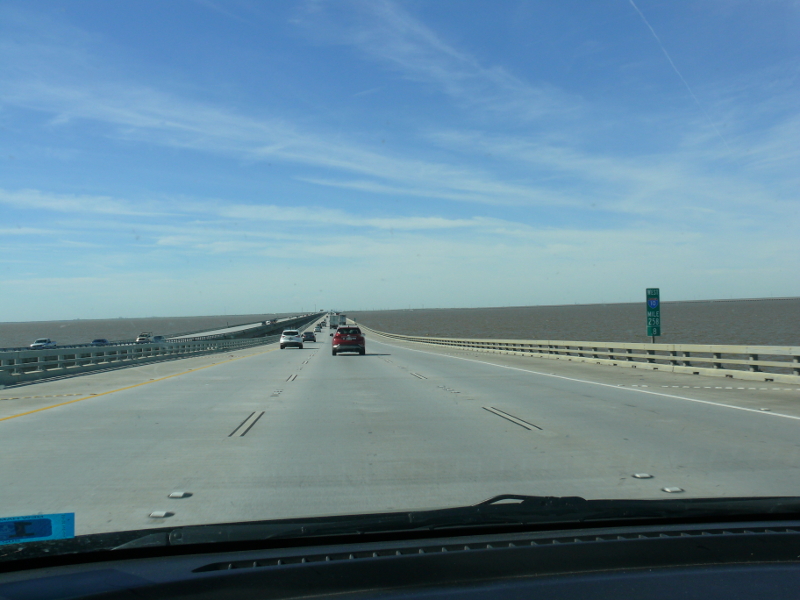
I got on Interstate 10 where there are concrete markers. They show the high water mark when the Hurricane rolled through. That's a lot of water. I crossed a large bridge into Greater New Orleans.
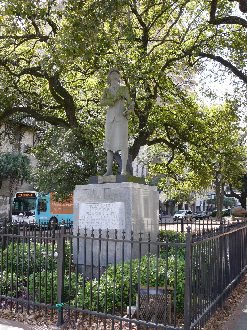
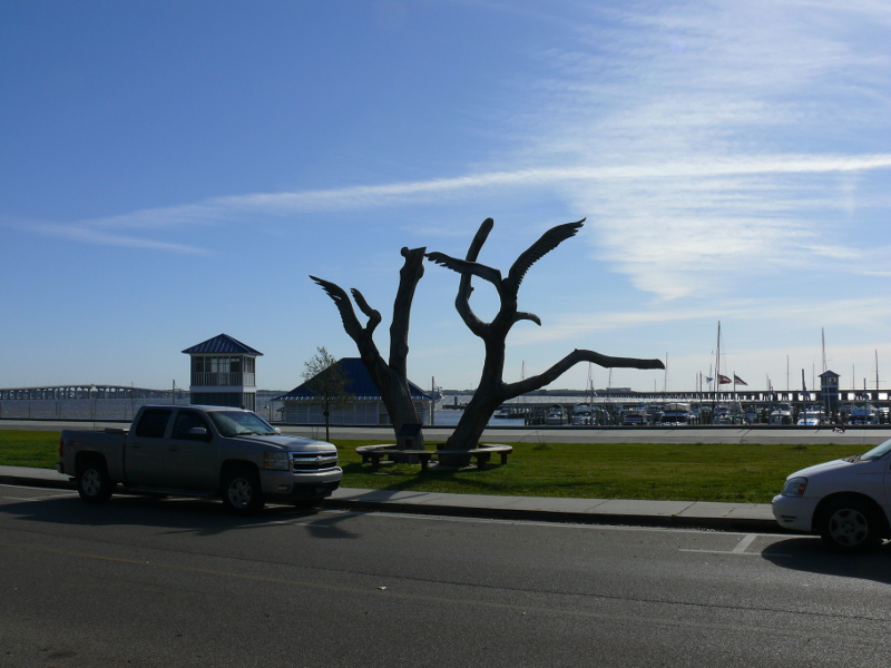
I parked in a lot near the Basin Street Visitors Center. It only cost $5 for 10 hours! I then had walkable access to the French Quarter. First stop was a statue dedicated to the women who became non-combat marines during World War II so men could fight overseas. It's on Canal Street.
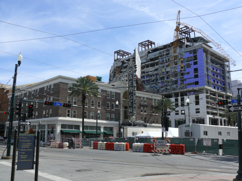
Also on Canal Street is this major accident! I don't know what caused the crane to fail.
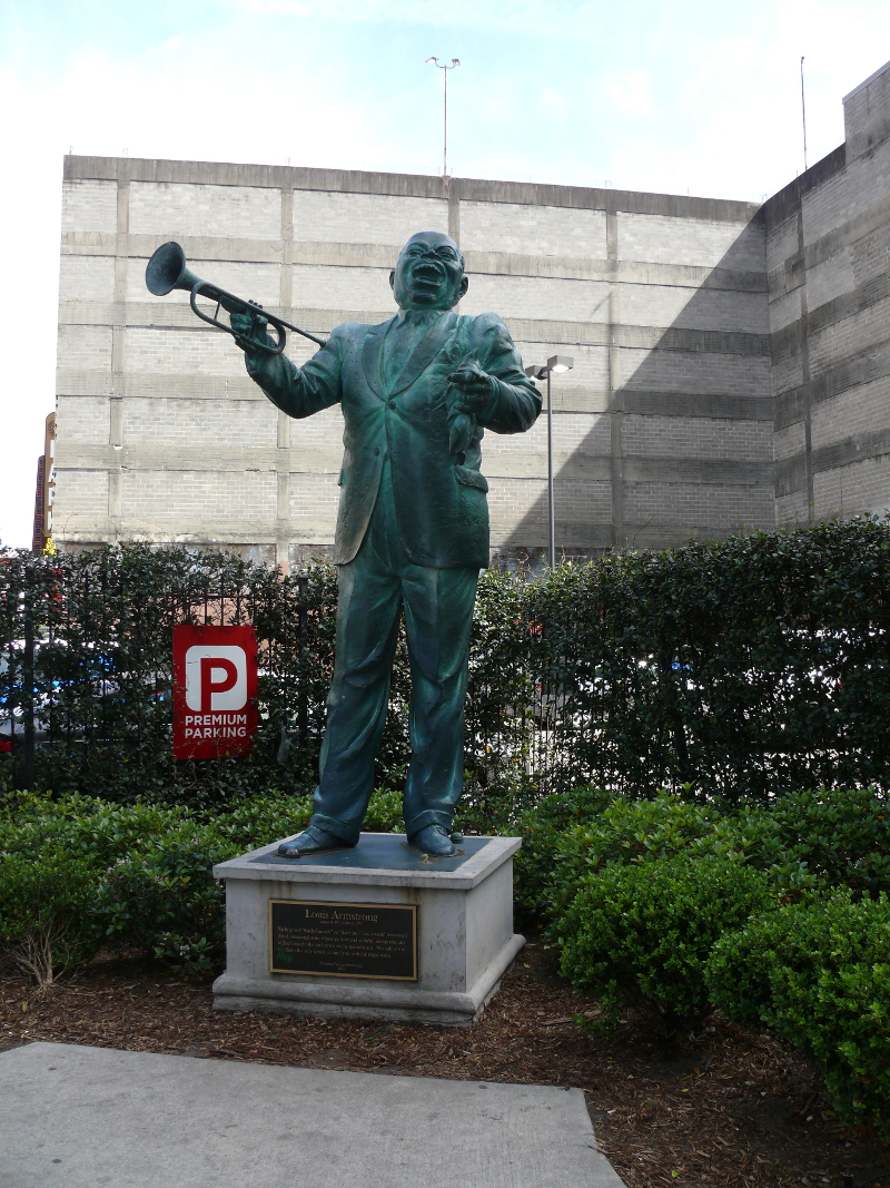
Nowhere near Louis Armstrong Park is this statue to the great musician! Around here two elderly individuals in motorized carts asked me for directions. I guess I looked like I know my way around!

Recall that I visited the start of the Jefferson Davis Highway? This pillar marks the end of the Jefferson Highway. The other end is in Winnipeg. This particular road is named for the Third President of the United States, Thomas Jefferson, not the only president of the Confederacy.
This road ran north-south and was a companion of the Lincoln Highway. Recall that I showed a large coffeepot that was originally located on the Lincoln Highway in Pennsylvania? However, these three highways were all a part of the Auto Trail System that crossed the United States and Canada. A fun fact for your next trivial challenge night!
I visited the headquarters of a National Park in the French Quarter. Yes, I, too, was surprised to find one in the heart of the city! It's dedicated to undeveloped lands around southeastern Mississippi. I learned about the Creole architecture that makes the French Quarter such a pleasant place to walk.
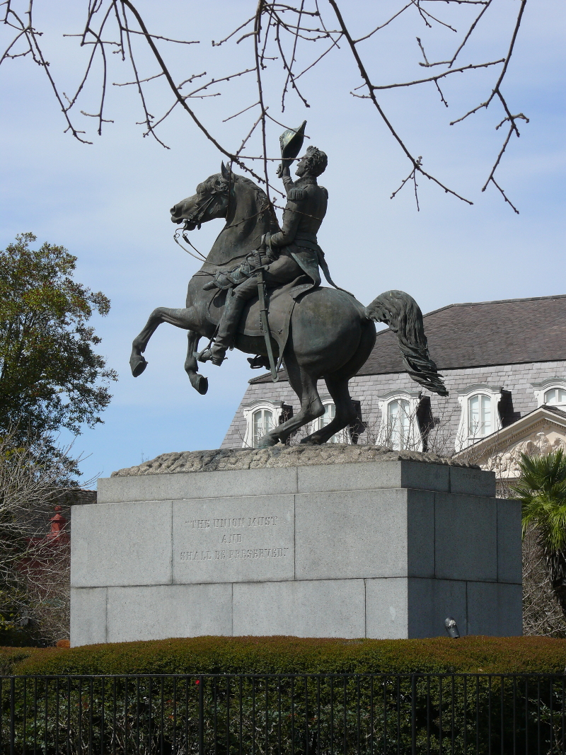
I continued to Jackson Square, centered around a statue of the general and later president. I was amazed by the number of homeless and tourists.
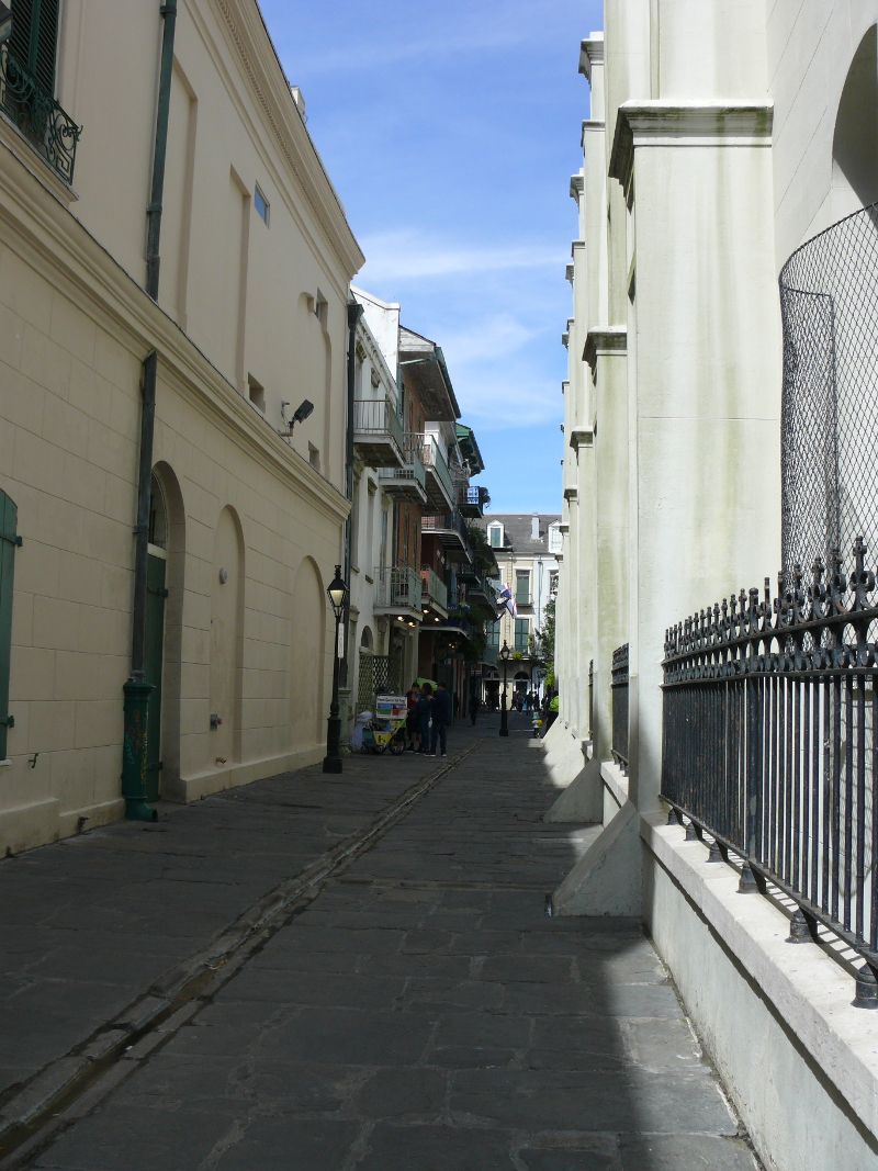
Adjacent to St. Louis Cathedral is Pirate Alley. Children ran by me. Times have changed. Argh!
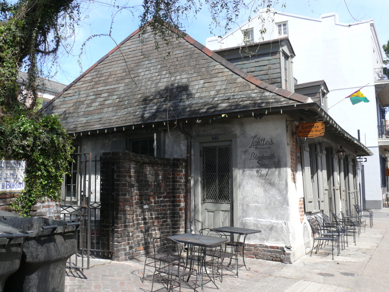
Lafitte's Blacksmith on Bourbon Street is reputed to be the oldest bar in the New World. Of course, Jean Lafitte, who ran the shop, was sometimes accused to be a pirate. I thought about ordering a pint; however, they were busy at 11 AM so I passed. The interior was a cool mixture of stone, wood, and stucco.
I liked the architecture. It looks just like in the movies, albeit not as crowded! I walked up and down most of the streets in the Quarter. It's a small area. Periodically, there would be plaques on the sides of buildings at intersections. They would provide former names for the roads. Click here for an example.
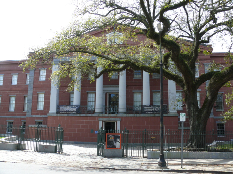
Today, this building houses the New Orleans Jazz Museum. Formerly it was a United State Mint. Someone working at the museum has a great sense of humor. See why!
I apologize for the partial shot of the building. Esplanade Avenue is wide but still too narrow to capture the massive building. This spot was the site of a Spanish--later French--fort, also.
This marker isn't modern art. It is a rally point for city-assisted evacuation. Sixteen Evacuspots are scattered around the city to help the massive population of homeless escape a coming hurricane. On the way back to the car, a Google car drove by. "Smile, you're on Candid Camera!"
Here's an oddity. Legend has it that Charles Durand, a wealthy sugar planter, had this alley lined with oak and pine trees. His idea was that when his daughter was wed, the couple could travel the lane under a canopy of leaves and spider webs, which would be dusted with gold and silver. OK, wow!

In Lafayette, Louisiana, the federal courthouse has an unusual look. Don't see it? Click for another photo.
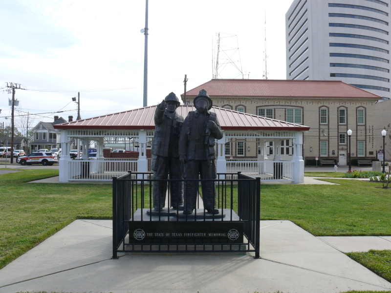
I left the "empty heads of justice" and stopped at the cool firefighter memorial!
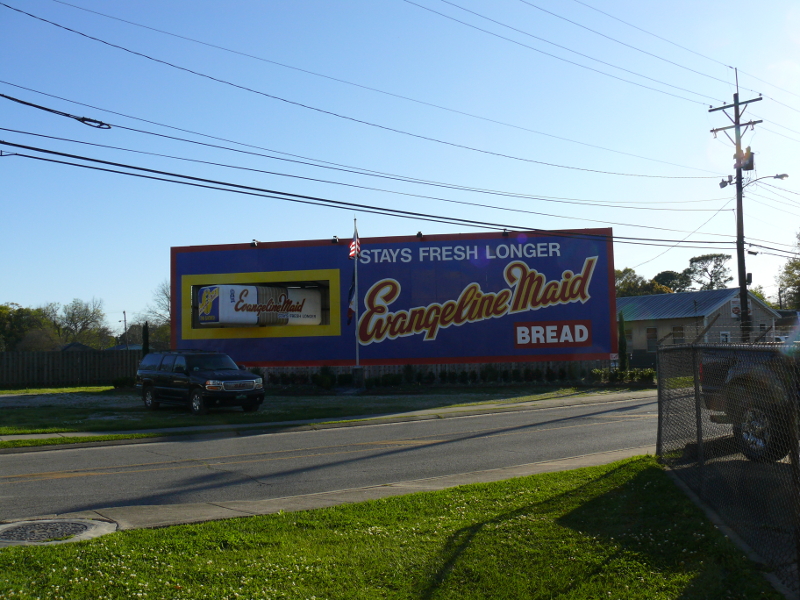
Lafayette is also the home of Evangeline Maid Bread. I parked near this billboard, and it smelled like freshly-baked bread! But that wasn't the best part. Watch a short video to see what I mean. 72_movie.m4v (2.8 MB)
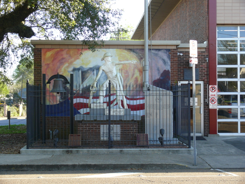
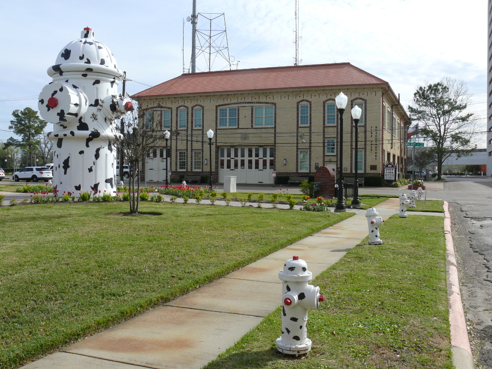
Driving around Beaumont, Texas was eeriely quiet. The roads are wide, but nearly empty! I finally found the Fire Museum of Beaumont. It was closed, but I was there for other reasons. There's a pleasant memorial for Texan firefighters.
Yes, that's a gigantic fire hydrant outside the museum (in the background). For scaling purposes, I included normal hydrants. Oh, and the behemoth works. That'll surely put out any fire! Click for a larger view!
Back on Interstate 10, I headed towards Houston. A semi with Massachusetts plates kept up with me for a few minutes. Maybe he was homesick? I hadn't seen any New England plates in days. I did see a sign that reminded me of home. Take a look here
The drivers in Houston are terrible: rude and aggressive. The metropolis does have one redeeming site. The world's largest car wash, with accompanying world's longest lines of vehicles! See a video of the car wash 75_movie.m4v (0.8 MB)
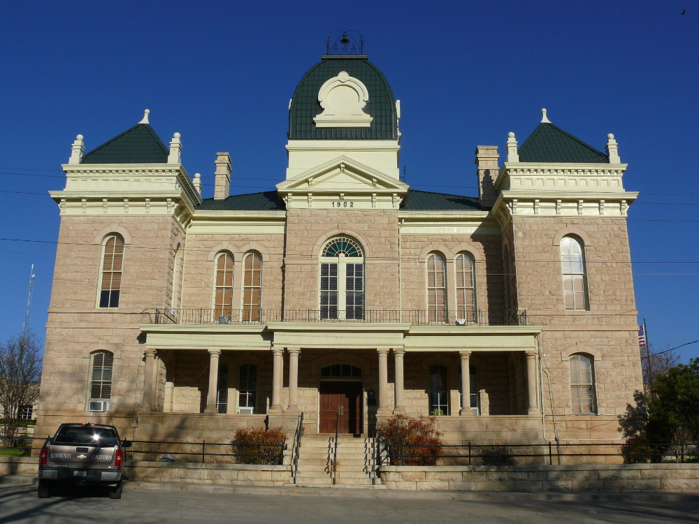
I continued around San Antonio and into West Texas. I stopped for the night in the "Biggest Little Town in the World", Ozona. The Crocket County Courthouse is a lovely building. Click for a larger view. I went to a small grocery store and was impressed by how friendly people were. The town seemed a mixture of Texan and Mexican architecture and people.
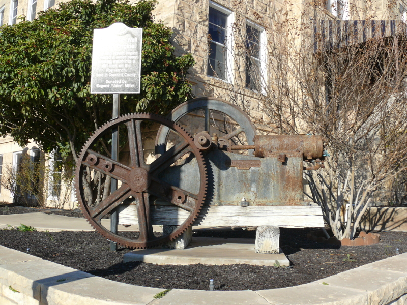
Outside the museum is a cool four-horsepower, water-well pump from 1933.
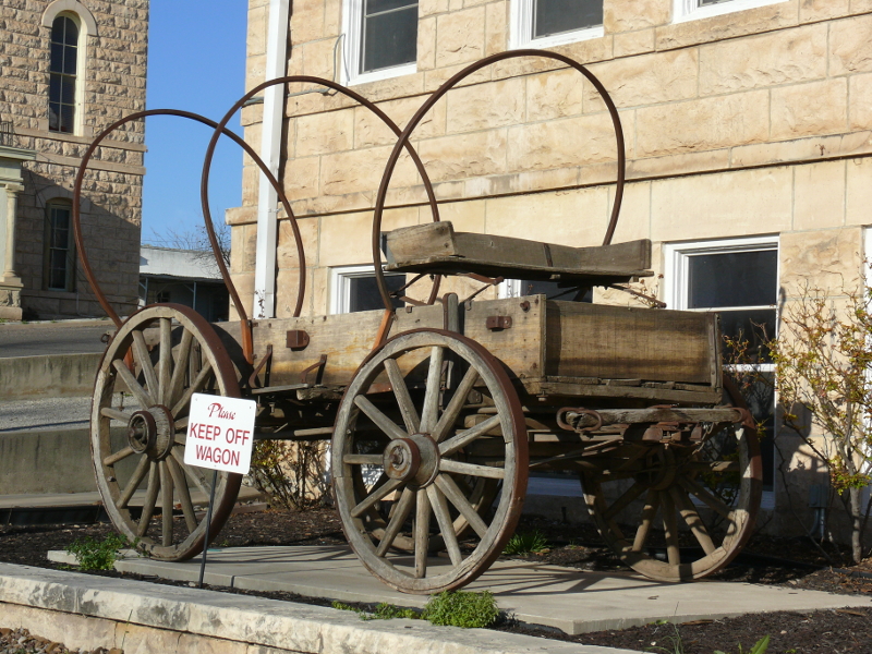
and a covered wagon
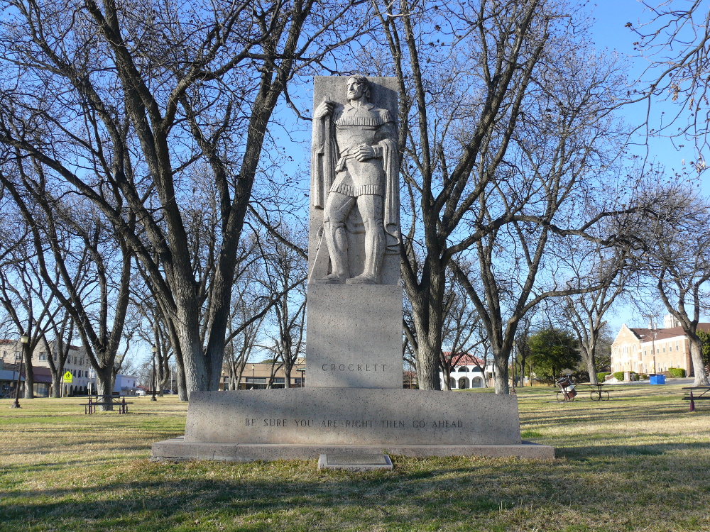
The reason why I stopped in town was this Art Deco statue, which is dedicated to the County's namesake: David Crockett. This is the same man who died at the Alamo. Click for a larger view. This statue was created by William Mozart McVry, a famous sculptor who led an eventful life!
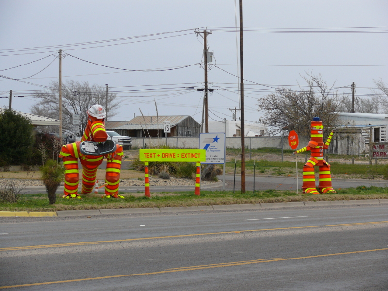
The message is clear outside the Texan DOT in Fort Stockton.
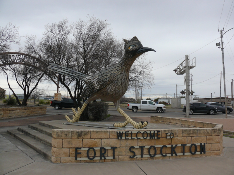
That's a big bird!
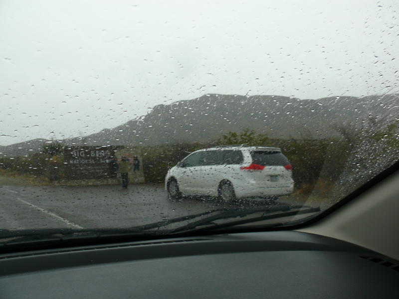
Asian tourists were standing in the rain as I sped into Big Bend National Park! I have an annual pass for the National Parks, so I didn't have to pay the $30/week admission fee.
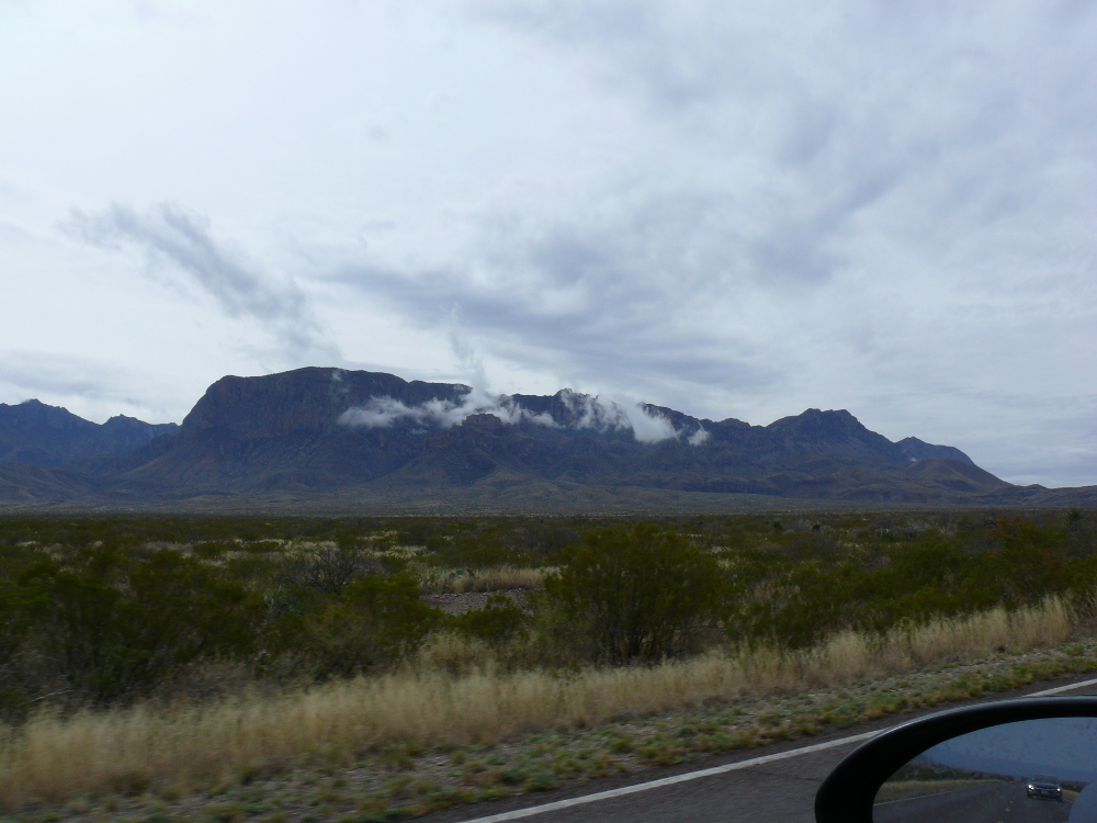
The low light didn't allow me to capture the prehistoric scenery inside the Park. The above photo is the best one. The Park would make an excellent place to camp and kayak! It was filled to capacity when I drove through. Click for a larger view.
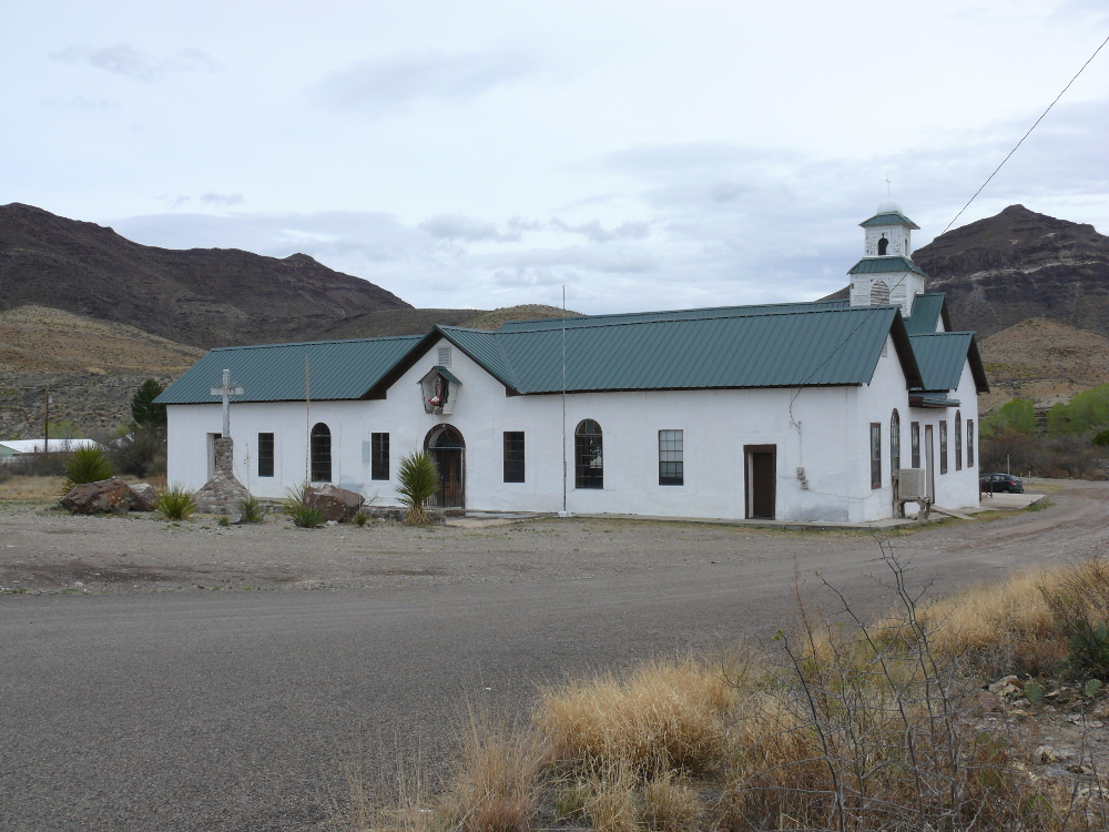
Does this church look familiar to movie buffs? Ghost town Shafter stood in for Piedmont, New Mexico. That's where an extraterrestrial disease, carried by a fallen satellite, killed all the townsfolk in Andromeda Strain. The church and the hills feature prominently in the opening scenes. Click for a larger view! This find reminds me of the Iron Man cave.
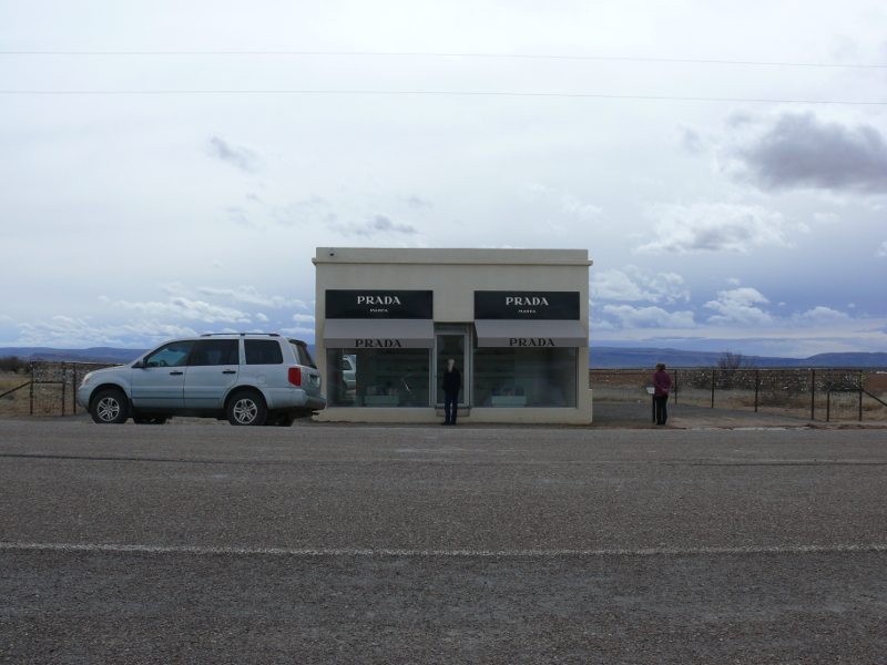
I drove through Marfa, which is well known for mysterious nighttime lights. Um, like stars
I was waved through two internal border checkpoints. Correction: The Army was also operating a Radar on Tethered Aerostat to detect foreign missiles and aircraft. See it here.
Near Valentine is a single, lonely shop. Peering inside, one sees hand bags and women's shoes. Odd!
Ahh, desert roads! I feel like Kowalski, except less hairy and driving a black, imported car...
I passed through El Paso without any problems. I stayed the night at The Big Chili Inn in Las Cruces, New Mexico for an obvious reason. The motel seemed to be a extended-stay for lower income folks. My car wasn't broken into and the room was clean, so all was well. The local Walgreens sells beer, wine, and liquor, in addition to, the usual items. Though, the booze was in a separate room.
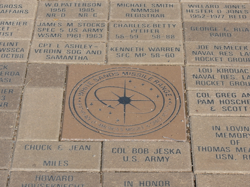
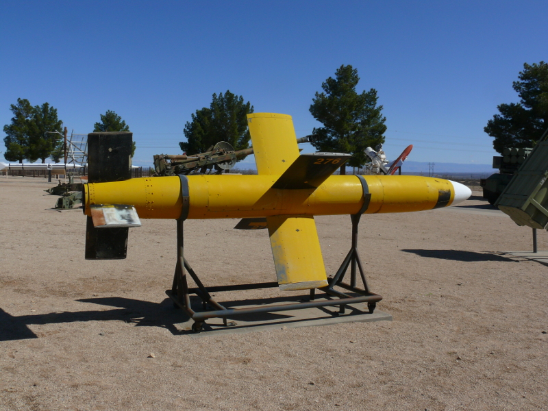
The next day I visited White Sands Missile Range. This army base was established in 1945 as White Sands Proving Ground to develop technology acquired from the Nazis: V-2 rockets. Like most military bases, one must check-in and be granted permission. The man checking my background turned out to be very friendly. He was from Everglades, and we spoke of the East Coast for a while.
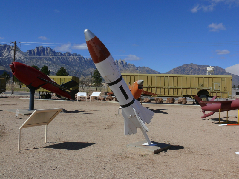
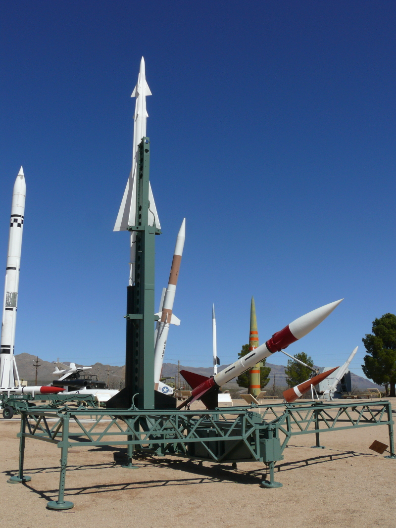
The museum was closed; however, the missile park was fantastic. Photography was only allowed in the missile park, which worked well for me.
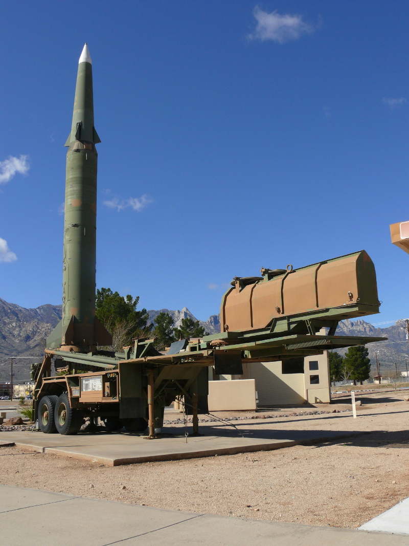
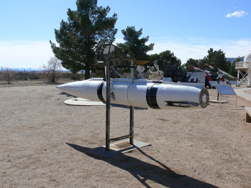
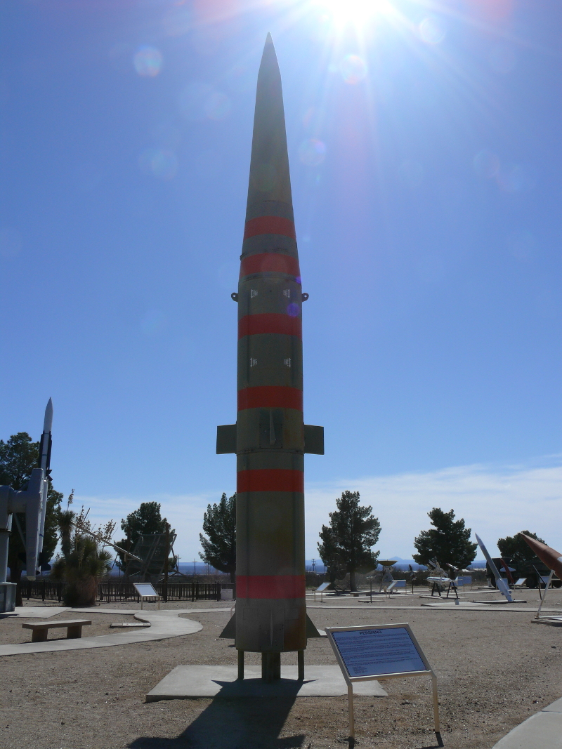
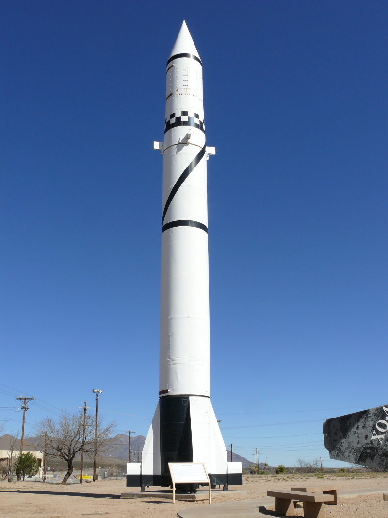
This missile is a Pershing II. I'll list interesting information below photos. For instance:
Pershing II, Length: 35 feet, Range: 1,125 miles, First Fired: 1982
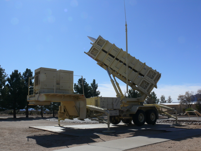
Patriot, Length: 17.5 feet, Range: 100 miles, First Fired: 1970
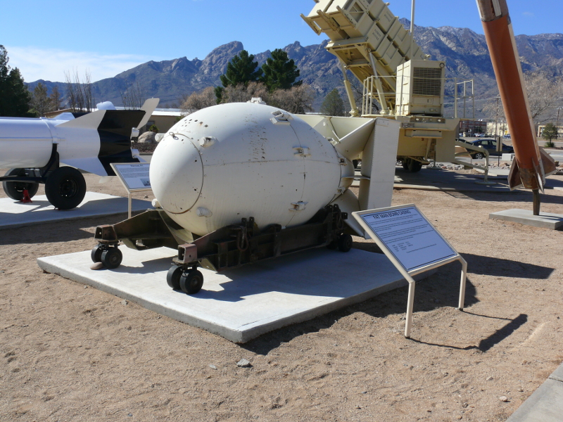
Fat Man, Length: 10 feet 8 inches, Range: N/A, First Used: 9 August 1945
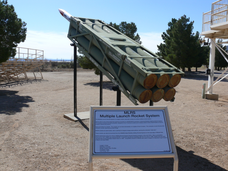
Multiple Launch Rocket System (MLRS), Length: 13 feet, Range: >18 miles, First Fired: 1977
Short Range Attack Missile (SRAM), Length: 14 feet, Range: 100 miles, First Fired: 1969, Comment: Nuclear warhead
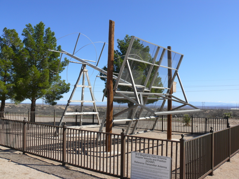
Doppler Velocity and Position (DOVAP) Reference Transmitter Antenna, Range: 300 miles, First Used: World War II, Accuracy 50 feet
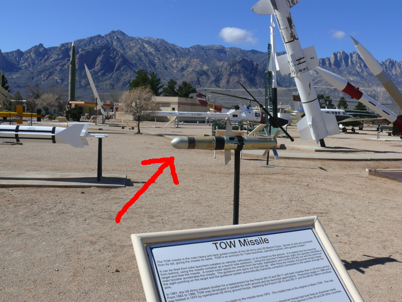
Tube-Launched, Optically-Tracked, Wire-Guided Missile (TOW), Length: 4 feet, Range: 1.9 miles, First Fired: 1967, Comments: Anti-tank weapon
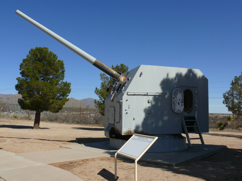
MK 39 5-Inch Gun, Weight: 73,000 pounds, Comments: Borrowed from U.S.S. Franklin D. Roosevelt, CVB-42 in 1945. Last fired in 1996.
Pershing, Length: 35 feet, Range: 400 miles, First Fired: 1963
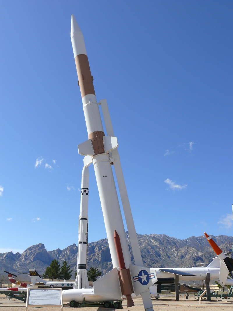
Athena, Length: 50 feet, Range: 450 miles, First Fired: 1964, Comments: Used to test Intercontinental Ballisitic Missile Re-Entry Vehicles.
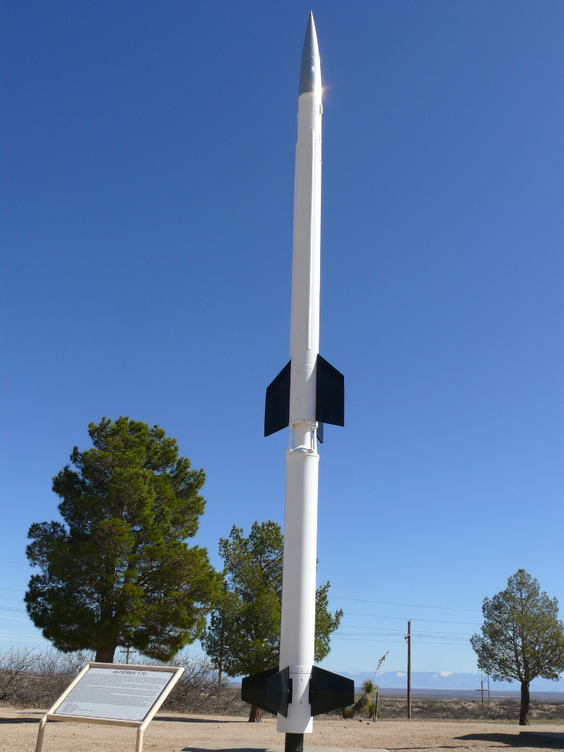
Aerobee 180, Length: 31 feet, Ceiling: 210 miles, First Fired: 1968, Comments: Used to probe outer space.
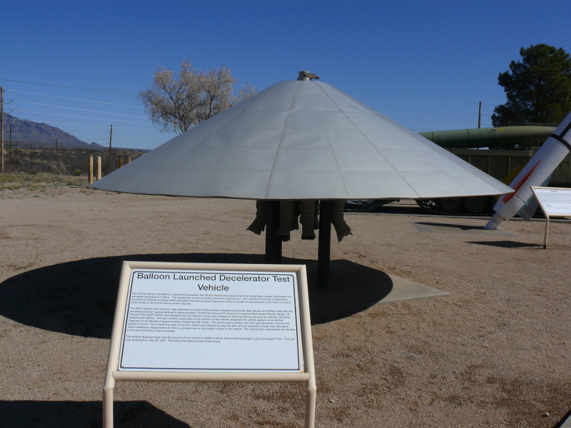
Balloon Launched Deceleration Test Vehicle, Comments: Used to test the Viking Lander Capsule. Not a UFO!
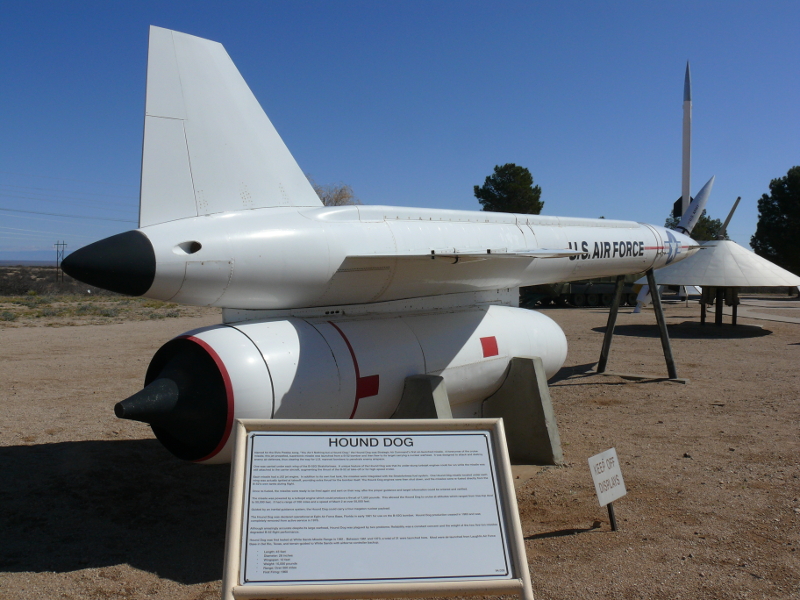
Hound Dog, Length: 43 feet, Range: >500 miles, First Fired: 1960, Maximum Altitude: 55,000 feet, Comments: Nuclear warhead and supersonic named for Elvis.
Redstone, Length: 69 feet, Range: 200 miles, First Fired: 1958, Comments: Direct descendant of V-2. First American design. Modified rockets launched Mercury capsules.
Genie, Length: 9 feet, Range: 6 miles, First Fired: 1956, Comments: First air-to-air nuclear weapon.
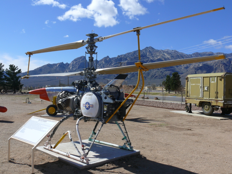
QH-50 DASH, Length: 7 feet 7 inches, Range: 40 nautical miles, Speed: 92 knots, First Used: 1965, Comments: First and only unmanned helicopter.
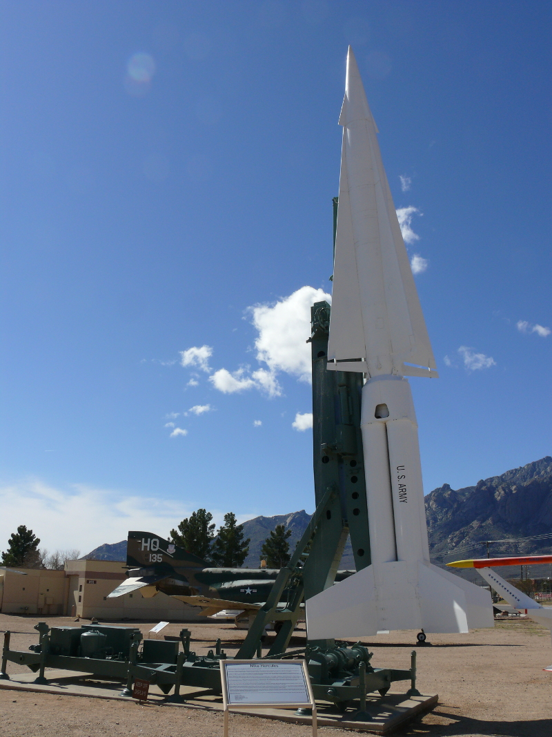
Nike Hercules, Length: 41 feet, Range: >75 miles, First Fired: 1955, Comments: Army's only nuclear-armed surface-to air missile. 145 sites to defend American cities during Cold War. Replaced Nike Ajax.
Nike Ajax, Length: 33 feet, Range: N/A, First Fired: 1946, Comments: First guided missile to destroy an airplane.
"This cab was part of the tower at White Sands Space Harbor, which controlled the landing of the [Columbia] orbiter" on 30 March 1982
Lark, Length: 14 feet, Range: 15 miles, First Fired: 1950, Comments: First missile to destroy a moving target. Designed to destroy Kamikaze jets.
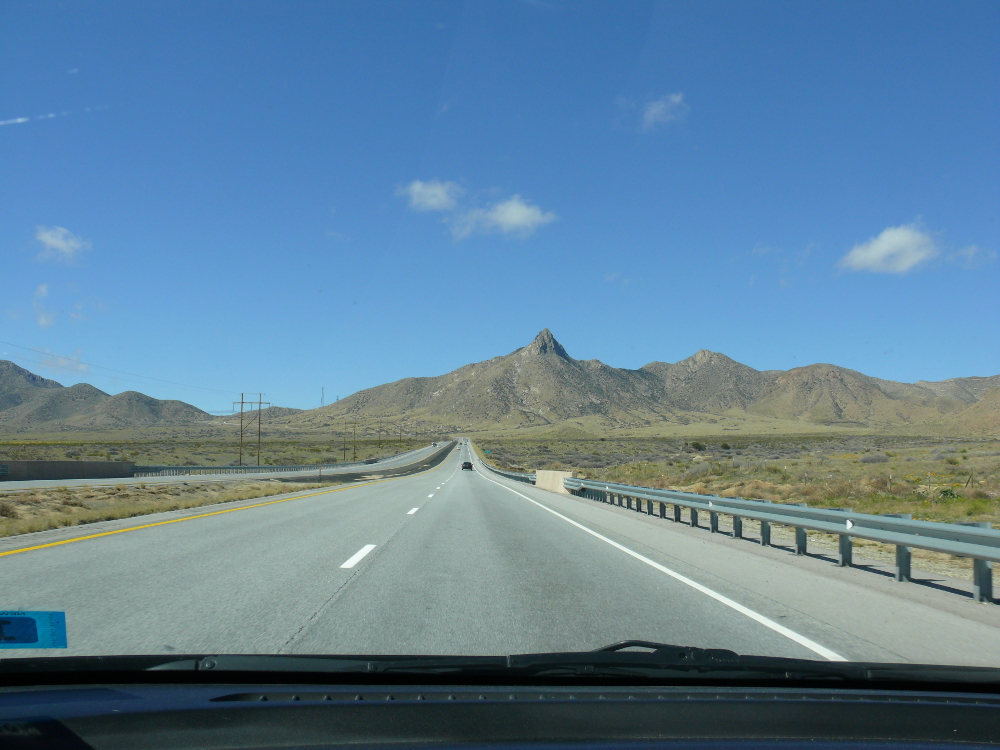
I left the Range and backtracked to Las Cruces. It is a pretty drive! Click for a larger view.
I found an Oldies station broadcasting at 570 kHz. I received the station all the way across New Mexico. It sure was convenient!
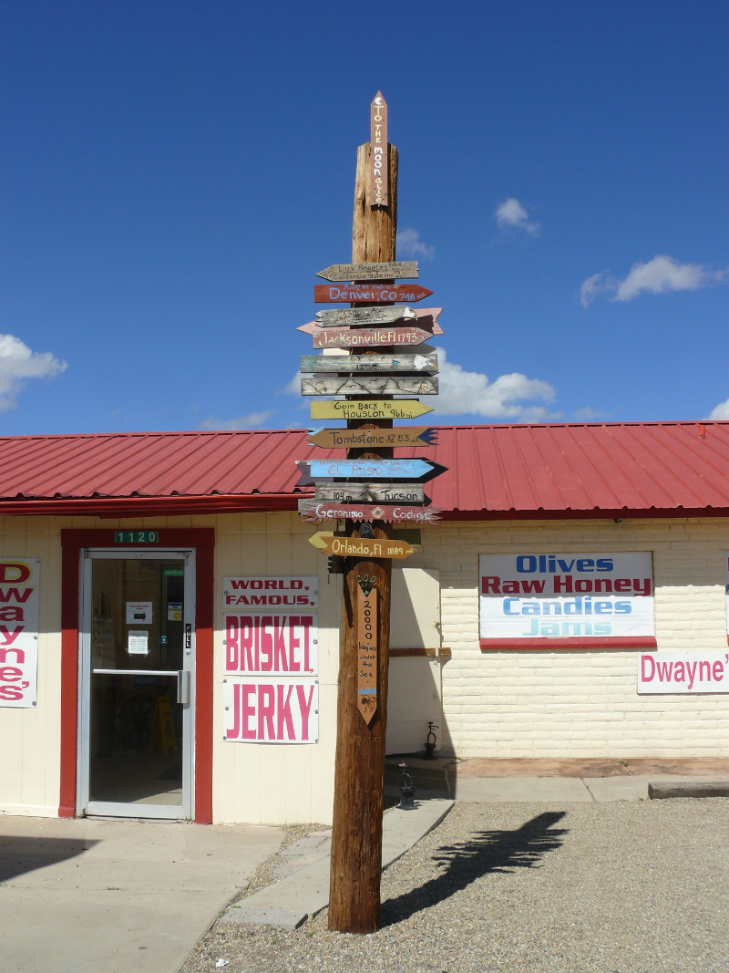
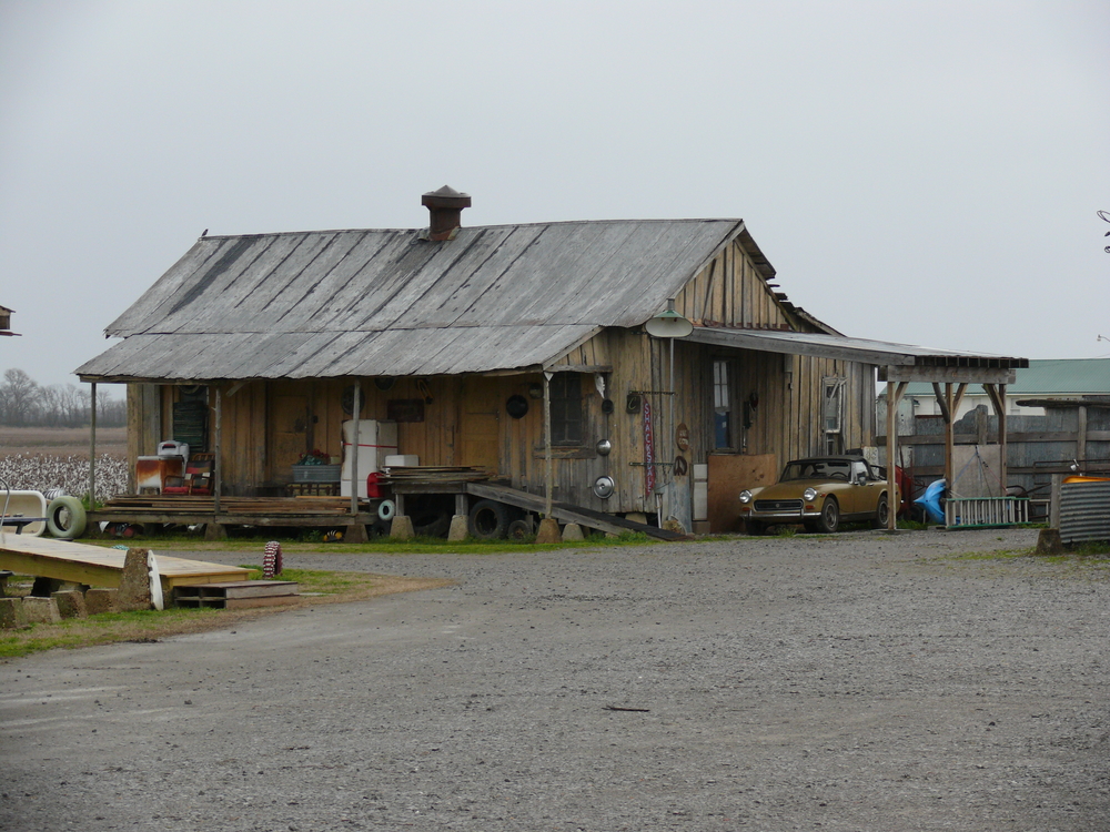
I stopped to buy some beef jerky for my brother. This place made their own out of rabbit, bison, and other exotic meats. They also have an unusual signpost out front.
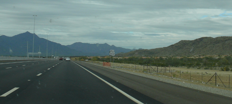
The next day I arrived at Mike's home! I used the recently-completed, west-bound 202 Loop. When I drove through, there was at least one off-ramp that had not been completed.
Since I was concerned that State governments would shut the Interstate Highway system or all the motels, I waited out the virus at Mike's. My original plan was to continue to the northern interior of our nation. That second half would just have to be postponed.
We enjoyed playing Virtual Reality games and watching movies! The government restrictions didn't affect us too much. In fact, we sampled the wide array of fast food restaurants. It seemed that a majority of the restaurants were staffed by attractive, young women. And you wonder why we kept trying them?
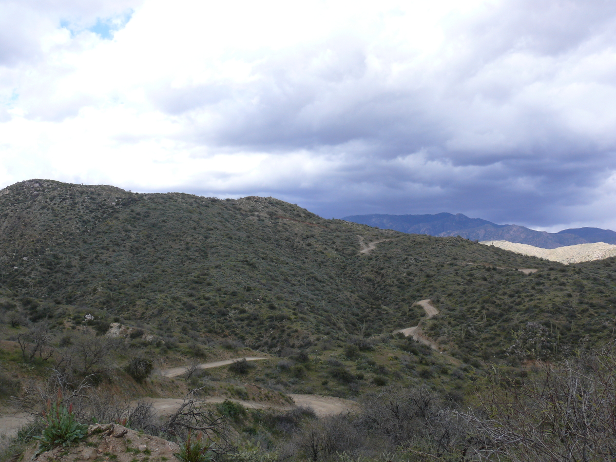
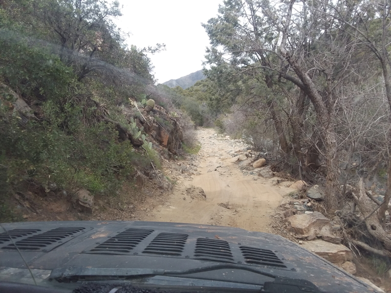
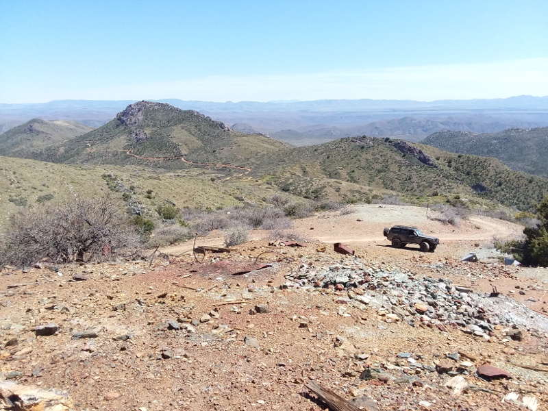
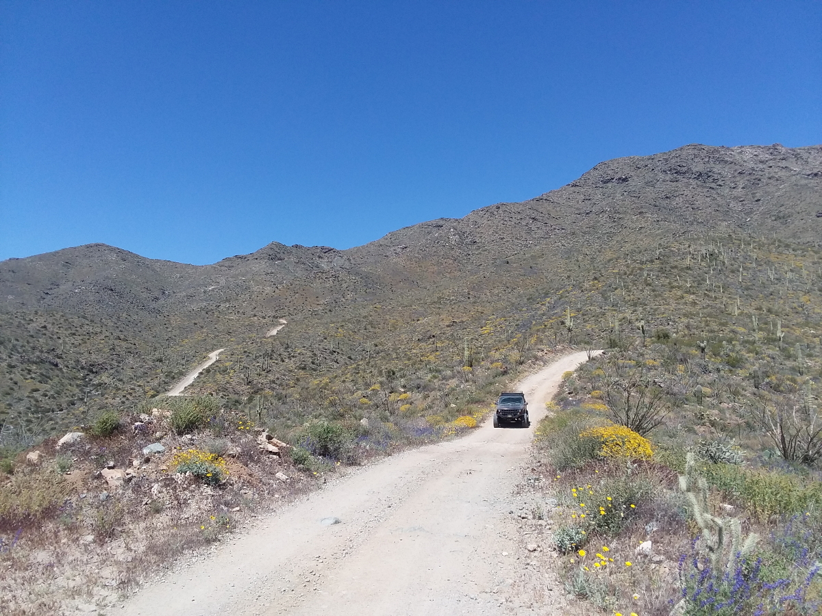
On Mike's days off, we explored the off-road trails around the Valley of Sun. I shot the above photo after we aborted our trek to Crown King, via the back way. The reason to turn around is visible in the background: it was raining at the peak. We feared being caught in a narrow section of the trail during a flash flood. Even the Beast would be washed away! Click for a larger view.
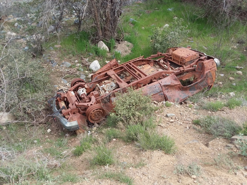
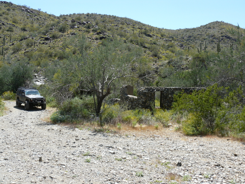
On the way back, we enjoyed this unusual site. It is located on someone's ranch in a small settlement.
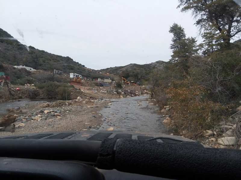
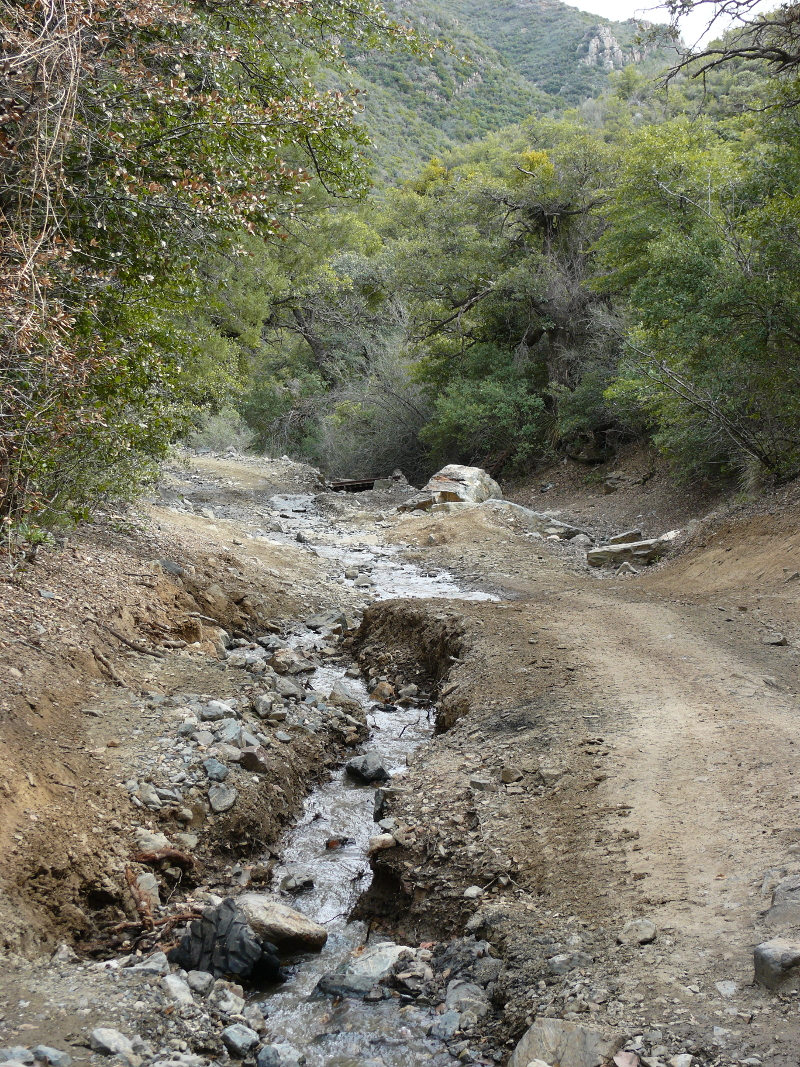
We went back a few days later when the weather was clear. One may observe the amount of water still flowing down the trail. It rained the longest time that I've ever seen in greater Phoenix.
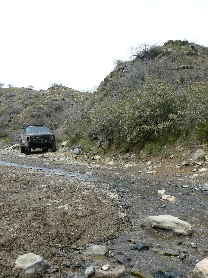
A mining operation was set-up on the trail that we were driving, so we had to drive through a creek. I was at the wheel for this leg of the off-roading. It was a new experience for me. Mike took a video of me fording one of the more exciting intersections with the creek. You may watch the video: 116_movie.m4v (12.5 MB)
I got pretty comfortable driving the Jeep. Perhaps too comfortable, because at this narrow Mike reminded me that we were very close to the sheer drop-off on the right.
The story is that a couple were drinking at the saloon in Crown King and didn't make a turn on the way back down the hill.
I did run out of talent when we reached a serious uphill section. Mike took over and made it look easy! Next, we stopped at this badly washed-out section. There was a cross for an off-roading couple who died here.
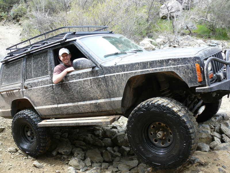
We passed a group of guys in a ATV. Then, we got stuck driving up a rocky escarpment just beyond a creek crossing. The guys had turned around to see how we'd make out. It was a good thing, because they helped us built a makeshift road and guided Mike over the obstacle. One of the friendly guys snapped a shot of me whilst the other helped Mike.
The going was rough much of the way. I took a video of Mike showing off the prowess of the Beast. You may watch the video: 120_movie.m4v (28.0 MB)
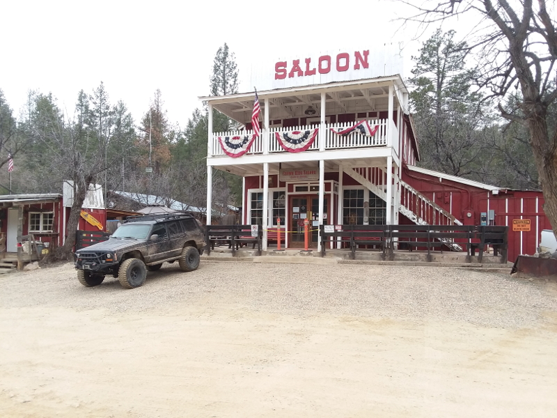
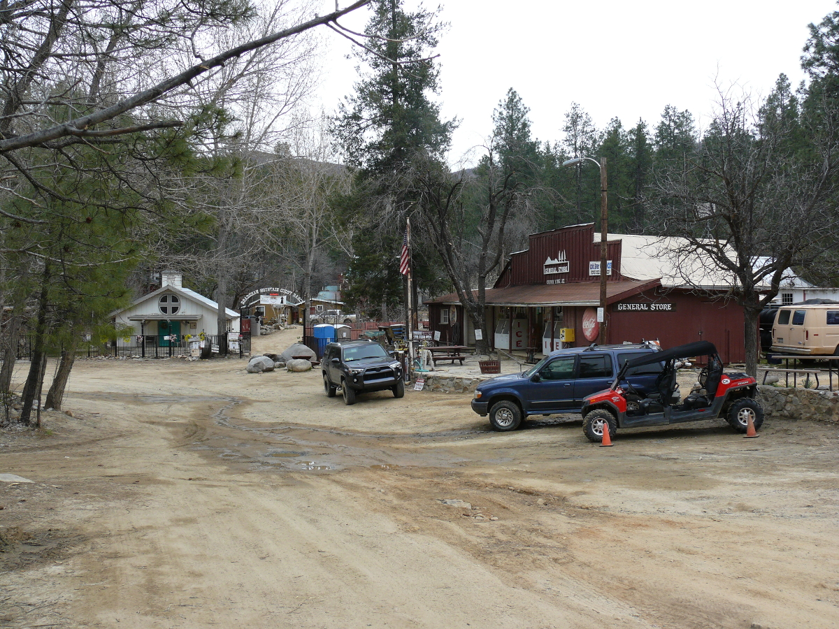
Though the trail was the worst that I'd ever seen and the worst that Mike could remember, we made it to Crown King. The saloon was closed due to fear of the latest virus. Too bad. I was looking forward to a shot of whiskey to calm my nerves.
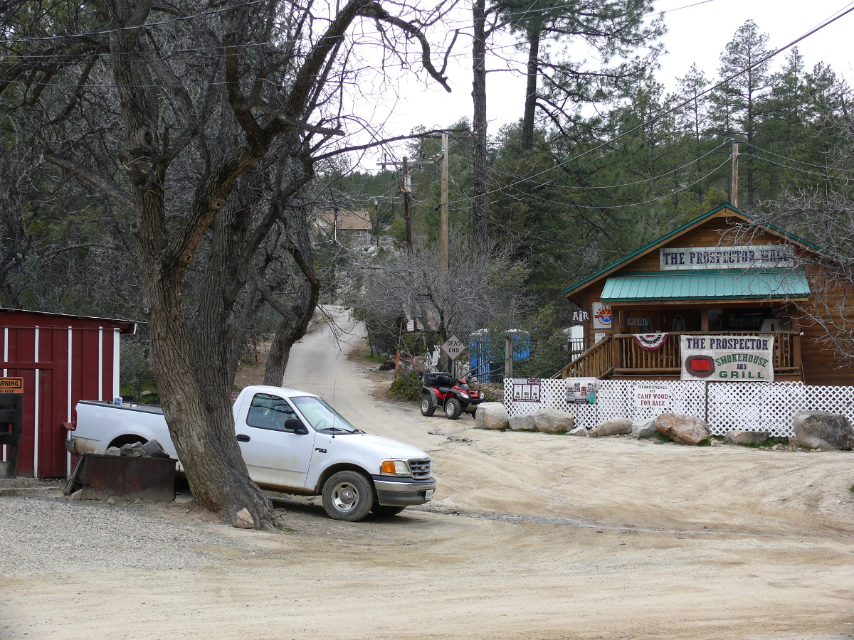
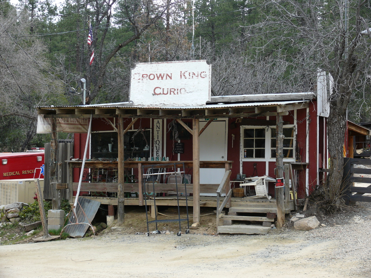
The town was quaint. I liked it. Below are some views of it:
 |  |  |  |  |
The trip back home was much, much easier!
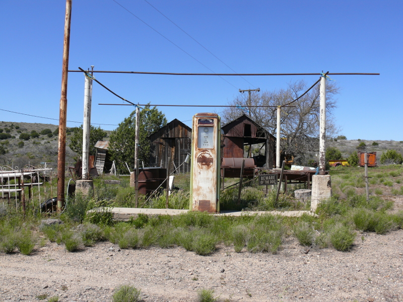
Got gas? Maybe seventy years ago!
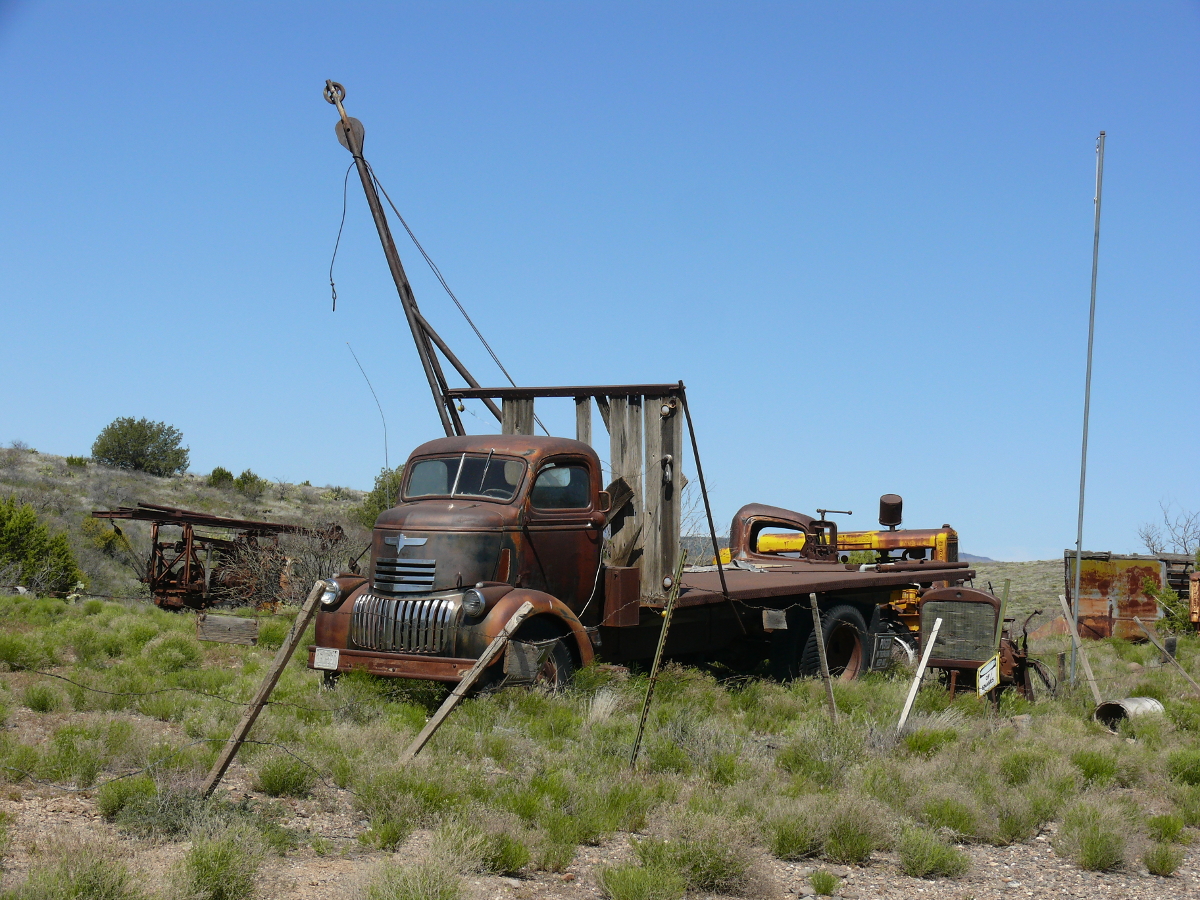
Now, that's a flatbed! Click for a larger photo.
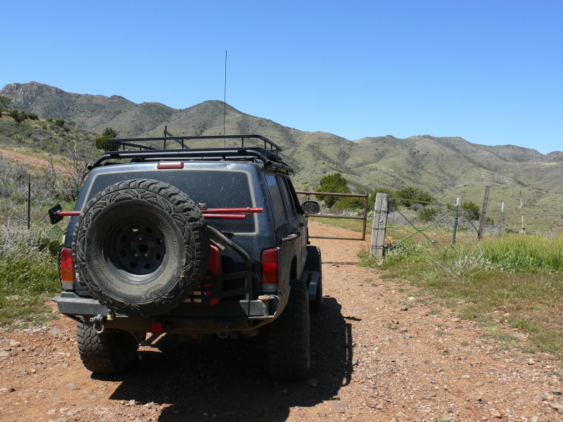
One of a few gates on the trail to De Soto Mine.
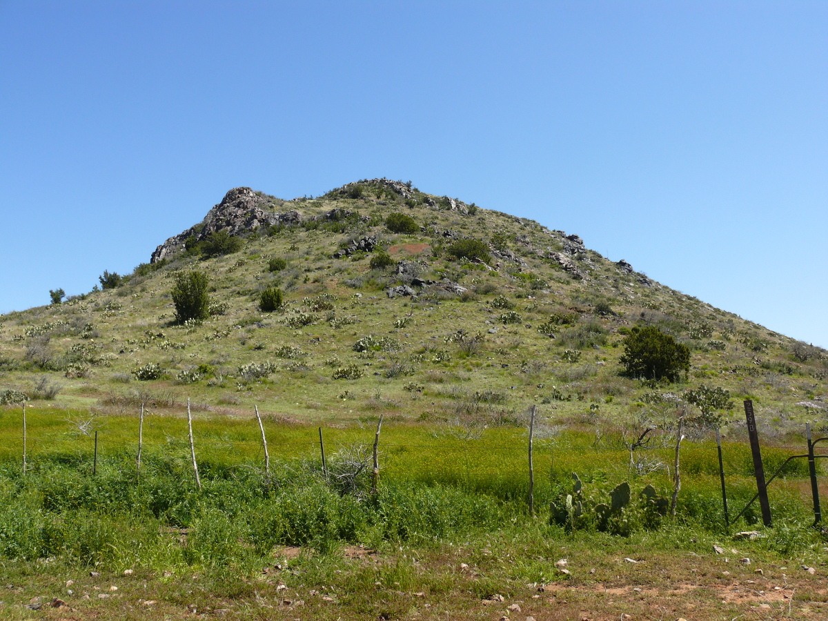
The unusually wet weather made everything so green! This hill looks more like New Zealand! Click for a larger view
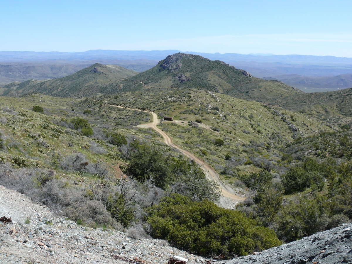
The view from the mine was picturesque! Click for a bigger photo.
The mine was a disappointment, though.
Mike took a good shot of the trail whilst standing over another mineshaft, which had been sealed by dynamite.
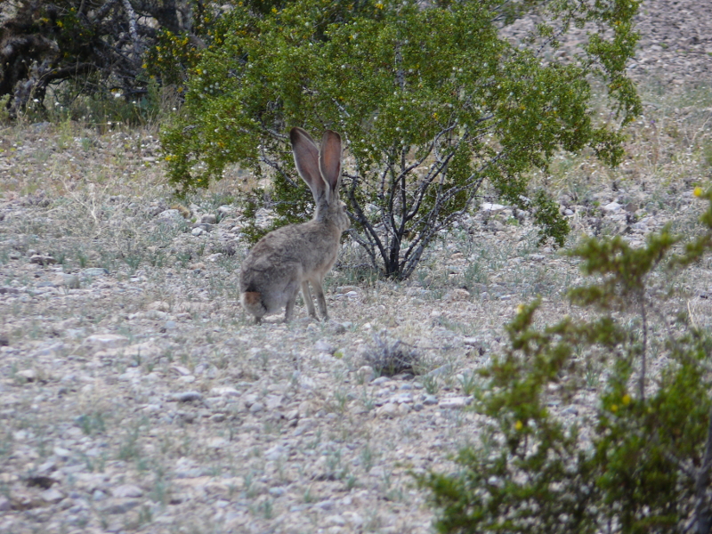
MIke was able to take five days off in a row, so we planned to camp and four-wheel at KOFA (King of Arizona) Refuge. As it turns out, everyone else had the same idea so we just drove through the northern section of the park. We did see a jackrabbit!
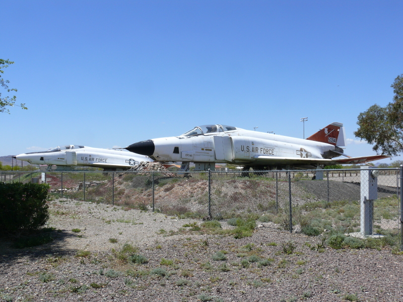
We took the scenic route back through Quartzsite. In their park are two F-4 fighters! I had forgotten the size of these jets. This model is one of the largest in the world.
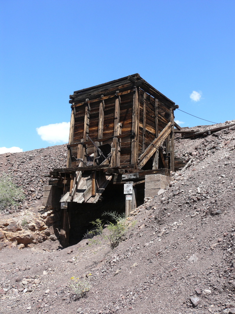
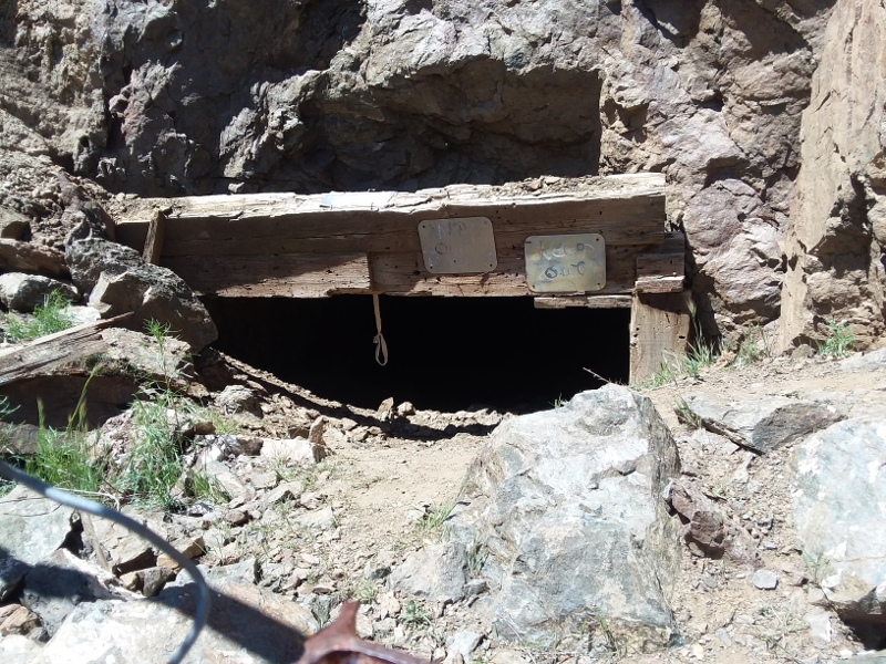
On a dirt road south of Brenda is Ramsey Mine. It's very intact and appears active.
The dynamite hut was empty but in good repair.

The view from above the mine entrance was pleasant. Back home, I cooked the meals that I wanted to try for the first time in the desert. For instance, I cooked pizza. I didn't make the dough, because of flour shortages. But the dough in the tube worked, and the pizza was a success!
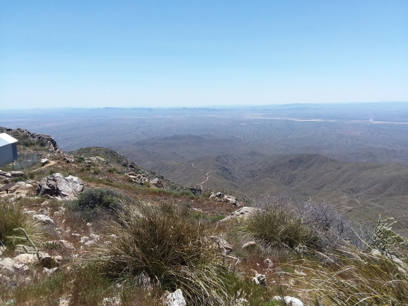
The next day trip was to the Harquahala Mountain. The summit is the highest point in southwestern Arizona. The name derives from an Indian phrase loosely meaning water high up.
The trail was more eroded than Mike remembered. It was much easier than the back way to Crown King!
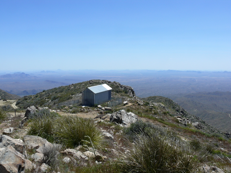
The main reason why people visit the summit is the disused observatory. This Smithsonian Observatory protected nine individuals from the harsh conditions between 1920 and 1925.
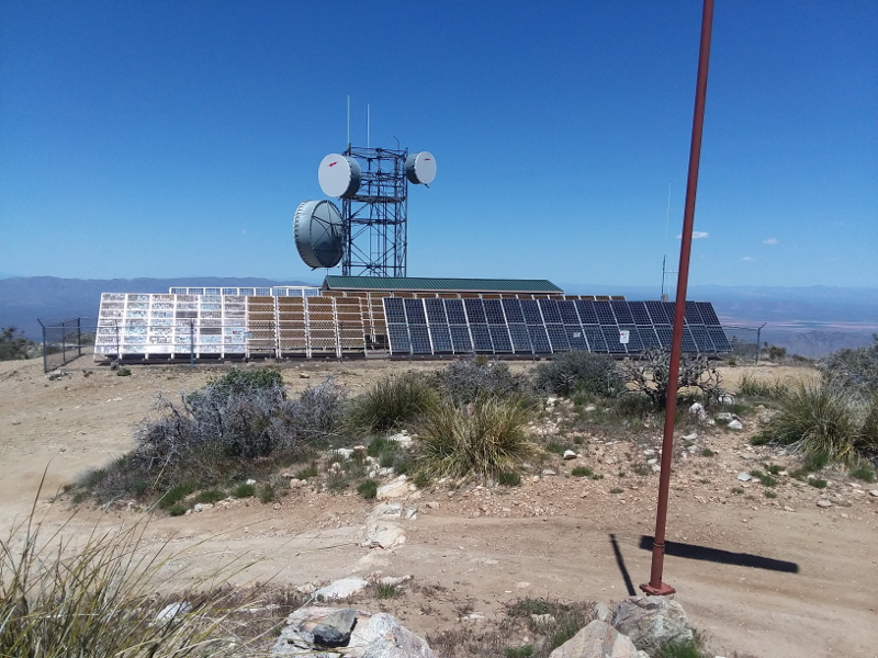
Also at the top is a solar array and a microwave station.
Everything was blooming, and it was very colorful. Click for a larger view!
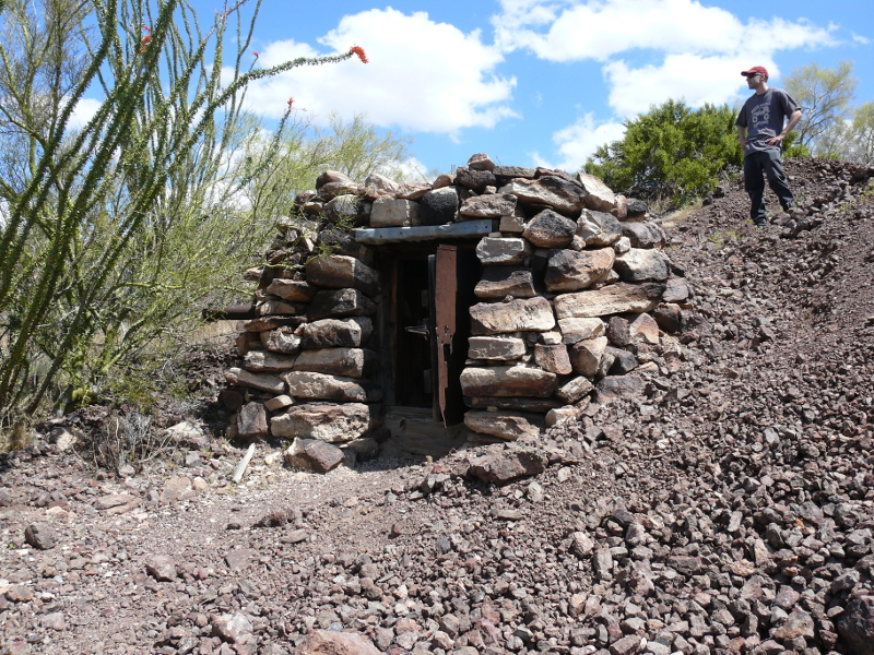
We found this cool, old stone cabin! With a little attention, it would make a quaint summer house halfway up the mountain!
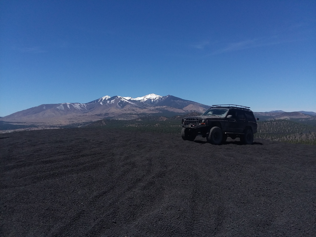
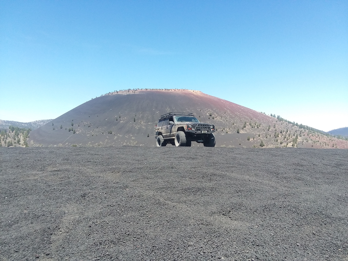
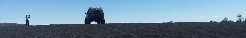
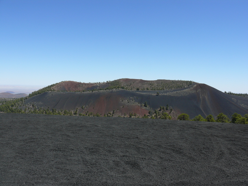
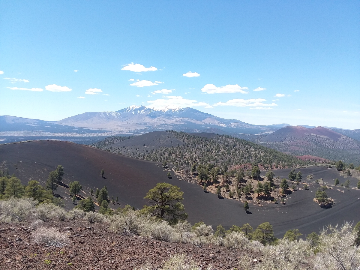
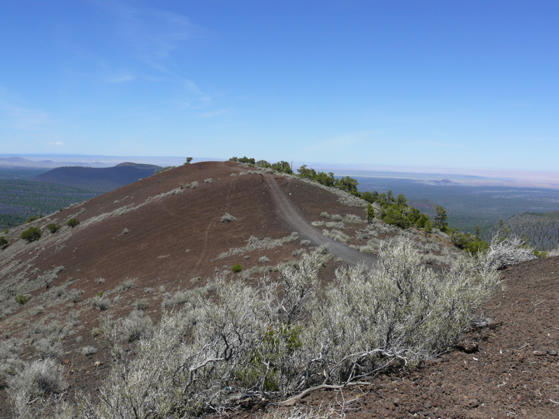
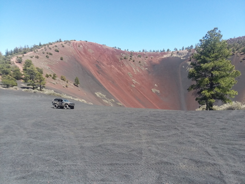
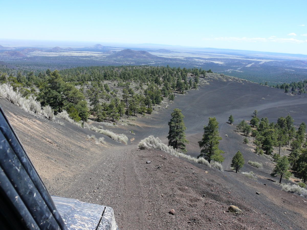
Next day off, we set out for the cinder cones near Sunset Crate Volcano Park.
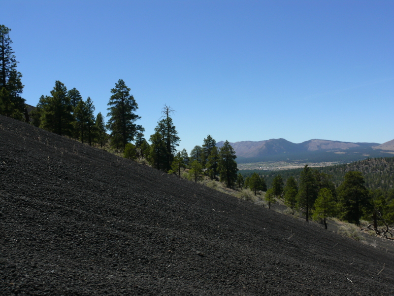
These cones are located in an ORV area so we could drive up and down them. It's a hard drive due to the steep angle and loose surface.

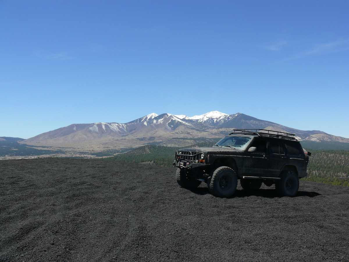
The view of Humphreys Peak was spectacular! Click for a larger shot.
Mike and I took some good shots of the Jeep:
 |  |  |  |
This clipped photo of Mike's would make a neat signature for forums! (Please, use it without fear of any penalty. I just ask for a casual reference to this site, and credit for Mike.)
Even the mighty Jeep gets bogged down sometimes. You may watch the video: 151_movie.m4v (16.1 MB)
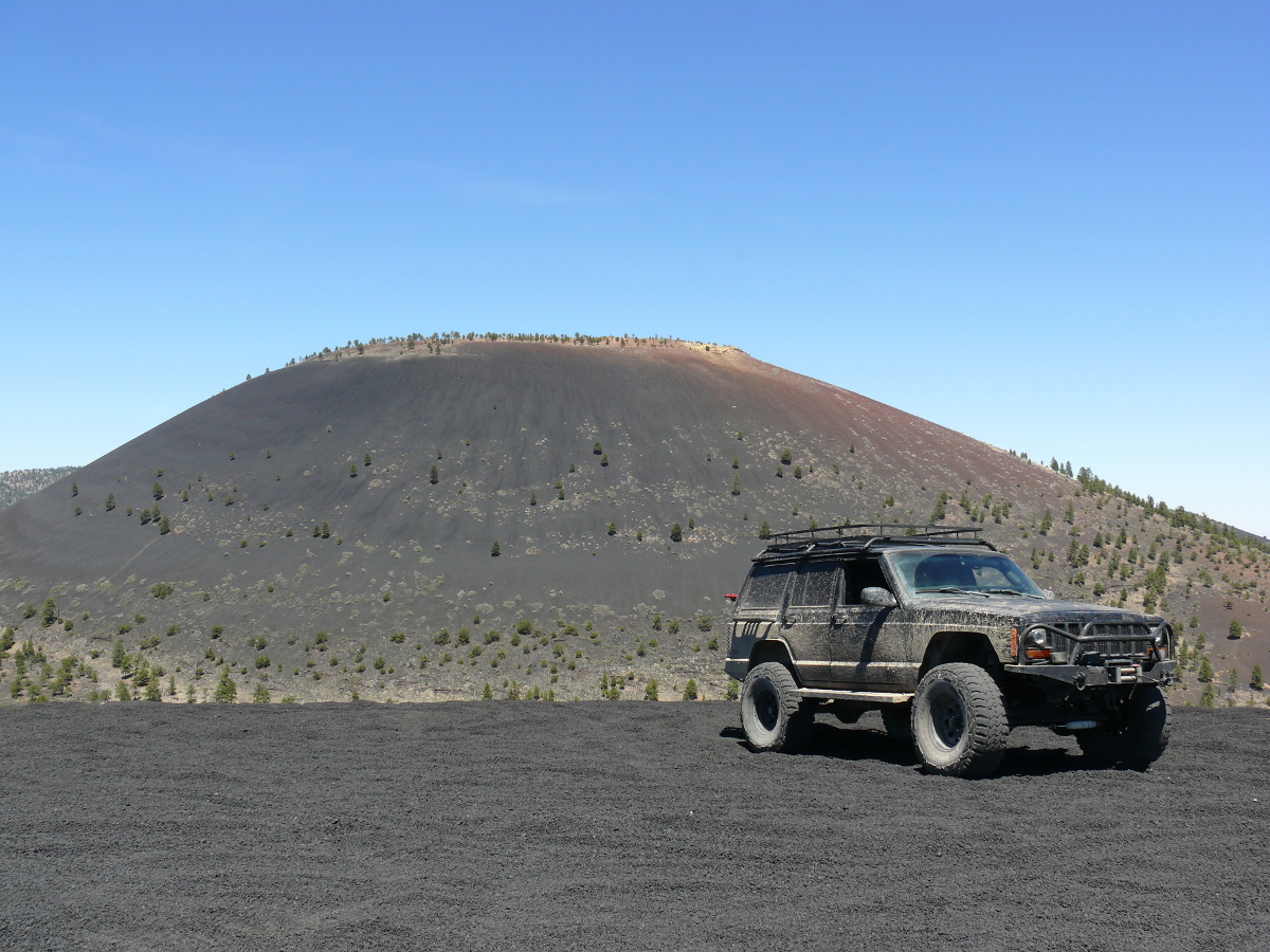
Our next stop is the crater. One may drive around the rim and down inside!
Once we found the correct route for our vehicle, which is not a sandrail, the view was impressive! Click for a larger image.
Ever feel like you're on top of the world?
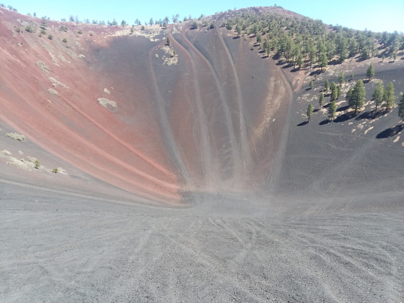
We didn't go down into the crater, fearing we wouldn't be able to claw our way out. Obviously, others didn't have that trouble!
Still, we made it up here!
Driving down presented a pretty view. Click for a larger view.
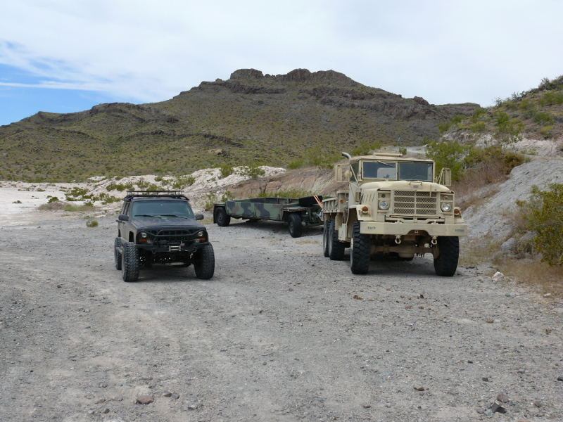
The aim of the final day trip together, for this year, was Oatman. We passed through a would-be neighborhood. It had dirt streets, road signs, few houses, and cattle. Then, we passed the Ford test track near the California border. There wasn't anything happening!
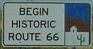
"Get your kicks on Route 66!"
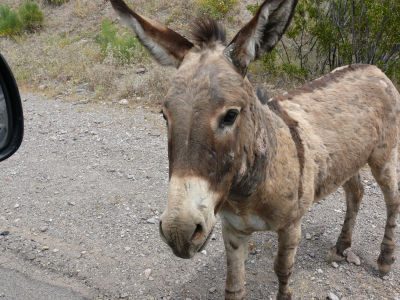
The area in and around Oatman is known for the tamed, wild burros. Or asses as we called them! They come right up to the window to ask for food!
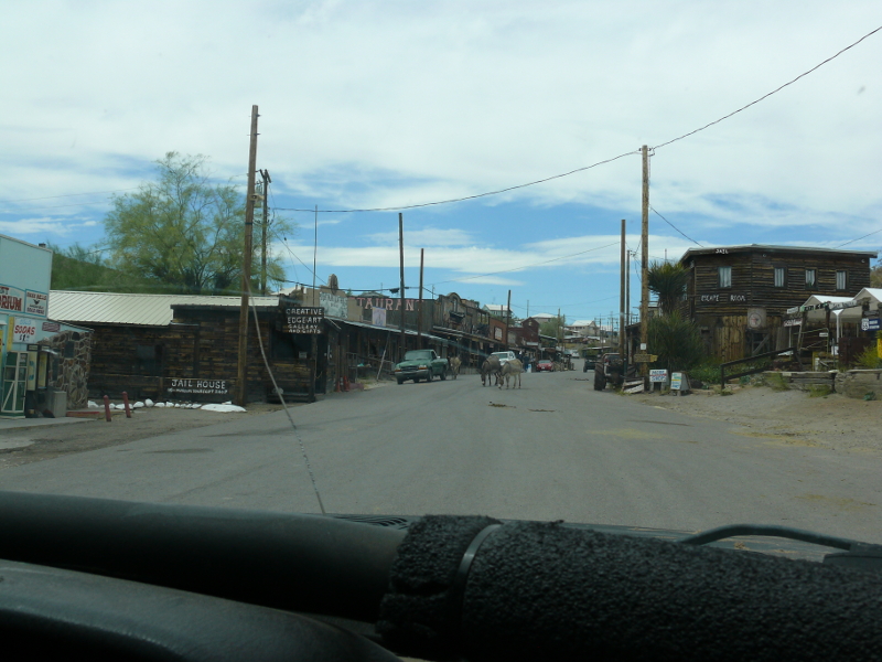
Oatman was mostly closed due to the fear of a virus. There were a few tourists. We didn't stop.
Just outside of town, we found something larger than the Jeep!
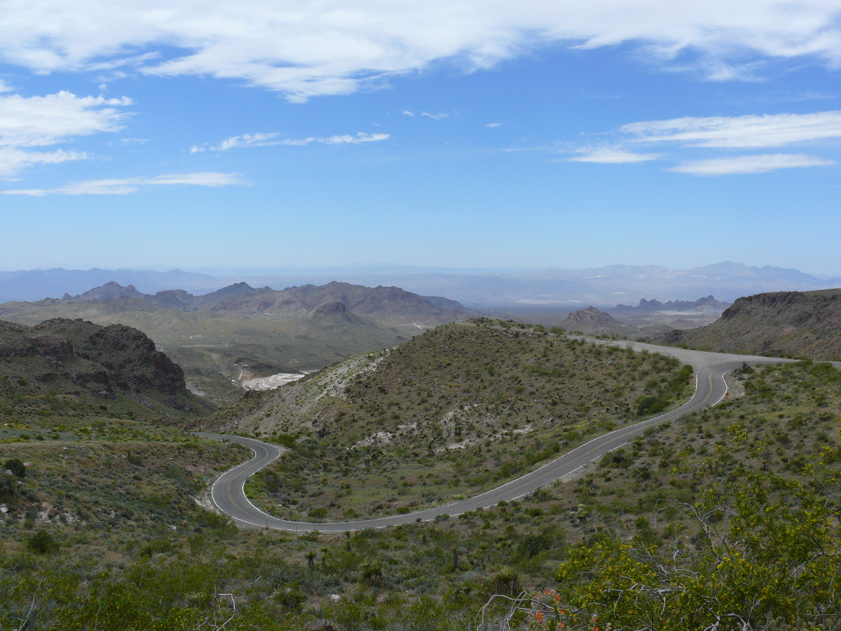
The road heading north out of Oatman was twisty! Click for a larger photo.
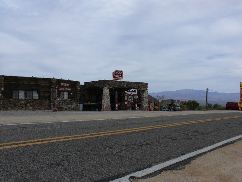
There was an old stone filling station in Cool Springs. Now, it's a gift shop and a tourist trap selling art & crafts.
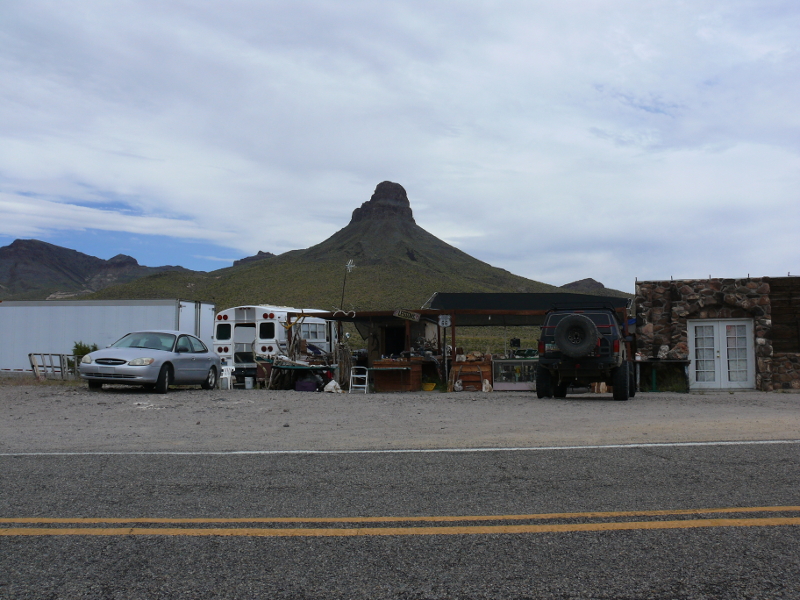
Behind the station is a cool butte.
I figured that I would make a break for home when it looked like the governments weren't going to do anything rash. The cross-country drive was the most unusual one.
I'd stayed seven weeks with Mike, driven 7,615 miles, and we'd driven 1,862 miles off-road!
Now, you have several reasons to explore the interior of the United States. Part 2 will be forthcoming!
 |
Copyright © 2002 - 2024 Billsuniverse.com