 |    |
Odd Florida, Part 3
(2018)
Florida is an odd state. This is the third collection of photos!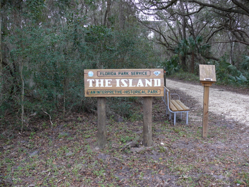
This may be my favorite Floridian oddity yet!
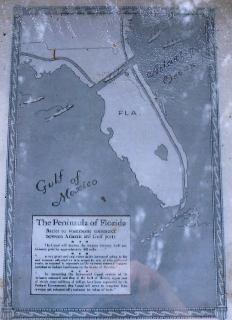
Since Europeans charted the Floridian peninsula, they have wanted to bypass it. One can't blame them, because it presents a substantial barrier to sea traffic arriving from the Atlantic, bound for ports in the Gulf of Mexico.
It wasn't until the nation was in the grips of the Great Depression that the Cross Florida Ship & Barge Canal was seen as a viable endeavor. The path started in Jacksonville and used existing rivers, like the broad and picturesque St. Johns River, before heading west. The exit into the Gulf would have been just south of Yankeetown and Crackertown.
(The latter is named for Florida Crackers. There are differing ideas about what a cracker is. A co-worker believes native Floridians, even those born of Northern parents, are crackers. In fact, the historic definition stems from the cattle driving days. These hardy individuals had very long whips that they cracked above cattle to drive them to, what is today, Crackertown. There, they were shipped to slaughterhouses across the Gulf. From Backroads of Florida by Franklin & Mikula)
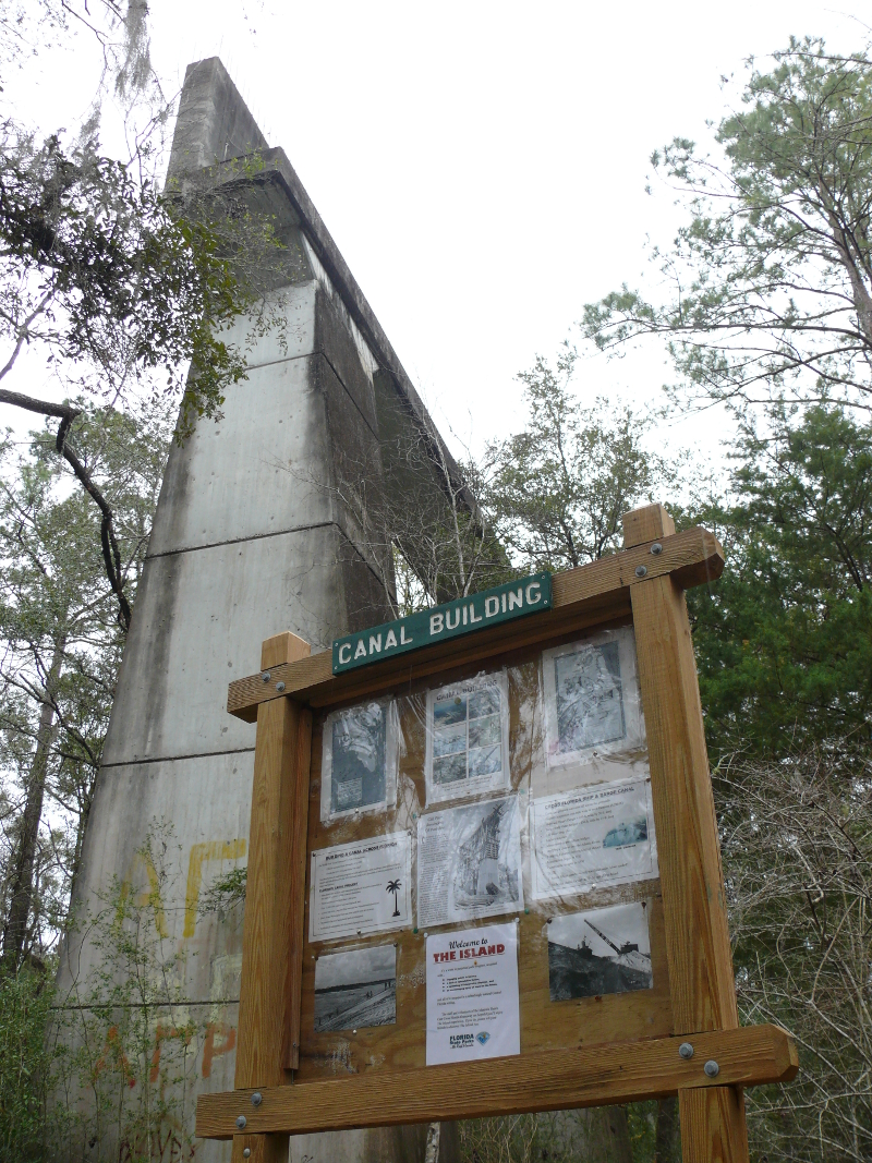
Today, there's a particular area in Santos that the Florida Park Service maintains as testament to the Cross Florida Canal. It's worth visiting!
Santos would have been a town bisected by the Canal. The existing U.S. Route 27, in particular, would have needed a bridge to cross the Canal. In anticipation of the upcoming overpass, the road was diverted around The Island of construction. This traffic pattern has been maintained since then.
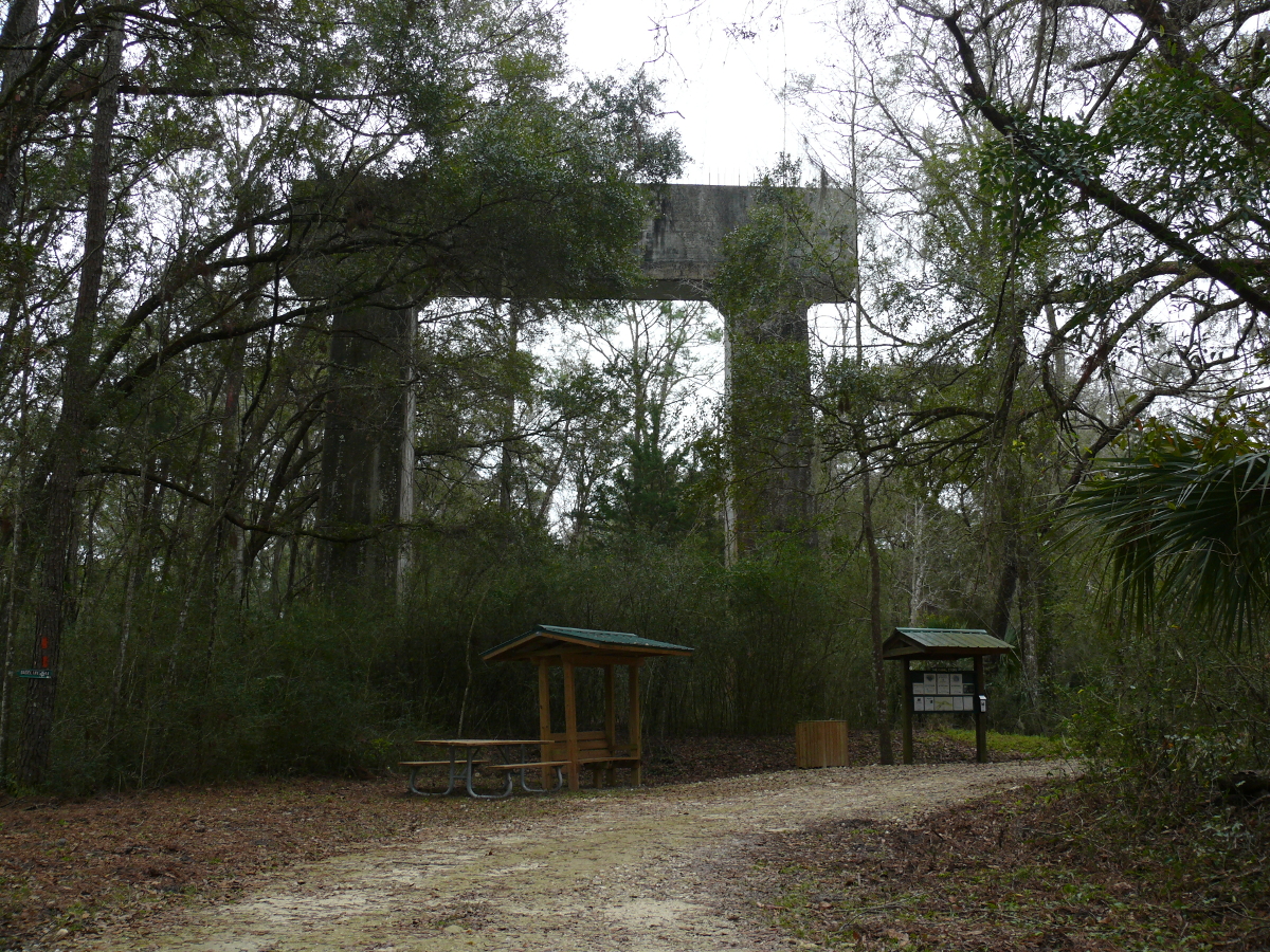
Above you see one of the stanchions to take the Route 27 roadway over the Cross Florida Canal. The educational structures do a fantastic job showing the scale of this concrete support. Of course, this entire Island would have been cleared of all vegetation nearly one hundred years ago. Today, it's eerie evidence of a stopped venture. Click for a larger view.
Or maybe the construction of the Canal was a plan to ditch the bulk of Florida into the Caribbean Sea? (Let the conspiracy theories fly!)
I wouldn't be surprised, because Florida south of the planned canal seems to be mostly swampland with the occasional "high" spot. It's possible that someone thought it was only a matter of time before the swamp "sank", so we should cut the land bridge now.
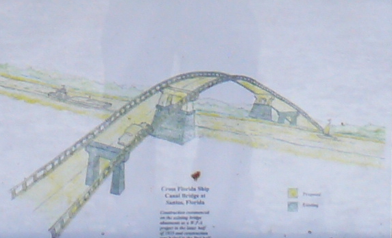
Above is an artistic presentation of the bridge over the Canal at Santos. Of course, people balked at the two-lane bridge. And, they would be correct because today the roadway is two lanes each way. However, nearly a century ago, there was a lot less traffic between Ocala and points to the South.
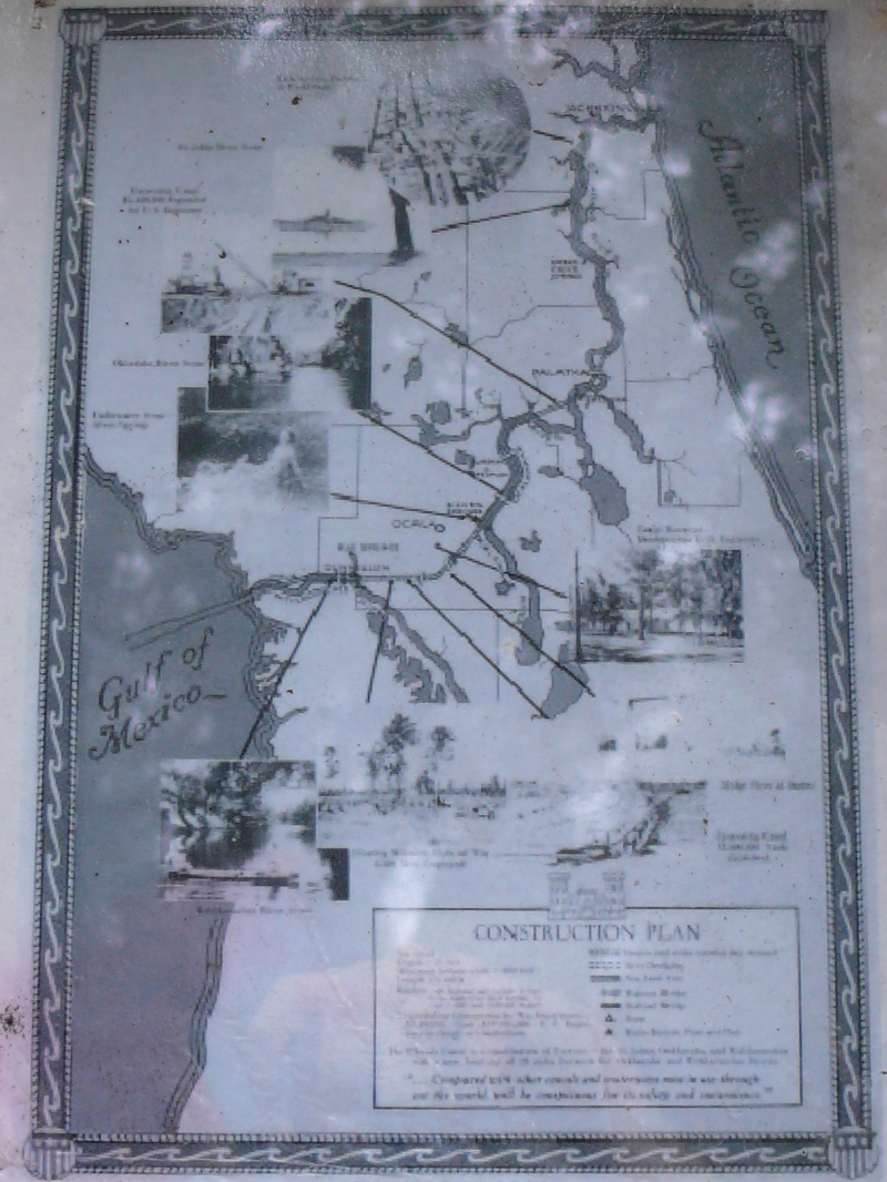
The actual route isn't as upsetting as the one presented in an above image. It would have largely followed the St. Johns River, a mighty waterway, to Palatka--an OK, little city. Then, it would have employed the large lakes to make its way to Santos, which is just south of Ocala. Then, the Canal would have been dug until it reached Lake Rousseau at Dunnellon.
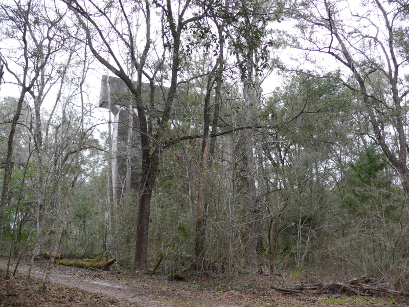
Even partially obscured by, what passes in Florida as, trees; the stanchions are impressive.
In 1971, Richard Nixon wrote an Executive Action sealing the fate of the Canal. He was convinced by many that the Canal would ruin the delicate fresh-water aquifer in central Florida.
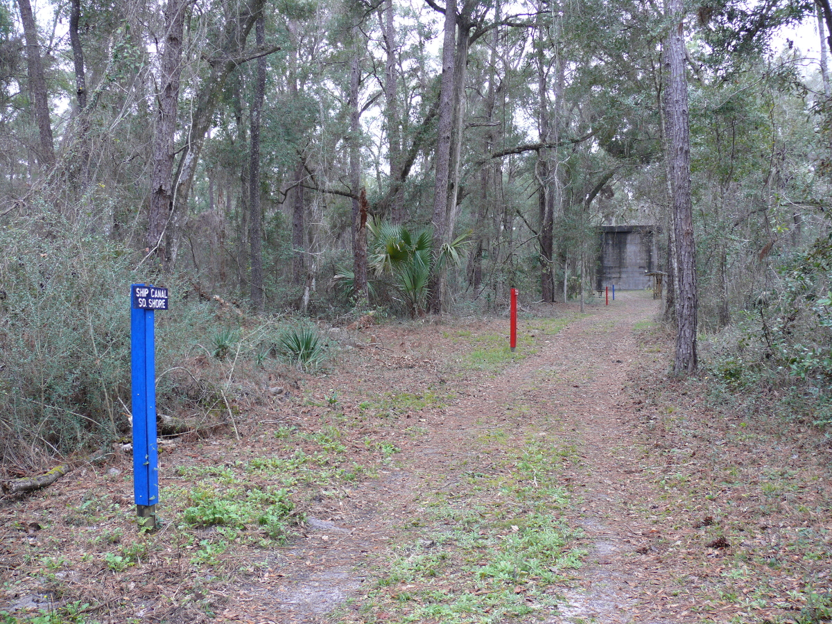
The folks maintaining The Island have staked out what it would have looked like with a canal of ship-width (blue markers) and barge-width (red markers). Remember that this area would be darkened by the roadway passing overhead. Cool exhibit! Click for a larger view to see the far markers.
I managed a good shot!
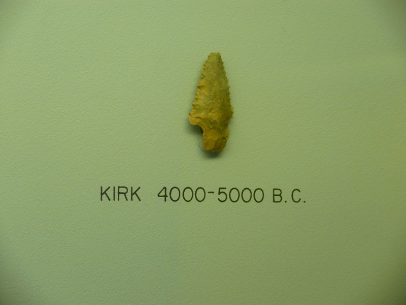
Next stop, ironically, was just south of the exit of the Canal. I didn't plan it that way. I stopped at the Crystal River Archaeological State Park. I intended only to purchase some postcards. It rained quite hard, so I couldn't visit the Indian (Native American) mounds that were built around the Site. Instead, I chatted with an interesting Park Ranger.
I also wandered around the inside exhibits. The photo above may seem insignificant. Please, allow me to explain it. I work with a gentleman named Kirk. He has guided me through the mess of this particular "defense" contractor, with ease. Now, I know why: he has been designing weapons for, well, a long, long time!
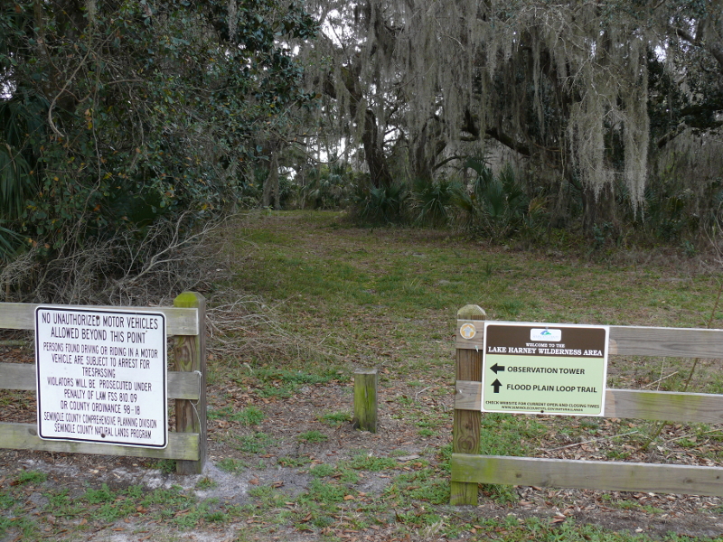
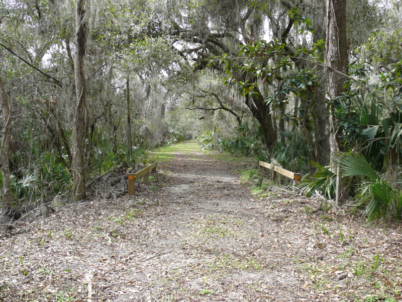
Not too far past Geneva, Florida, is Lake Harney. There's a wilderness area that's preserved. I walked along the flood plain trail.
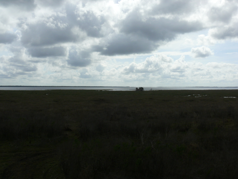
The southern view from the observation tower shows the lake and the flood plain.

The water level rises more than three feet during a flood. Like the Nile River, this flooding rejuvenates the soil.
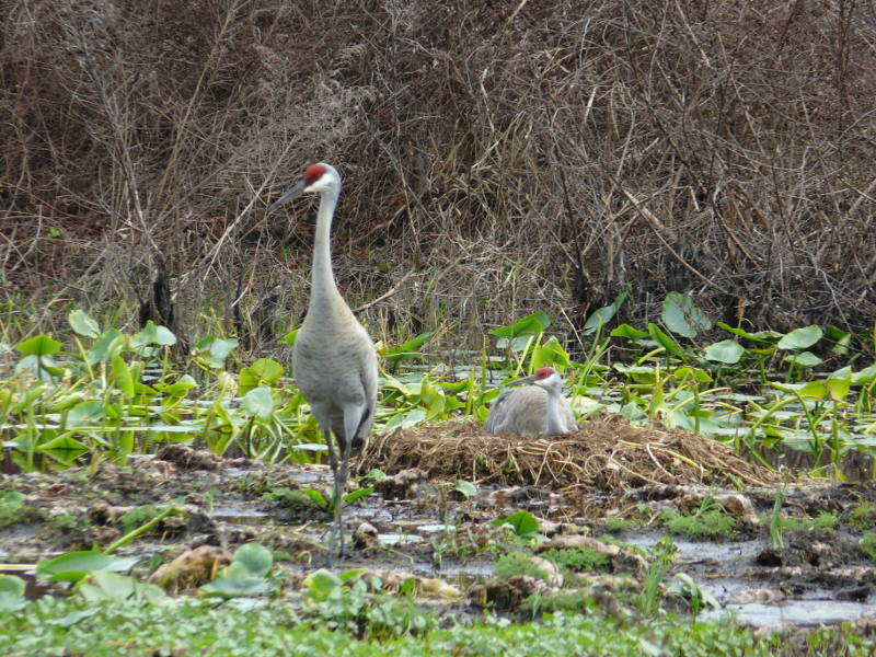
The area is also home to families of birds.
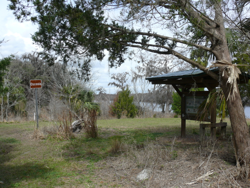
Welcome to the town of Osceola. It was once a thriving mill town that also claimed to be self-sufficient.
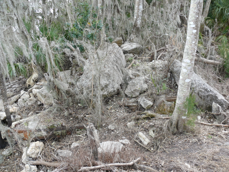
It was linked by rail to the east. Above is the remains of the bridge that conveyed the tracks across St. Johns River.
Not much remains of the town. This is the main street. I couldn't find the concrete general store vault, which is supposed to still exist. I did find a fence or two.
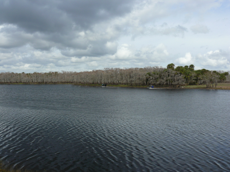
Meanwhile, two airboats were being driven up and down the river and lake.
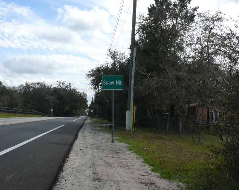
Don't laugh too hard! Yes, there's a town named Snow Hill in Florida. These are two words that have no place in the Sunshine State!
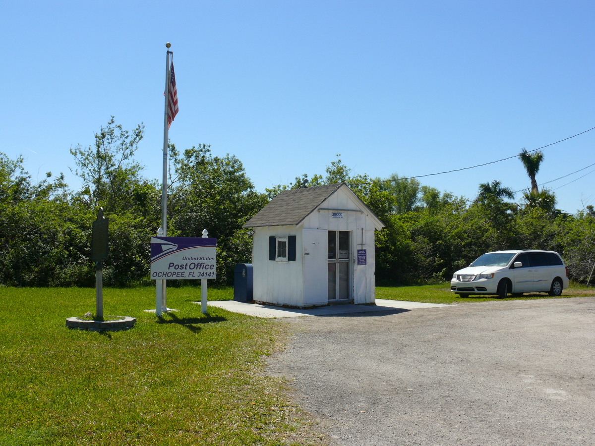
Near the Everglades, in Monroe County, is the small town of Ochopee. They claim to be served by the smallest Post Office in the U.S. The shed--I mean Post Office--is just large enough for one person, so it's possibly the smallest. Click for a larger view.
Exploring the Everglades is probably best done in a kayak or airboat. I didn't have the time for either, so I drove the Tamiami Trail. This road connected Tampa to Miami, hence the name. Construction of the road was a difficult task due to the swampy ground. When construction faltered, wealthy Barron Collier offered to use his money to continue the job. His stipulation was to have a county renamed for him. Today, the Trail (or Route 41) runs through Collier County. (source: Weird Florida by Charlie Carlson)
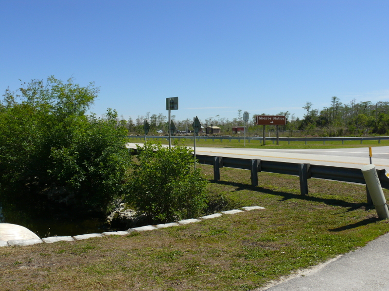
The area is a vacation spot for backcountry campers, and the canals offer anglers relaxation. The stations, established by Collier, along the Trail that were once used as bases for patrolling policemen are being demolished. For instance, the abandoned Monroe Station is now a staging spot for swamp trucks and provides toilet facilities for backcountry campers.
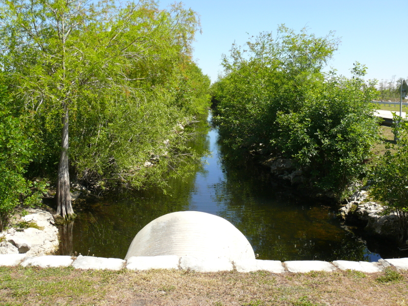
The Trail was created with earth from an adjacent canal. In the mid '20s, construction was costing Mr. Collier more than $20,000 per mile! However, the Trail was opened in 1928.
The Park Ranger at the Everglades National Park Visitor Center told me that the permanent building is a total loss. The Center currently operates from a trailer. She said that the storm surges were nine feet! The Flamingo Center (at the tip of peninsula) fared no better. These buildings probably won't be restored until 2019.
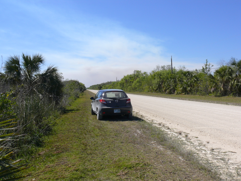
I turned off the Tamiami Trail and found an unsealed road to speed along. I was also looking for a place to stop to photograph the Everglades. I only got a few terrible pictures. Really, the Everglades look much like the rest of Florida. What's wrong with this photo?
A brush fire closed Route 29 just south of the town of Immokalee--love these funny Seminole names. I was diverted onto I-75. This highway is referred to as "Alligator Alley". Today, few 'gators wander onto the asphalt anymore because of the chain link fences. The brush fire was mostly contained by the time I was nearby; however, the smoke was still impressive. That area is panther country. Unfortunately, I didn't see any of the cats.
 |
Copyright © 2002 - 2024 Billsuniverse.com