


Cross Country Trip
(February 2010)
Financial needs warranted a move back to New England. This time I had no rush to be anywhere quickly so I could stop and see the sights I've always wanted to see.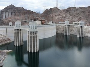
I got a late start from Los Angeles but made it around Las Vegas and to the Hoover Dam. In this photo you can see the intakes of the dam. Security to drive over the dam is tight, which is a good thing. Trailers and campers must take a detour around the monument.
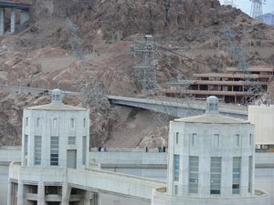
In this photo you can the scale of the dam. I also noticed the power line structures leaning over the edge. They look precariously placed.
The breakwaters block waves from Lake Mead or the Grand Canyon from reaching the dam inlets.
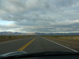
On the Arizona side of the Colorado River, they were widening Route 93. I saw a digger high above the roadway. It wondered if the dirt under it would crumble under its weight! I would have liked to see them put it there. It looked very difficult to get to.
The sunset was a spectacular red gleaming over the desert. I stayed overnight in the Arizona Inn in Kingman. I like this small town on Route 66. It's friendly and historical without being an annoying tourist trap. I had the top down during the day.
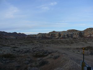
The next day I backtracked on Route 66 towards Oatman. I wanted to see the old mining town but 66 turned into dirt halfway between Kingman and Oatman. You can almost see the road go to dirt in this photo.
So I turned around and headed for Lake Havasu to see the old London Bridge. Don't bother. The casino, resort, and tourists cover this old bridge.
I spoke with a worker at a Mobil gas station in Tonapah (ouside Phoenix). He complimented the condition of the MR2 and we chatted about politics and common sense for a while.
I drove through Phoenix. The speed cameras there are sickening because they have signs warning drivers exactly where they are. So people speed right up to the cameras and then slam on the brakes so they won't get ticketed. This defeats the purpose!
Fortunately, Phoenix redeemed itself with the Heart Attack Grill.
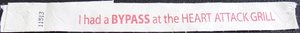
This is my wristband. I had a bypass and was patient number 11513. Imagine that: go in for a meal and come out with a heart bypass. And it cost less than twenty bucks! The scenery was great (the nurses are probably not registered) and the food was, well, fatty. Frying food in lard will do that! I recommend eating at this place if you're ever in Phoenix.
I continued through Tucson and stayed in Tombstone. This is the view from the Best Western. Yet another spectacular sunset! I had the top down again during this day.
The next day I went to visit Old Tombstone. It's more of a tourist attraction than I expected but the winter kept the camera-toting, Hawaiian-shirt-wearing fools at bay. I pulled my steed up to the site of the O.K. Corral gunfight.
 |  |  |
Click on the thumbnails to see shots of the three plaques at the site.
 |  |  |
Here are some of the cool buildings in historic Tombstone.
 |  |  |
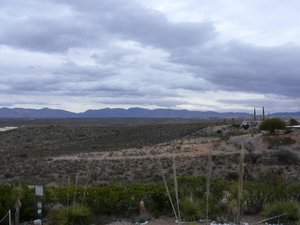
Here's Bisbee, Arizona. I thought this little town right near Mexico would be flat and dusty, like how it's portrayed in the movie 3:10 to Yuma, however obviously it isn't flat! There's a quarry near the town too.
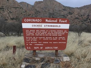
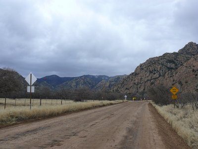
I drove back north, passed through a security (illegal Mexicans) checkpoint, and visited the area where Cochise, the Apache chief, held out against the US cavalry. The road through the Stronghold leads to a campground.
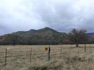
In the Stronghold is an air strip. Cool!
The view in the Stronghold is impressive. Click for a larger view.
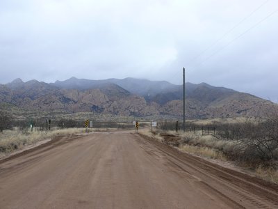
The parting view was spectacular!
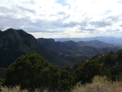
Eastern Arizona south of I-40 is fairly remote and very pretty area. Click for a larger view.
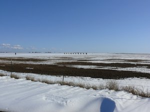
There was a good bit of snow near Luna Lake. This is in Apache territory. I thought that Apaches lived in flat deserts not mountain forests. But no there's an Apache National Forest. You learn something new every day!
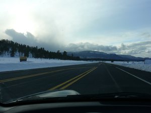
I wanted to take 191 north but it was closed because of snow so I took 78 to 180 in New Mexico. What an awesome drive! Everything happens for a reason. When I got back in Arizona I climbed and climbed. I saw a sign listing the elevation as 9,000 feet. At one point there was so much snow that the snowbanks were much taller (ten feet?) than the car. This is Arizona!
It was snowing a bit but with the windows up and heater on it was tolerable. However, as I headed down the mountain towards St. Johns, I had to put up the top and slow down a lot. I stopped in St. Johns because it was snowing an inch an hour. Fortunately it only snowed for two hours. The hotel concierge said this weather was uncommon. Today I had the top up most of the time.
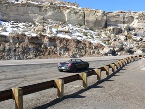
The next day I headed into Holbrook looking for a hardware store. I wanted to see if I could rig up another wind deflector for the side window. Bob had made a couple of them but they have a tendency to fall inside the door.
I stopped in at the hardware store in Holbrook and couldn't find a small sheet of Plexiglas. The clerk gave me a phone number and name of a guy who would cut the plastic for me. I then went looking for a small piece of plastic. I found a plastic cutting board at a nearby dollar store. The cashier saw my car and asked me where I picked up the snow. That's how it is in February in Arizona: snowing and only a few miles away parched and dry.
The guy who could cut the plastic turned out to work, or had worked, in alternative energy. I thought that pretty neat but he didn't want to talk about it. However, he did have some Plexiglas and cut it into the triangular shape for me for no charge. Nice guy.
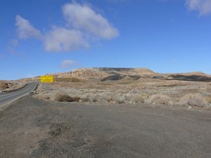
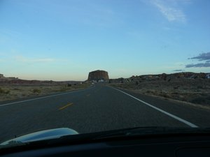
One of the three mesas in northeastern Arizona. Highway 264 goes up and over these unusual land formations.
Halfway up the mesa...
I believe this is a shot of the third mesa from the west.
 |  |  |
 |  |
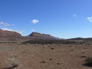
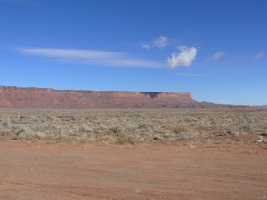
These are the Vermillion Cliffs (a national monument) and they stand some 1,500 feet above the valley lining the Paria Plateau. This is the western border of the Grand Canyon. The road to the north rim of the Grand Canyon was closed due to snow.
Cliff dwellers used to live around here.
The clouds cast a cool shadow in this photo.
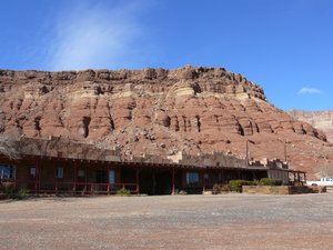
When I stopped for gas in Fredonia and asked the attendent if Pipe Spring National Monument was worth the time. He said it definitely was so I gave it a chance.
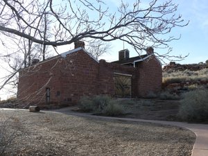
This is Winsor Castle. It was built to be defendable but never needed to be. It was intended to guard a natural spring, called Pipe Spring. This was a major stop on the Mormon route to Salt Lake City.
The spring no longer flowed because of tectonic plate shifts. It's a fun place to visit. Don (originally from Long Beach, California) gave a great tour of the fort and Jennifer showed me how to spin yarn out of wool.
A ripple of sedimentary stone on one of the steps of the Grand Staircase.
I continued along the third step of the Grand Staircase past this unusual bump just west of Big Water, Utah. I liked what I saw of Utah.
I stayed in Page, Arizona. I had the top down most of the day. I did put the top up occasionally to stop from getting a sunburn. Not bad for February!
This is Navajo Mountain on the Arizona-Utah border.
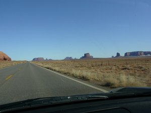
I filled up in Kayenta before heading north towards Monument Valley. This is view from Route 163 as I approached the valley from the south.
 |  |  |
 |  |
Here's the view from the souvenir shop & hotel overlooking Monument Valley. One can see the orange ribbon winding amongst the mesas. That is the trail leading into the valley. One of the van drivers suggested against my driving the MR2 in the valley because of the mud. At $50 for a tour I didn't take his van ride.
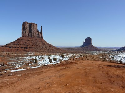
The view as I started down into the valley. Here you can see the Mitten Buttes. Magnificent! Click for a larger photo.
 |  |  |
Here are a few shots of Mitchell Mesa and the Three Sisters.
 |  |
The Elephant Butte actually looks like an elephant.
 |  |  |
The Camel Butte doesn't look like an animal from the back, unlike from the front!
 |  |
The Rain God Mesa.
 |  |
This is part of the Spearhead Mesa. Around here a Californian couple in a Hyundai were scowling at me. I think they were jealous because I had the top down.
As the sign says: this is Cly Butte! Left click for a larger view.
 |  |  |
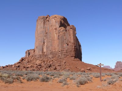
The Mitten Buttes and Merrick Butte.
 |  |  |
The view from the base of the Spearhead Mesa.
 |  |  |
Looking through the North Window Overlook.
 |  |  |
Here are some other photos that I took in the Valley.
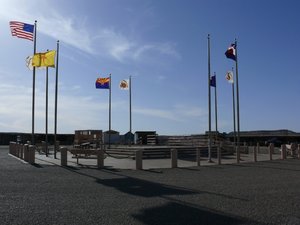
Four Corners, like Monument Valley, is on Navajo land. They charge a small fee to enter their lands. It's $3 for Four Corners and $5 for Monument Valley.
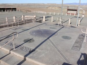
The monument at Four Corners is pretty neat. It reads "Four States Here Meet in Freedom Under God."
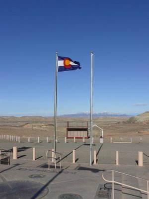
The view of Colorado maintains the stereotype of that state.
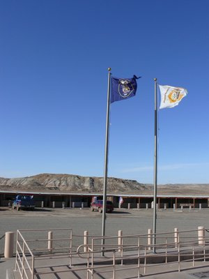
Utah is no different!
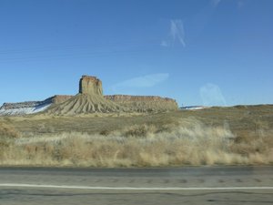
I then drove into Colorado. The daylight was running out and I was beginning to get tired of driving so I decided to head towards I-40 in New Mexico. I saw this mesa just into New Mexico.
As soon as I got into New Mexico the speed limit dropped by 10-15 mph and the road work began. It was annoying because the road was no more treacherous than the nearby roads in Arizona, Utah, and Colorado. I think New Mexico is just trying to protect people from themselves. "Careful! You might hurt yourself."
I drove through Shiprock, New Mexico and was not impressed. It seemed like a welfare community like the cities of northern Massachusetts. I saw plenty of stimulus-bill signs along the road to Gallup. Disgusted, I headed towards I-40.
I stayed overnight in Gallup. I like that town. I had the top up most of the day. In fact Monument Valley was the last time I had top down during this journey.
The next day I continued my trek eastward. I stopped at the Cadillac Ranch near Amarillo.
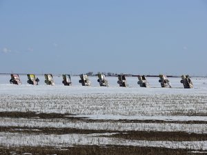
There were some people frolicking around the half buried cars so I decided to just use the zoom to take a photo.
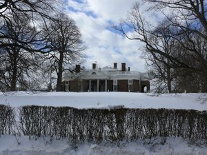
I stopped near Charlottesville, Virginia to see Monticello.
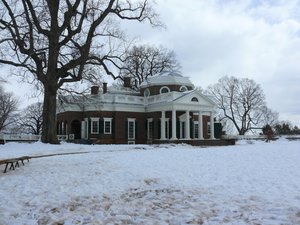
Thomas Jefferson's house is striking from either front or back!
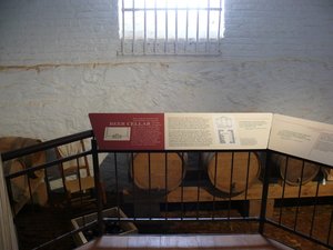
After a guided tour of the house, I went into the cellars. The highlight was, of course, the beer cellar. Click the thumbnails below to read the sign:
 |  |  |  |  |
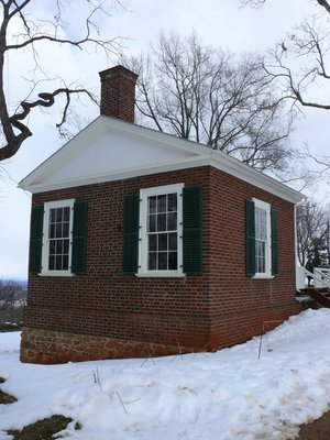
Here is a shot of one of the pavillions.
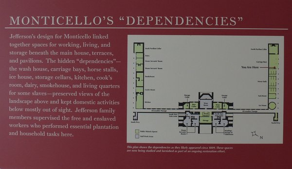
Monticello is pretty complex structure so here's a map. Click for a larger photo.
 |  |  |
Here are a few of the signs on the land around Monticello.
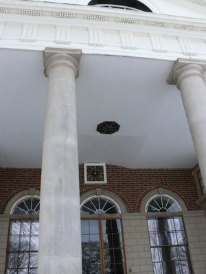
Jefferson was a student of many fields. He loved to know stuff and was a great thinker. Here's a gauge that communicates the wind direction to the ceiling of his front porch. This way he could see the wind direction from his three front rooms. He took wind speed and direction readings twice a day for decades.
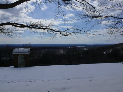
The view from Jefferson's mountain. Click for a larger shot.
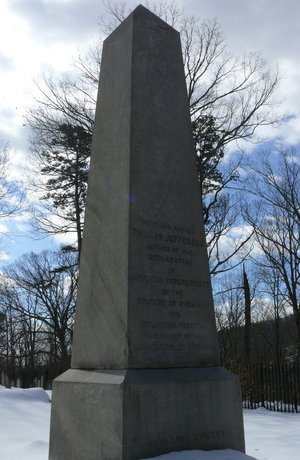
This is Thomas Jefferson's grave. It's in a private cemetary halfway up the mountain to Monticello. There's a hiking path upon which one cannot hear the buses and people. I felt this must have been how it was when Jefferson owned this land. Very peaceful.
Copyright © 2024 Billsuniverse.com