 |    |
Capitol Reef, Utah
(November 2017)
Capitol Reef National Park was our next destination for camping and four-wheeling.The flight from Orlando was uneventful. I almost thought that I wouldn't make it through Orlando International Airport's security in time. (SuperShuttle was late picking me up, due to a broken van.)
Finally, I walked through the metal detector, thinking I wouldn't have to pass through the body scanner. No such luck: I was one of the lucky few. So I used the body scanner for the first time. Now, I glow in the dark

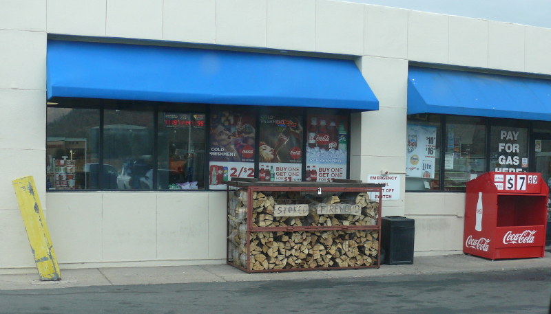
Since Mike and I had a motel room arranged, I suggested we wait till after Carley, Mike's girlfriend, left for work. The traffic wasn't bad and we soon found ourselves in Flagstaff. After we filled the Jeep, I saw a new type of firewood. I took a photo so I could look up what "stoked" meant. I'm always looking for an easier way to release the heat in firewood. As it turns out, Stoked Firewood is a company name.
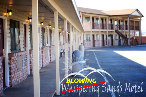
The wind was very strong the entire day, fighting our uphill trek. In Hanksville, Utah, Mike checked in to the Whispering Sands Motel. Scratch that! Blowing Sands Motel is more accurate! The above photo was modified from an original found at www.whisperingsandsmotel.com.

After a good night's sleep, we set off for Capitol Reef. The wind had died down and all was well in the high desert, once again.
...and we arrived on Mars! OK, not really. We stopped to visit the Mars Desert Research Station. Click for a larger view.
They have about the same number of solar panels as I do. But mine are on poles so I can adjust the angle for seasonal changes.
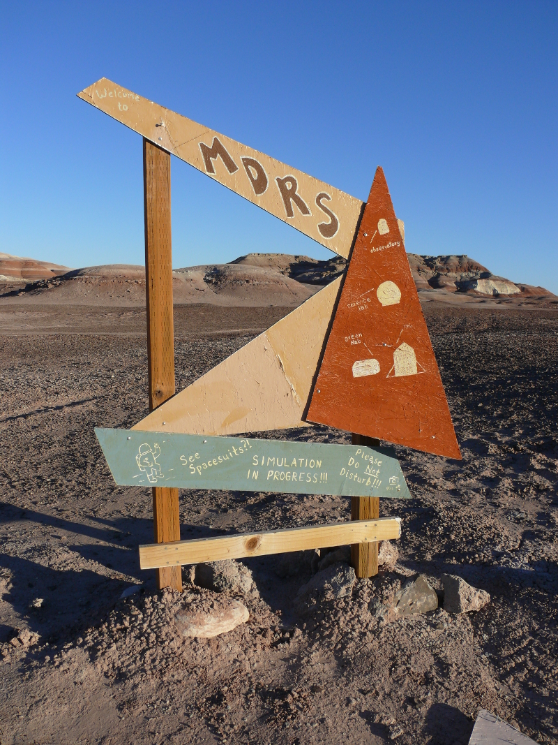
It was worth visiting this neat site. Above is the sign that also explains the purpose of the various structures. Wouldn't it be great fun to participate in the Mars missions? Mars, Utah, spacesuits, solar panels. The only thing missing would be a serious Jeep.
There's one! And in the background is the Capitol Dome or Navajo Dome, as it's now named. It's supposed to resemble the dome on the Capitol building in Washington D.C. It looks more like a boob and nipple to me. But what do I know? Then again, there are lots of boobs in D.C... Click for a larger image.
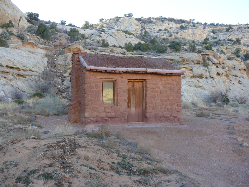
Speaking of boobs, I forgot to show the Behunin Cabin. This structure was built by a Mormon family in 1882. The location is not the greatest, though. Flash floods frequently washed out the surrounding area, and even threatened the cabin. The family later moved to Junction, which is now known as Fruita.
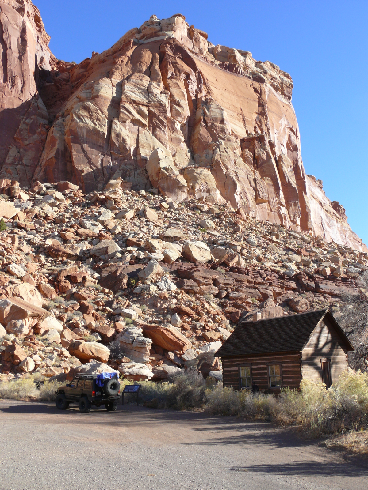
Just inside the remaining area of the town of Fruita is the schoolhouse. I don't know how any studying could be done with that butte in the background. Click for a larger image.
Fruita is named for its multitude of orchards. Apple, apricot, peach, pear, plum, cherry, almonds, pecan, and walnuts are some of examples. I'm told by a friend that the place is very fragrant during the flowering season. Obviously, November isn't that season!
Calvin Pendelton built this house, and the unshown barn and surrounding stone walls. He was a polygamist. Maybe he kept busy because he wanted some peace!
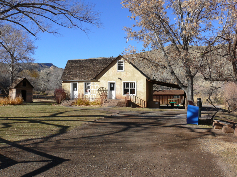
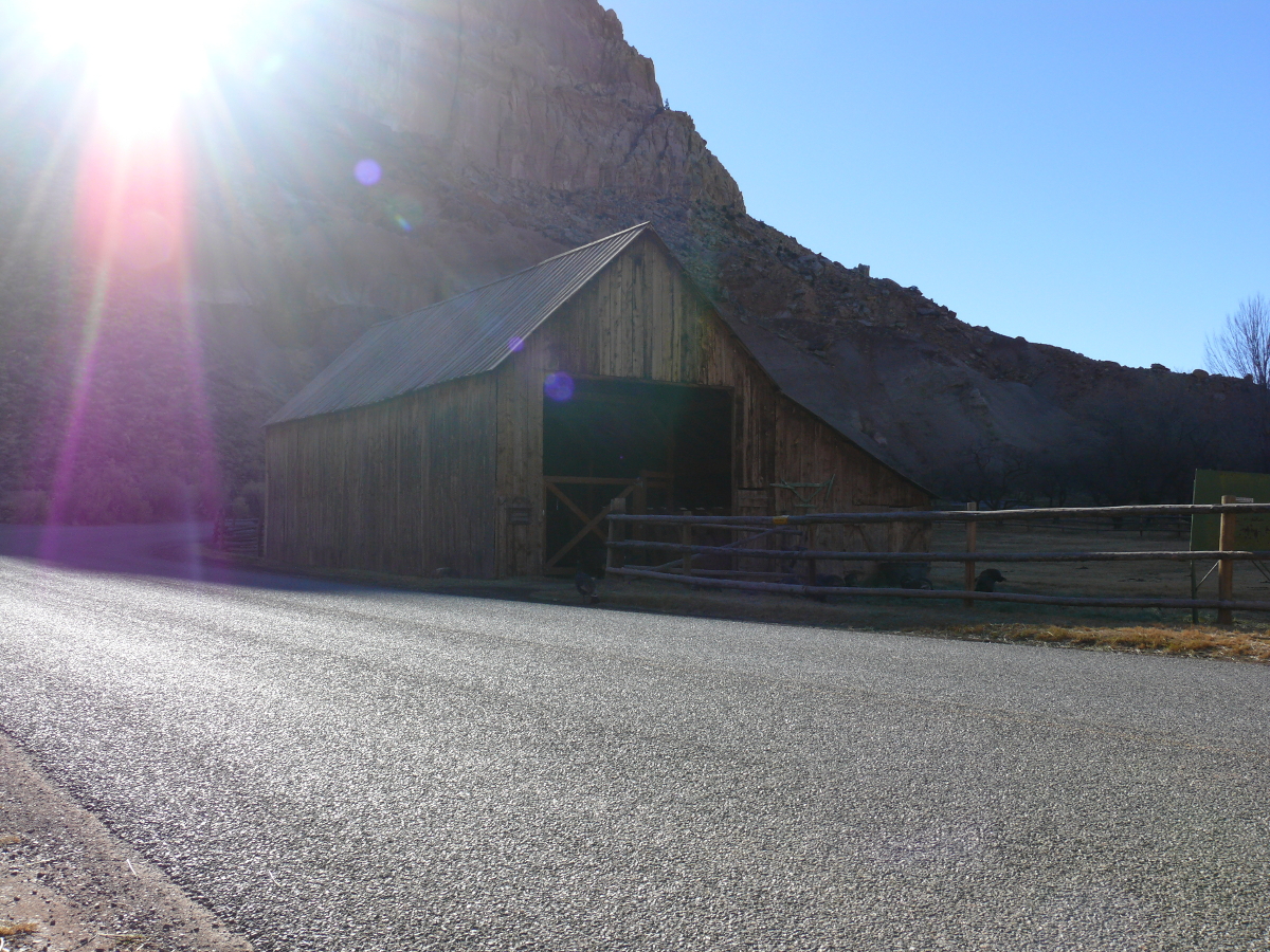
The Gifford House, as it's known today, is a museum and shop. It was closed when we visited.
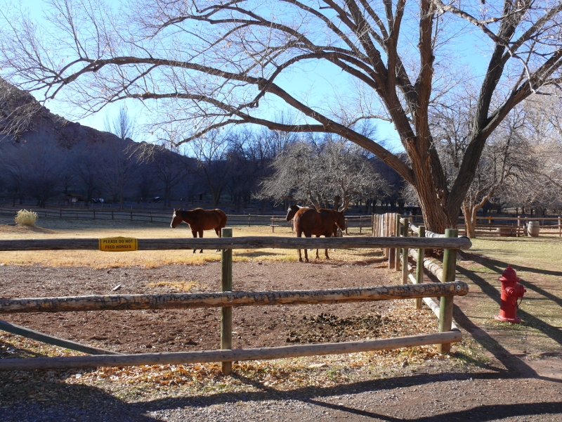
These horses were so still and quiet that we wondered if they were statues. Maybe they were just sleeping? It was still somewhat early.
Here's Pendleton's barn. It's pretty good size. Not as large as a friend of mine's, who incidently has the same given name as Pendleton. And this one isn't as old: my friend's was built before the Revolutionary War! But this barn is located in a picturesque spot! Click to see what I mean.
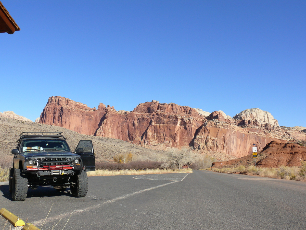
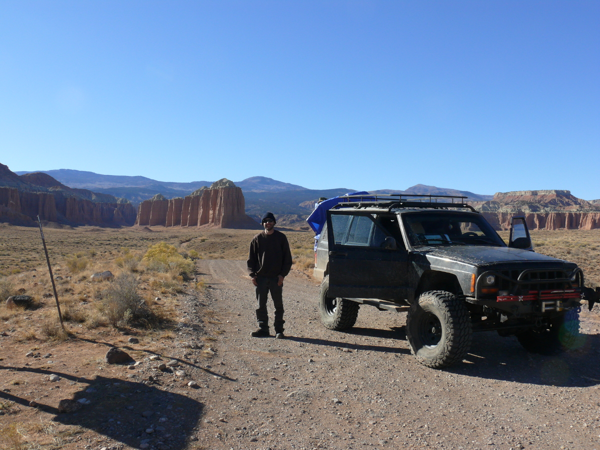
Before we set out down the Scenic Drive through the heart of the Park, we stopped to take in the view. There's a $10 fee to take the Drive. It is, of course, by the honor system during the off season.
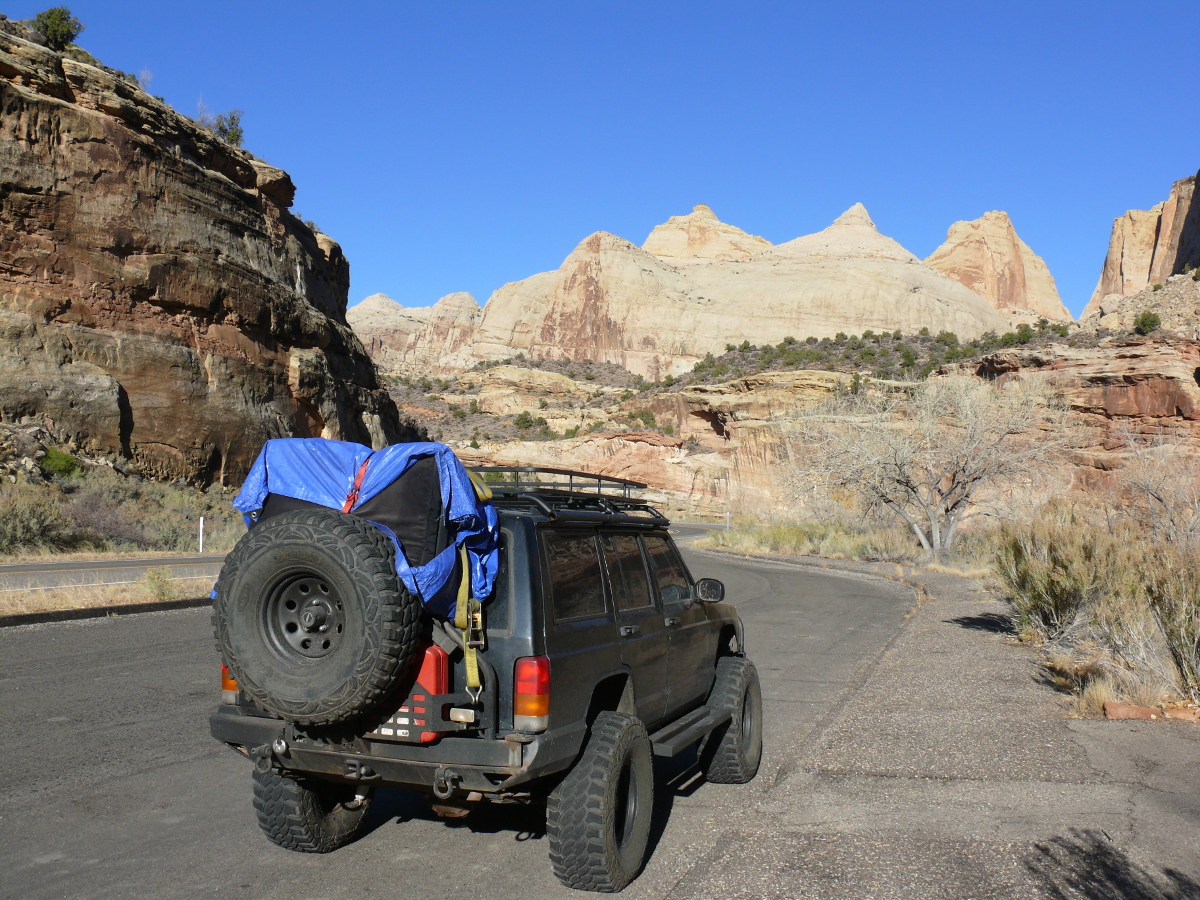
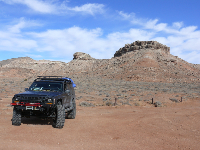
Now is a good time to point out Mike's hard work transforming his Jeep into the beast shown above. The last time I saw it, it look liked this. Since then, he's
These are only the major updates! He sure has been busy in the two years since we last went four-wheeling! Click for a larger image to see the "new" Jeep in a beautiful setting.
We then set off along the Scenic Drive. There are many trailheads inside this National Park, and this area is no exception. We took the turn-offs and drove the graded dirt roads until we ran into the trailheads. Not wanting to waste time, we would turn around and continue south. 'Maybe, we could forge a career as the world's worst explorers?'
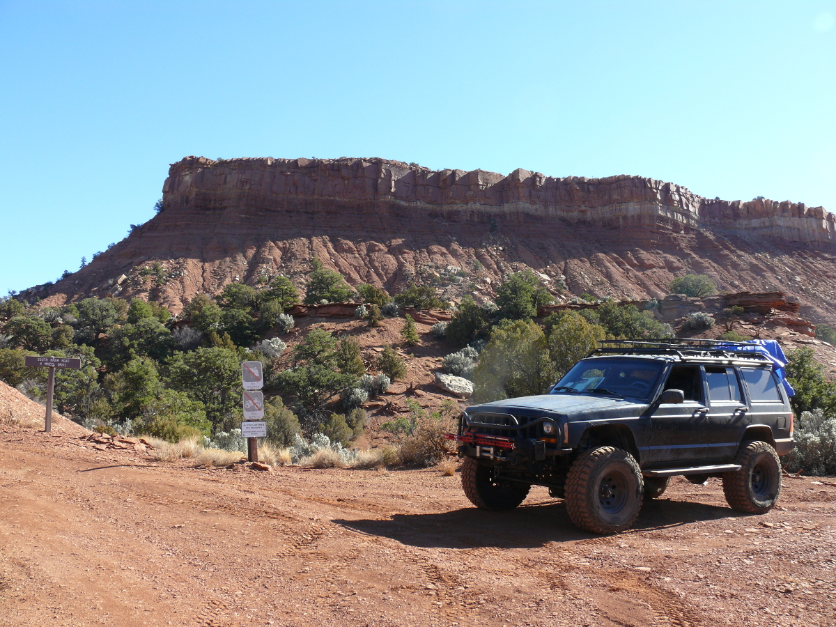
Shortly after the tarmac ran out, we came across an empty front-wheel-drive car. Curious. Then, an Asian woman materialized out of one of the bends. Mike thought she was walking ahead to see if the road conditions improved. They didn't. That's the South Draw Road, a four-wheel-drive trail.
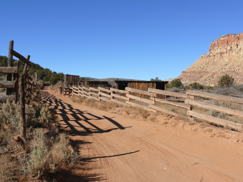
We did come along this old ranch and corral. Click for another view of the disused ranch.
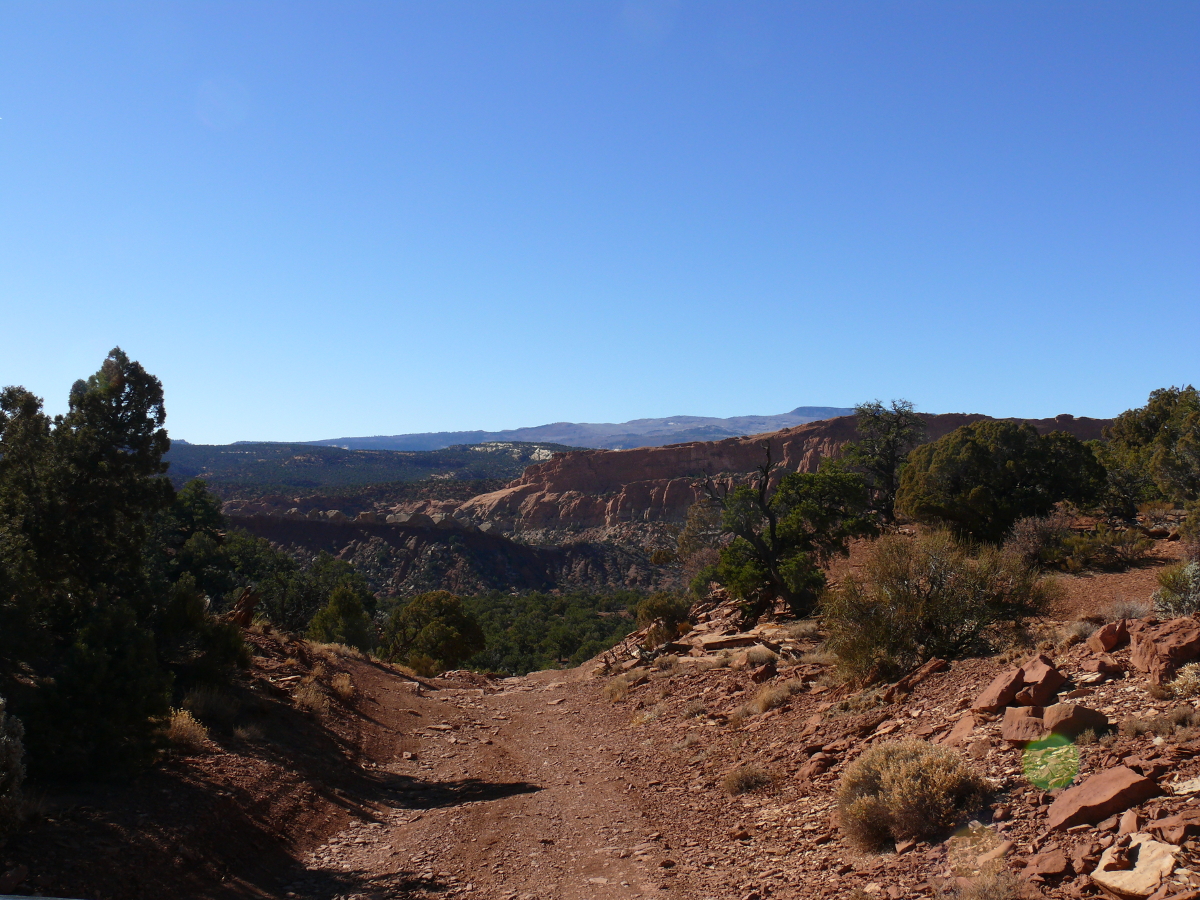
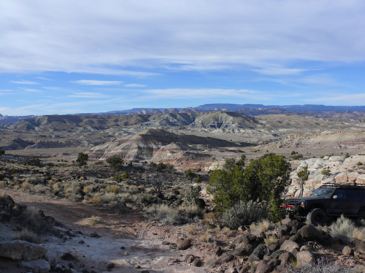
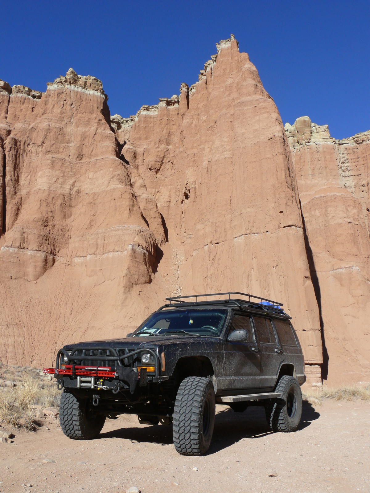
Once we crossed one of "reefs" out of the Park, we were rewarded with a beautiful view. One may also see the conditions of the trail. Click for a larger view.
Does the Jeep look a bit smug? Maybe! One of the reefs is in the background. This one is called the Waterpocket Fold. The blue tarp on the back of Jeep protects our thick, sleeping pads from the dust and rain. Thank you, Carley, for purchasing them! Click for a larger view of this pretty spot.

Now we were out of the National Park. The trail followed Pleasant Creek, which we forded shortly after this shot was captured.
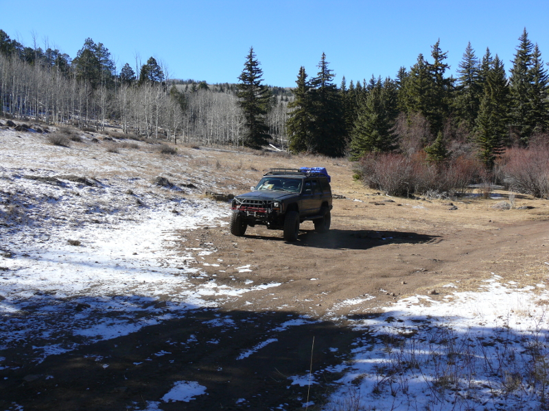
The trail climbed into the Dixie National Forest. The sudden increase in elevation gave us a view of the wintry stuff. The Jeep is standing at more than seven thousand feet in this photo.
I had planned to steer us back into Capitol Reef. We would have crossed it on a 4WD trail into the BLM public lands--the Bureau of Land Management ministers our lands--to the east. But the trail was closed and blocked just behind where I took the above photo.
I contemplated camping in the Forest, but figured since the ground was still below freezing at the warmest part of day, it would be a bad choice. Looking at Mike chilled in his ski jacket and knitted cap, confirmed my theory.
I referred to this Forest as Dixieland. I enjoy nicknames that reflect personal thoughts of an area. Summer is obviously the high season for this National Forest, because we found many established fire rings as we headed back to the main road.
We made out way back to the main road, Route 12. At more than 9,000 feet, we weren't surprised to find ice and slush on the roadway. The Jeep, piloted by Mike, had no trouble winding our way down to Torrey, about twenty miles north, and more than two thousand feet closer to sea level.
In that small town, we stopped to fuel the Jeep and us. The weary woman in the Subway was brusque. That is, until she realized that our day wasn't going according to plan either. Regardless, we were able to feast on late-lunch sandwichs as we motored through Capitol Reef towards the BLM lands east of park.
Just outside the boundary, we forded the Fremont River. We both expected the fording to be more exciting. The beast made it look easy, despite the swiftly flowing water. Along the Hartnet Road, which is unsealed, we found a trail leading to the east.
We climbed along it until it we found a good camping area. Mike found the spot. We did wonder if we'd find enough stone to make a fire ring
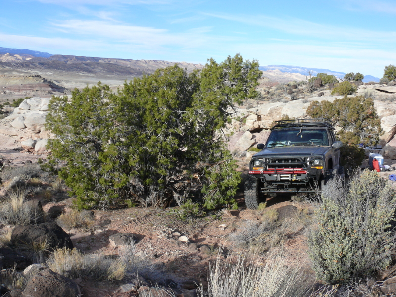
Getting the Jeep near the campsite, which wasn't that far from the trail, was no easy job. A stony drop and a particular piñon pine presented a challenge.
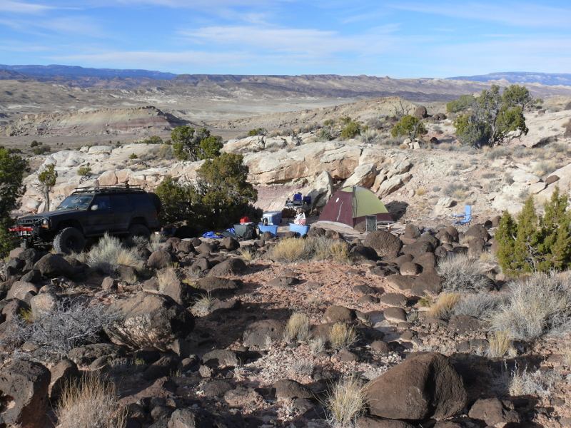
The view from our campsite wasn't bad. It looks a bit Californian with the yellow sands. I do enjoy the prominently red sands of southern Utah, but it was still beautiful. There was also plenty of wood for our campfire. In fact, we burned only locally-procured wood AKA deadwood the entire night. There was that much within stumbling distance. Could this be Heaven? Click for a larger view.
We burned a fire the entire night because there was no moon. Unfortunately, I located my tent just downwind from the campfire. It's no wonder why I woke up in the wee hours not being able to breathe. So I was able to supervise the final burn down of our overnight campfire before clambering back into my tent during the early hours. The above, daylight photo shows my mistake, as well as some of the abundant seasoned, or stoked, firewood within easy reach. Oh, and that view! The overnight temperature was in the low 20s.
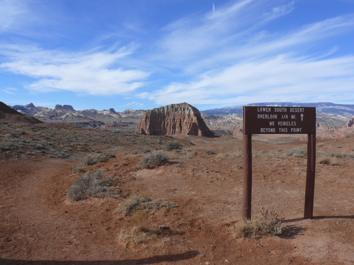
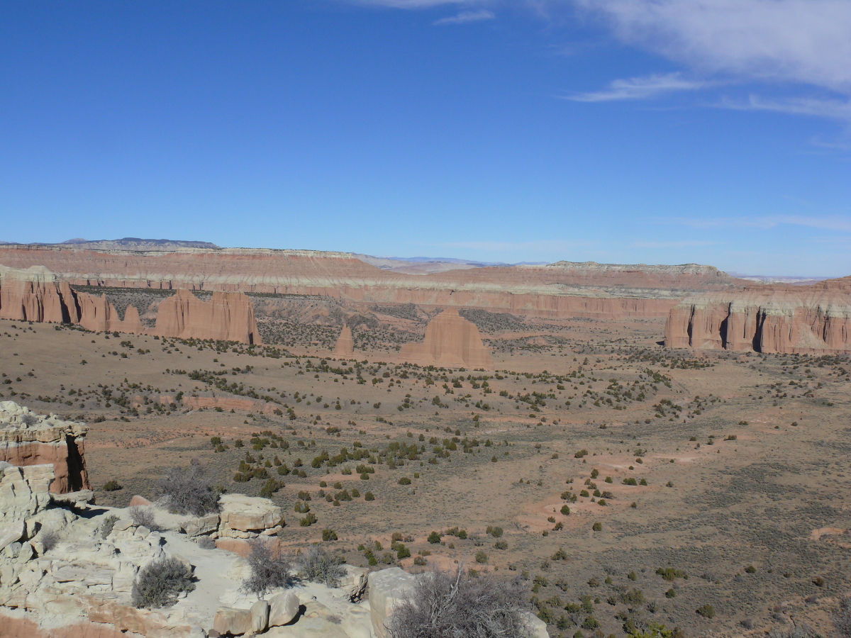
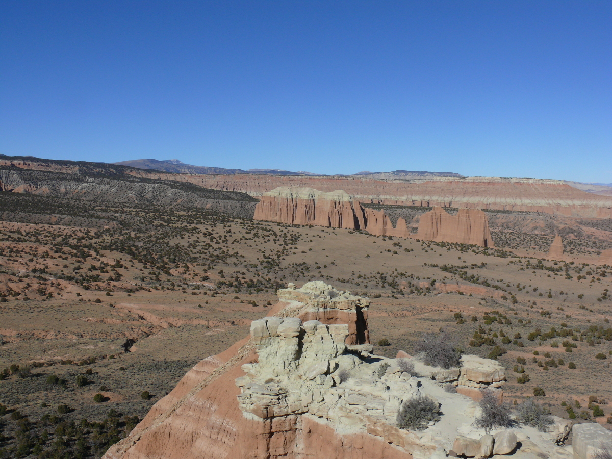
The next morning, we found our way back to the Hartnet Trail. We continued northwest along it. Not wanting to abandon our tradition of driving up to trailheads, we stopped at the Lower South Desert Overlook 'head. Could this be Jailhouse Rock? Or maybe I'm just channeling Elvis? (We do have a connection.) It's a pretty spot. Click for a larger view.
Meanwhile the Jeep waited. Ever-ready, it studied us through bespectacled eyes, and behind a grill of metal. We were too busy enjoying the picturesque scenery to notice!
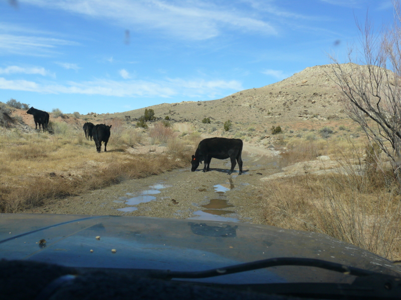
I guess it was inevitable. BLM land is the land of choice for grazing cattle. I don't mind, because cows make great hamburgers--oh, and they are docile creatures, too
In the past, we observed cattle gazing at us from the side of the trails. Not this time, this cow was not frightened by the beast. I could understand if it was a bull.
Mike's honking made no difference. I had an idea and opened and closed my door. Would you know it, that made the cow walk off the trail?
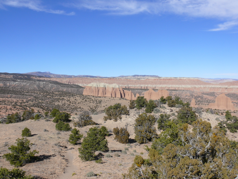
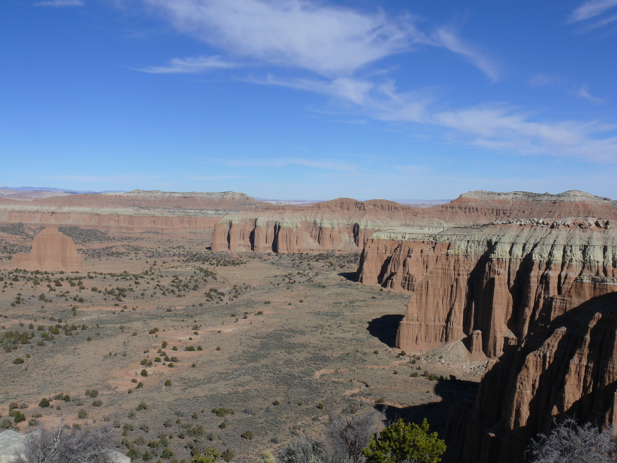
What really gets me is the fact that no matter how well I take a photo; no matter how meticulously I frame a shot; or how good my camera is, I can never capture the true beauty of being somewhere. The above shot is no break in my tradition. It's so frustrating!!
Yes, the above shot is pretty. It's just not enough to move you out of your chair. That is the letdown of photography. It's why these Parks should be visited to be fully appreciated.
Don't believe me? Take a look at these shots from a slightly higher elevation.
 |  |
 |  |
 |
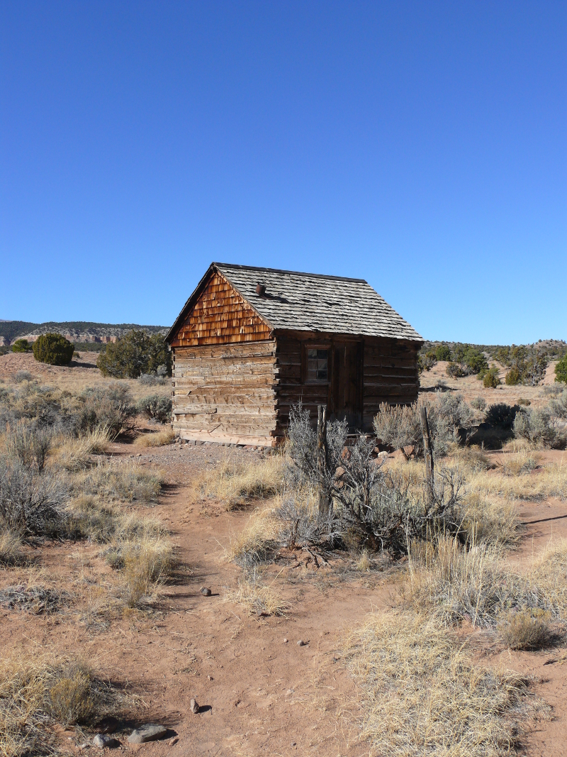
As we drove north, we found the Morrell Cabin just inside the northern border of the Park.
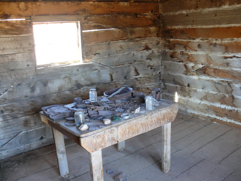
Inside was a table with period items.
The cabin is a symbol of a life that should be. So, we argue that Les Morrell' cabin shouldn't have been abandoned in the 1970s.
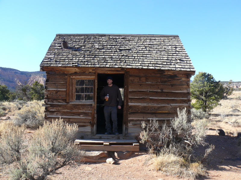
Above, Mike presents a modern, if mock, picture of life in the open West. We were both ready to move here! Just need to re-fit a wood stove.
Grudgingly, we hiked back to the Jeep, crossing the stream that provided the occupants of the cabin with water.
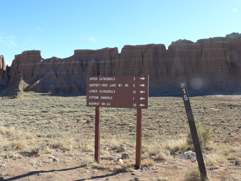
Back at the intersection of trails, we had a choice. We had enjoyed the Upper Cathedral viewpoint, so we figured we had time to visit the Gypsum Sinkhole.
Mike displays his optimism beside the Jeep that he built. This Jeep became our lifeline to our unfortunate connection to the "real world". We could always trust our Jeep to take us back, after we wandered into the wide-open lands of the Southwest. It's difficult to ignore the beautiful background of this part of southern Utah. Click for a larger view.
We stopped at Gypsum Sinkhole. The Jeep looks right at home at the base of the mesas. Click for a larger view.
The sinkhole was pretty good size. I couldn't get the scale of it in the frame, so I took a video. You can watch it by clicking this link (1.6 MB).

We were thinking about finding a camping spot. Though, we did stop near this formation. I think it's called Soloman's Temple.
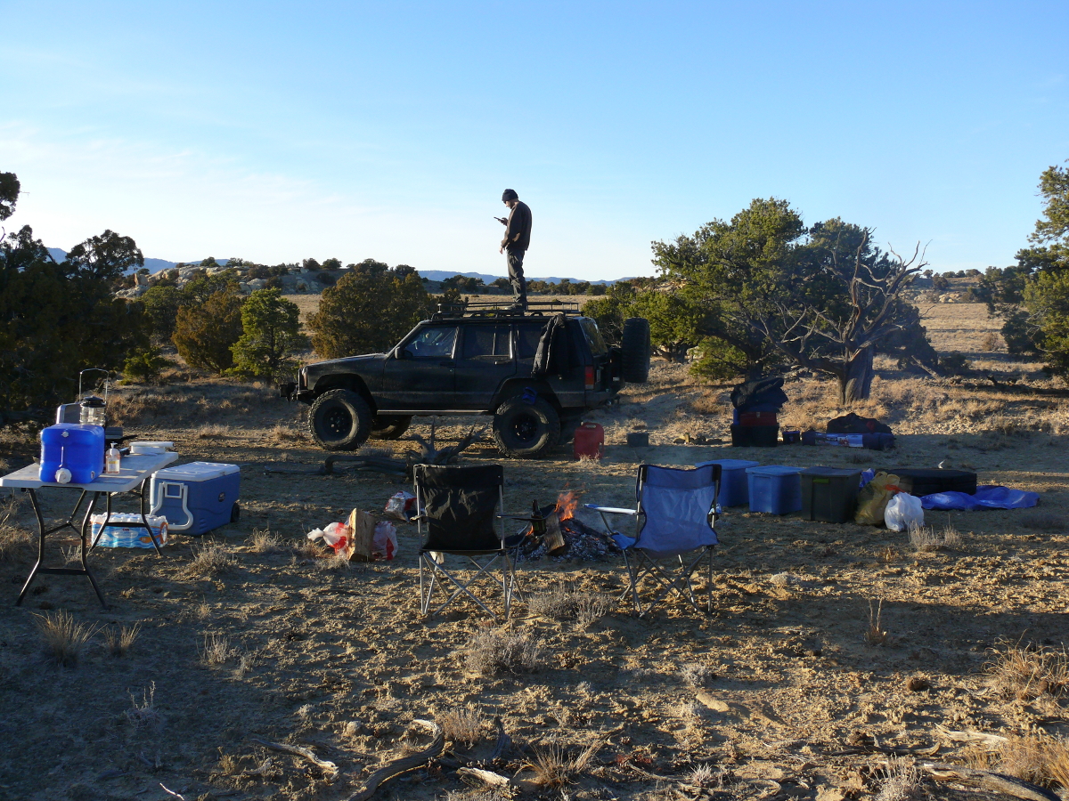
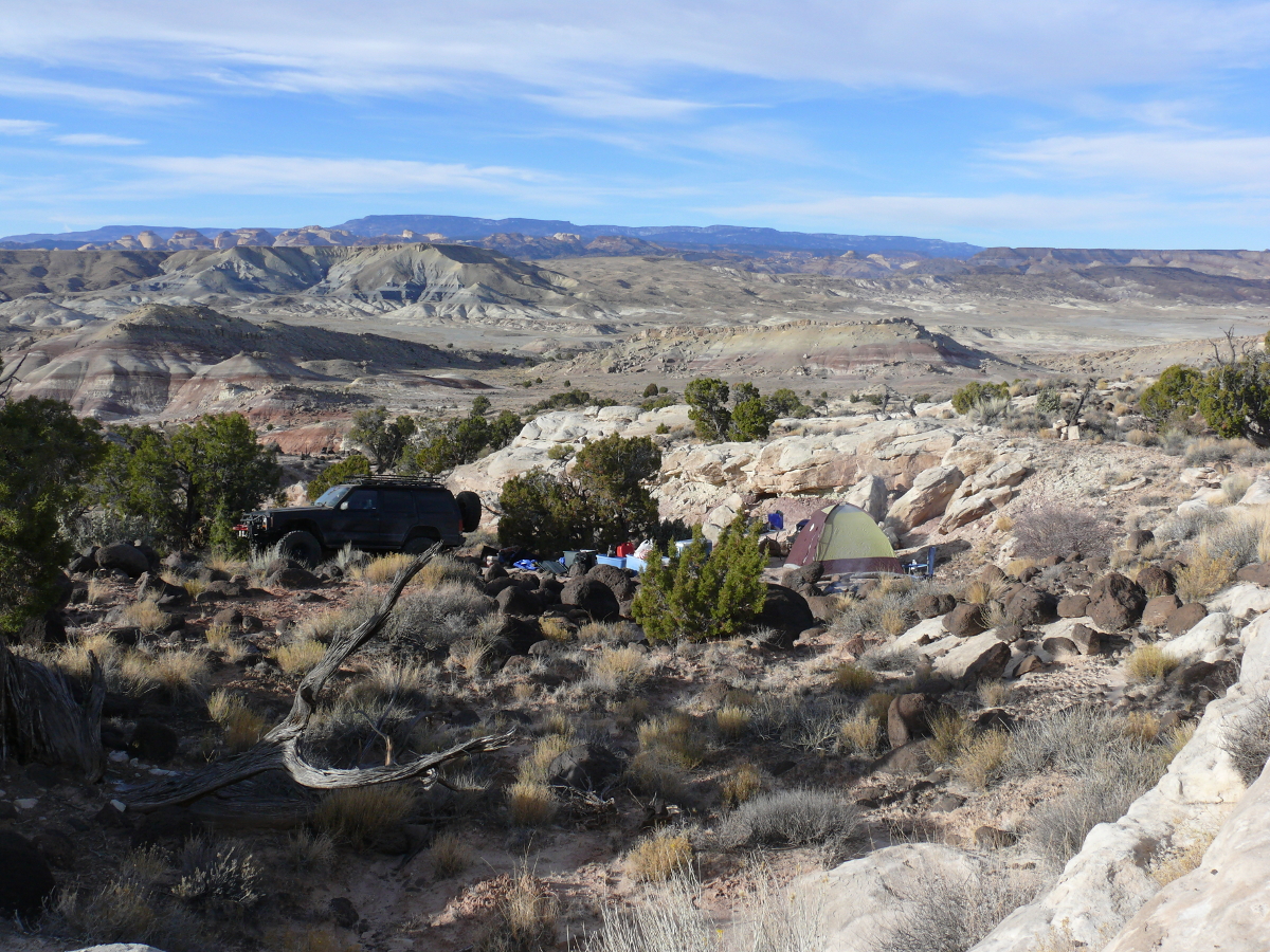
We found a camping spot on a dead end trail. Despite being near the Interstate, it was quiet and had plenty of firewood nearby. I'd say it was even more plentiful than last night. Mike even got enough cellular signal to use the Internet! He's "getting up in the world."
We had a large campfire and stayed up a bit late talking and drinking. I slept better because I wasn't smoked out! It was a bit warmer than last night overnight. The next morning, we took a different route back to Phoenix. This one took us by Zion and Bryce Canyon National Parks. We were impressed how much warmer it was over there. The high temperature seemed to be about 20 degrees higher!
Flying back to Orlando was easier. I think Sky Harbor Airport has security figured out. I was able to get a pat down instead of using the body scanner. I got a lot of reading done on the return flight, too. Good trip!
 |
Copyright © 2002 - 2024 Billsuniverse.com