 |    |
Canyonlands & Arches, Utah
(November 2014)
Setting our sights high, my brother and I set out for the wonders of southeast Utah. Our destination: Canyonlands and Arches National Parks near the old-mining-turned-4WD/tourist gateway town of Moab.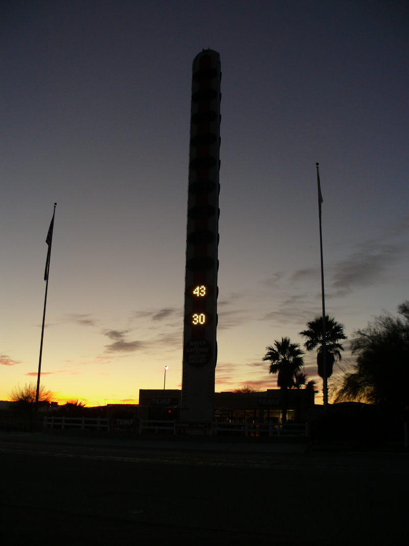
We set out early, 3:30 AM, to avoid Monday morning Southland traffic. We made a fuel stop in Baker before dawn. The World's Largest Thermometer is back running. Evidently someone can now afford the electricity. It's good to see it working!
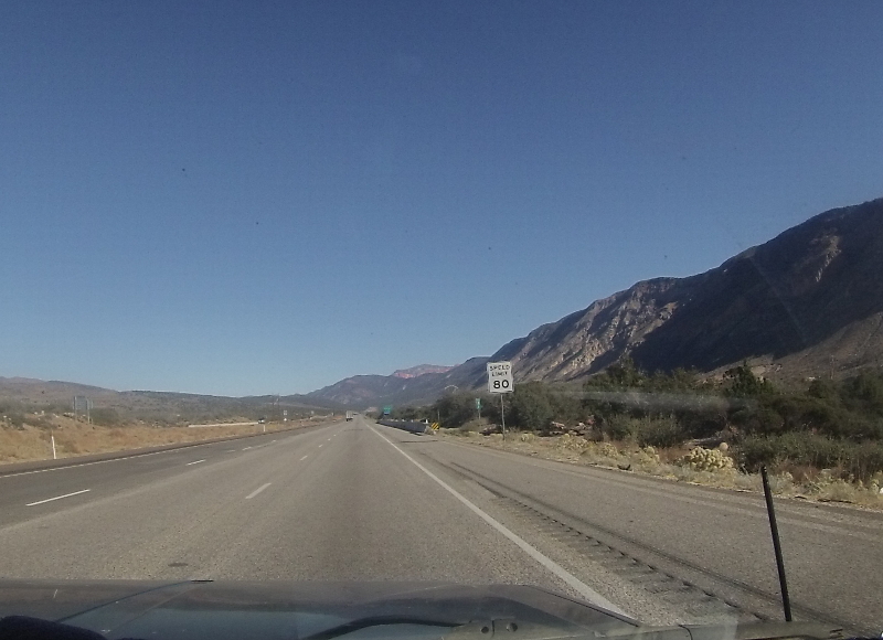
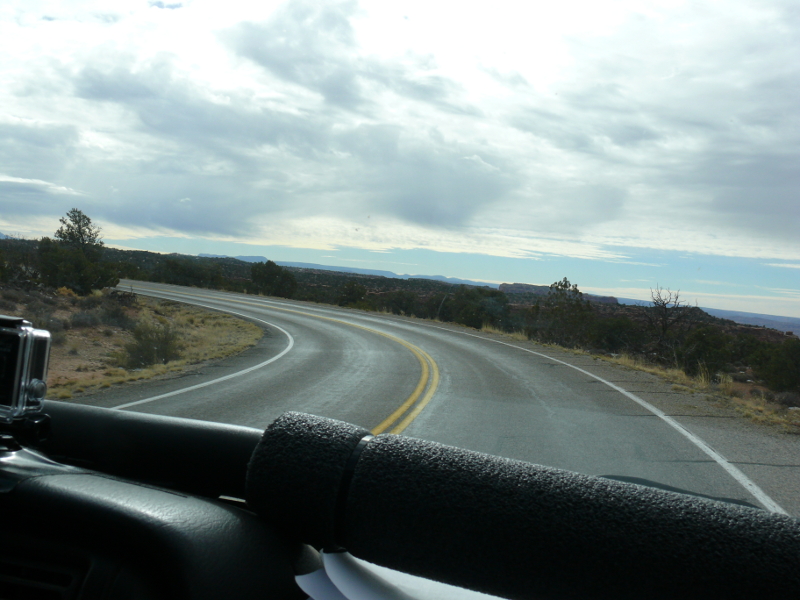
Continuing past the Mojave Preserve, we entered Nevada. The hotel-casinos of Sin City were quickly vanquished as we sailed on through Arizona and into Utah. The 80 mph speed limit gave me a reason to try out Mike's new gift, a Go-Pro video camera. The fisheye lens is oddly obvious in photos but not in videos. Here's a video taken somewhere near Cedar City: m02.avi (3.5 MB)
We reserved a hotel room in Moab. We thought it a prudent measure considering that the drive from Orange County to Moab is about 12 hours.
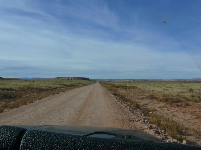
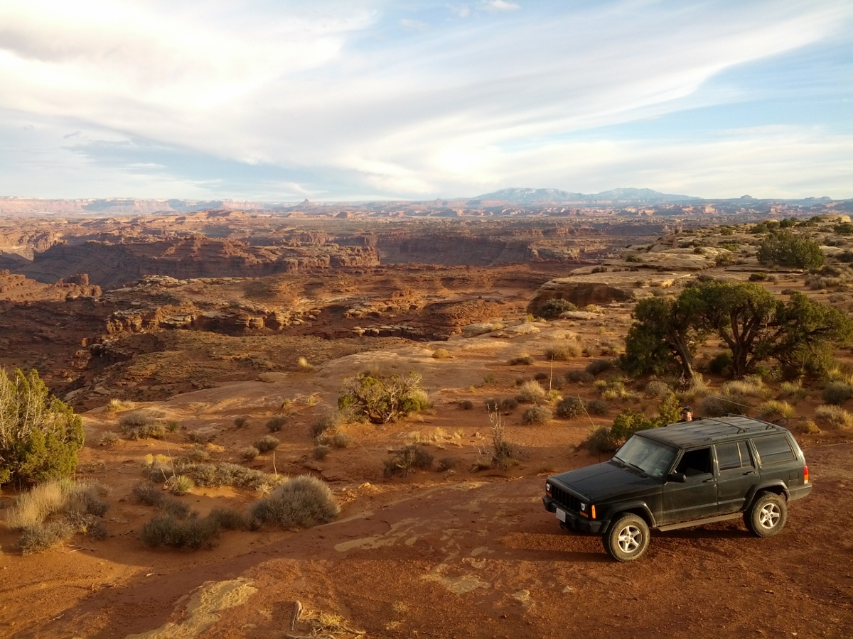
Moab is nestled in a valley of the same name. At one time, this town was an important uranium mining center. Today, it is used as a gateway for the two National Parks, state & BLM lands, and a convenient destination for rolled-over trucks. Yes, we were definitely in the high and rocky land of canyons!
The next day we found a light frost on the Jeep, which started right up with only a mild, grumbling complaint. Today was going to be Arches day. We took route 191 the few miles north to Arches National Park. The visitor center was informative, complete with a bored female ranger manning--couldn't resist the pun--a help counter. We saw a backcountry camper drop off his rubbish and get some water. His status was obvious because as we shivered inside winter coats, he was clad in only light garments and a boisterous woven cap.
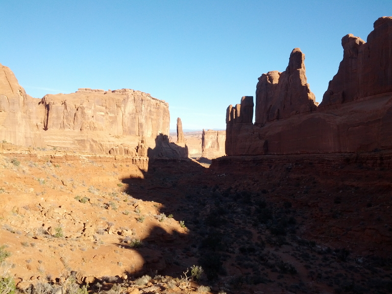
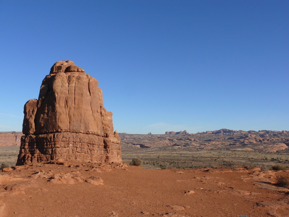
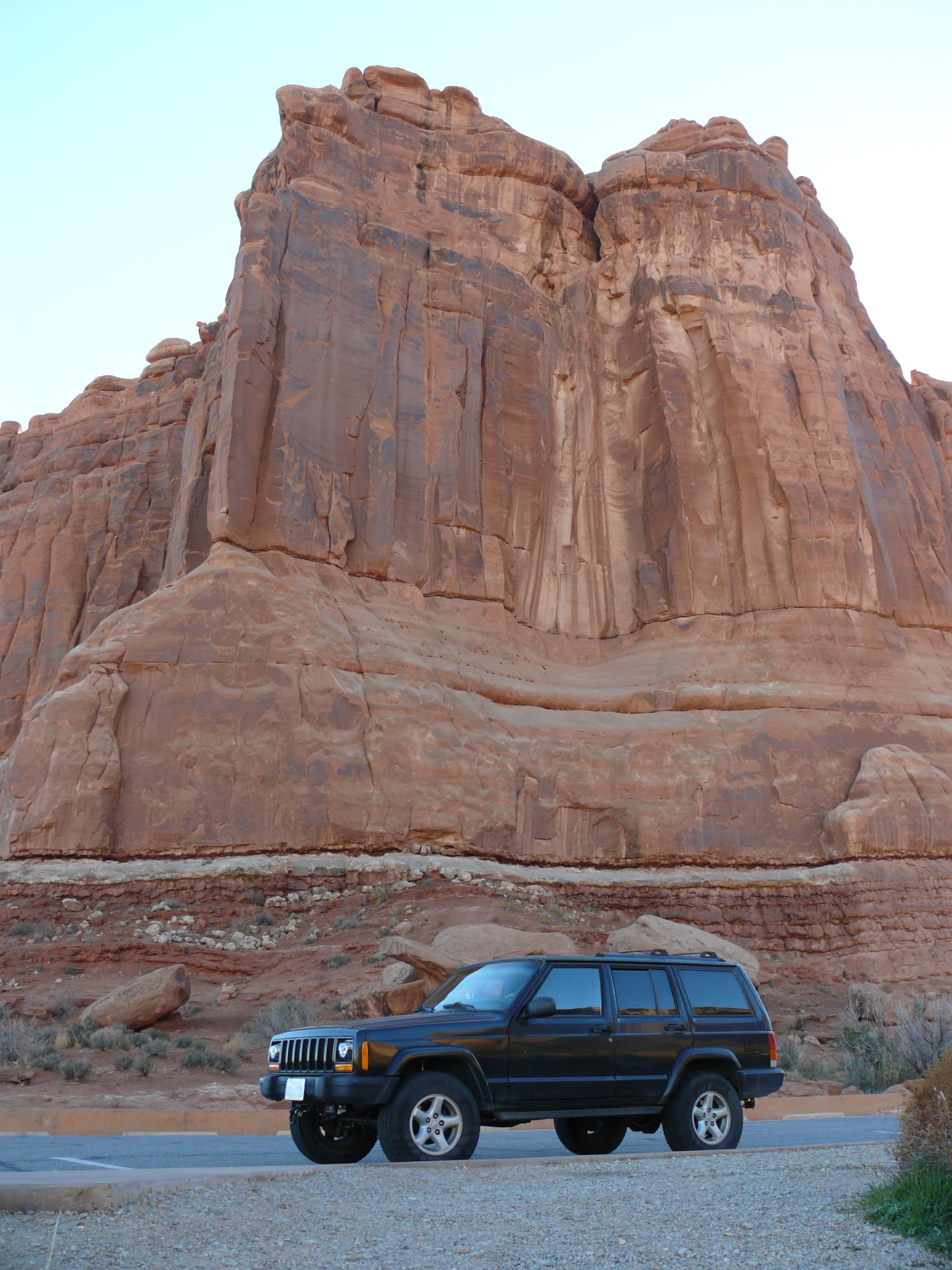
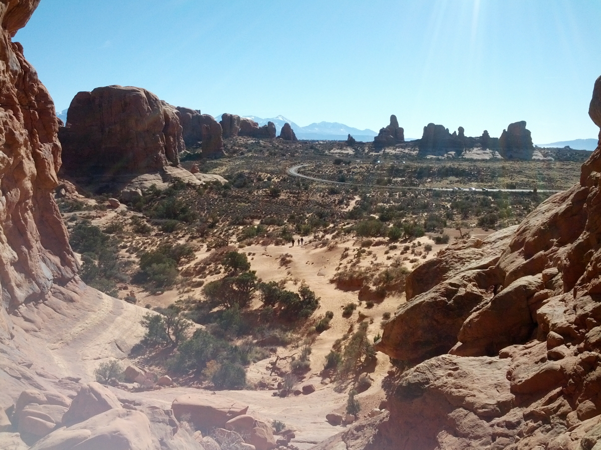
We followed the winding blacktop up into Arches. Our first stop was Park Avenue. It's pictured above. Did you really think that we'd teleported to New York City?
 The short hike between the Entrada Sandstone outcroppings reminded early visitors of the big city back east, hence the name.
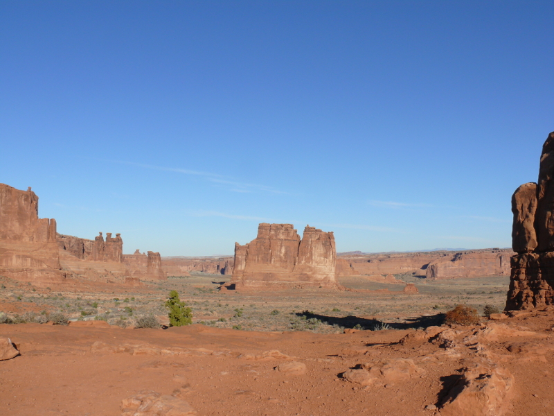
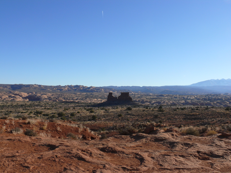
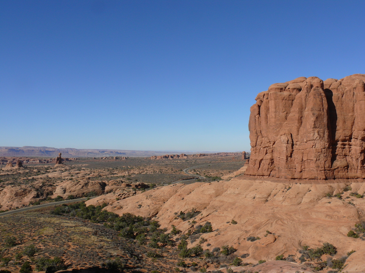
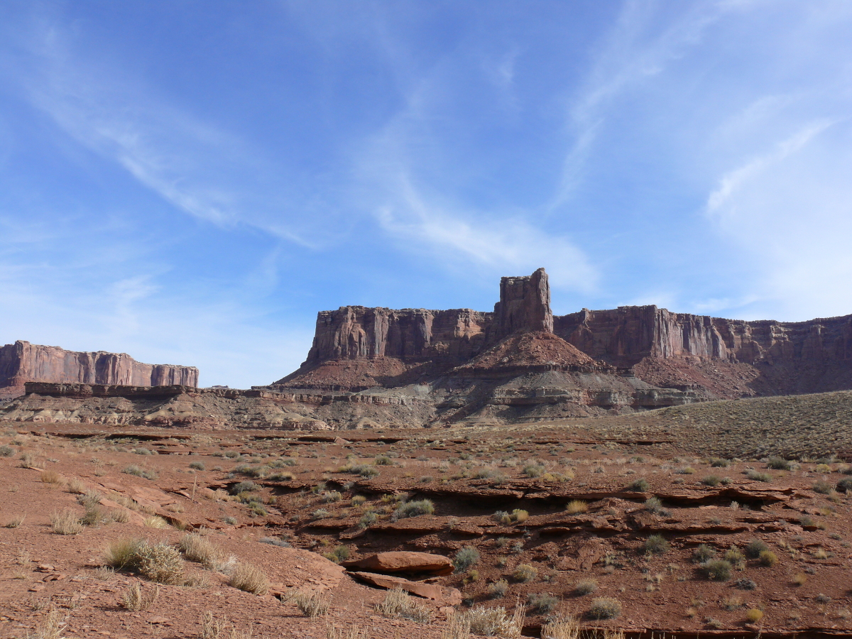
Now is when you need to use your imagination. According to the park service, the Three Gossips, Sheep Rock, and Tower of Babel & The Organ are all visible in this frame. OK, I'll take a toke and maybe I'll see it, too! Regardless of what they may be called, they comprise a beautiful part of our nation.
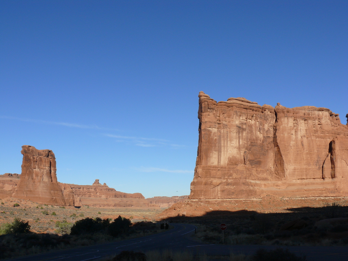
I wasn't terribly impressed. So I took a photo of a more impressive, if "nondescript", butte. In the center background, standing with a beefier companion, the Balanced Rock can be just made out. (Click for a larger view.)
The view is pretty and rugged. As I wondered what this twin mesa structure, which dominates the picture frame, was named, I gazed at the park service exhibit. Want to guess? Twin orchestral conductors? Two chimneys? The divided house? Nope, the park service ignores it. They seem to have other interests. Take a look!
Joking aside, this is a picturesque place. Here I managed to capture (what I believe to be the Sheep Rock). Notice that the blacktop is almost completely overshadowed by another mesa or butte behind me. This helps to put into perspective the scale of these stony leviathans. The park service exhibit piddled on about the fall of some arch. I felt like telling this silent guide to shut up and look around. Who cares what it was called because today it is staggeringly beautiful.
Want to begin to understand the scale of these beauties? Watch our video of driving up to them: m08.avi (2.2 MB)
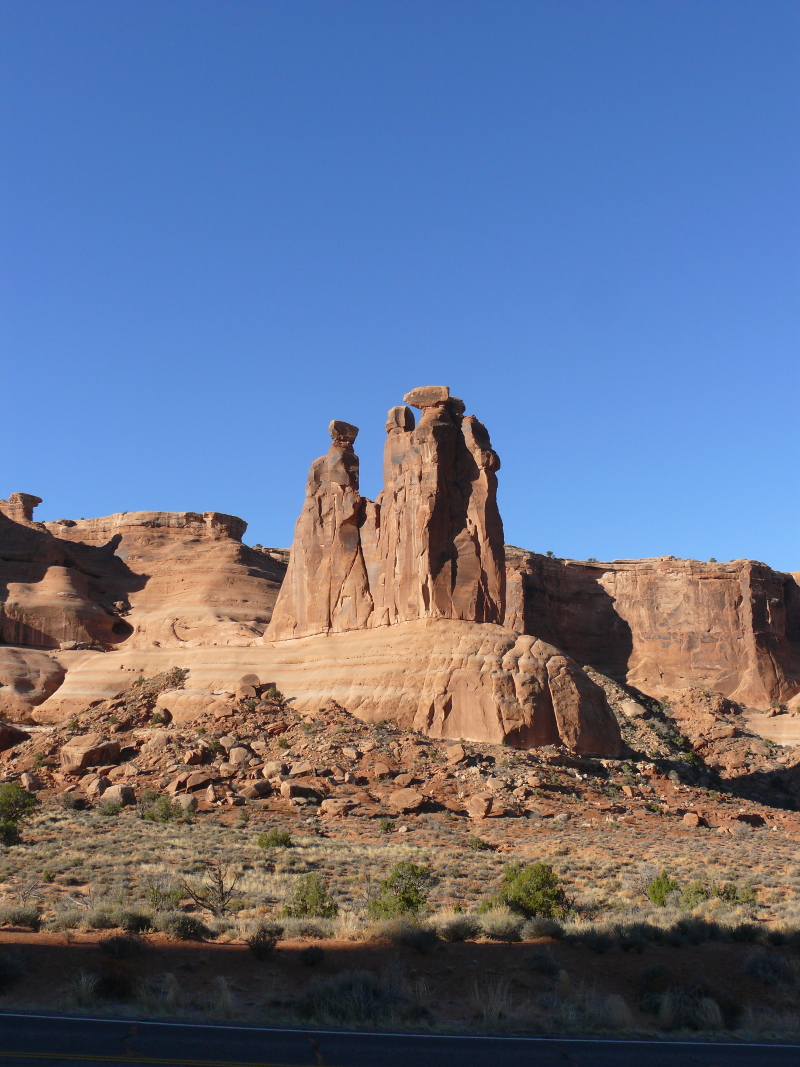
These still look like a pile of stones to me, not Three Gossips. A pretty pile, but they're nothing that I felt capable of boring me with the latest Kardarsian faux pas.
What a great shot of the Jeep overshadowed by, what the park service would probably call, the great philharmonic orchestra with the pipe organ soloist, who's a female and comes from a disadvantaged...
Whatever. It's a beautiful shot. Click for a larger view!
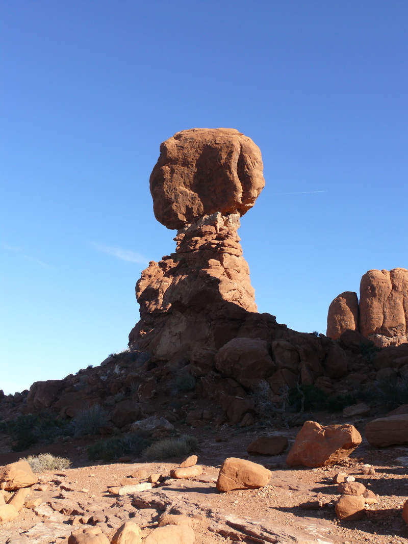
Remember the power of distance? Or maybe it's the power of perception? Either way, the Balanced Rock is impressive and will without a doubt topple over. It just won't happen during our lifetimes. Don't believe me? Click the photo and see the backside.
(Hard to believe, huh?) Perspective is important.
We did stop at the Garden of Eden turnoff. It was OK. We looked at each other with expressions of "is this all?"
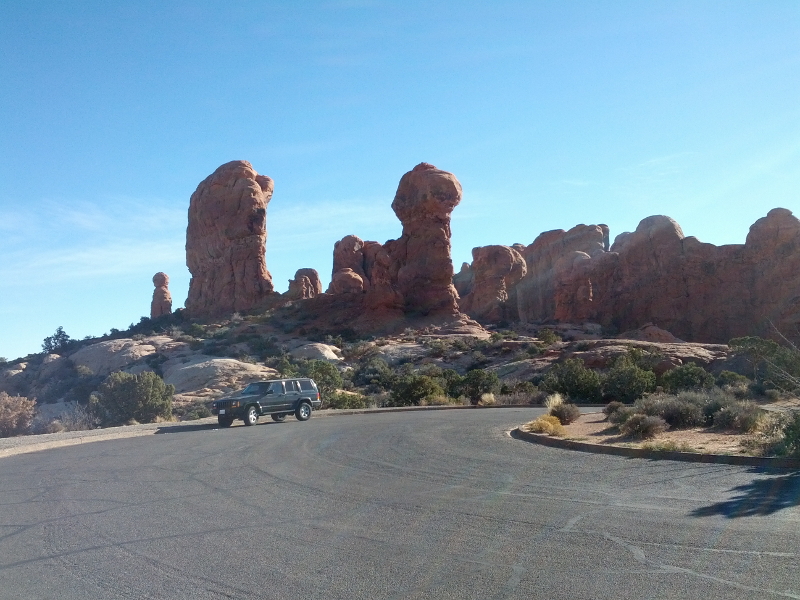
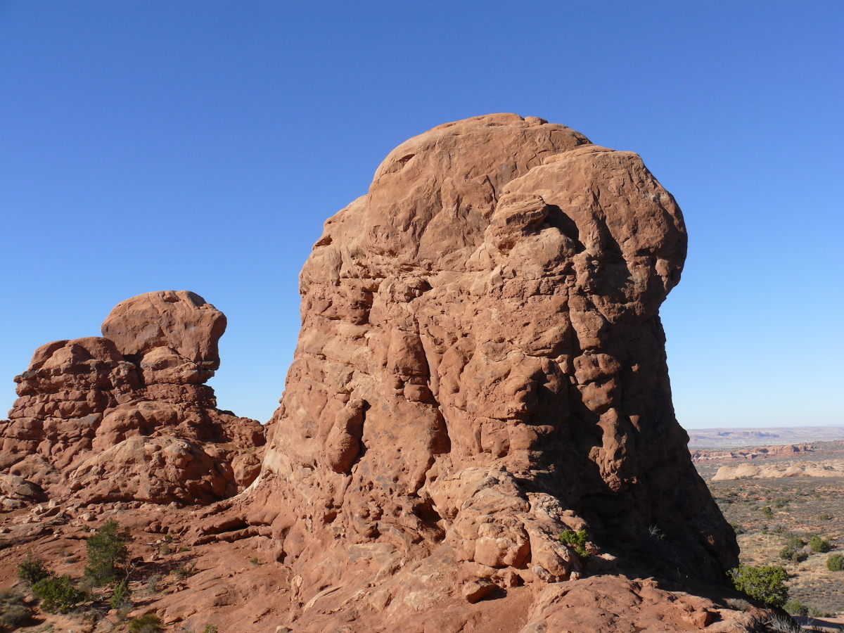
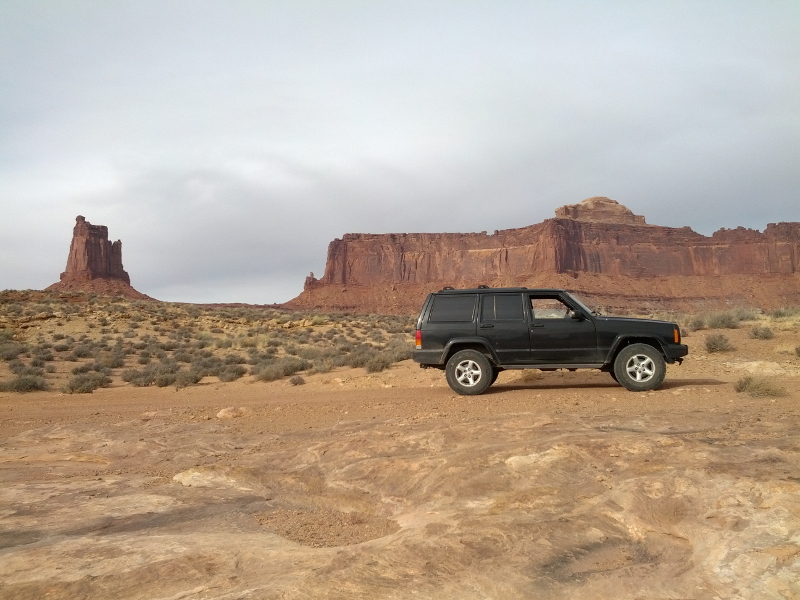
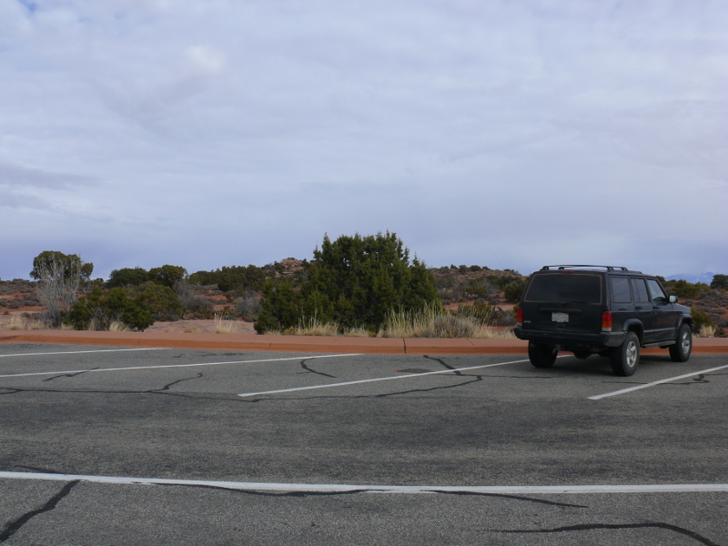
We found the parking loop more interesting. Mike was right to take a shot of the Jeep against the nearby bulbous stones. What are they? How were they formed? The park service didn't seem to know. (But the spotted, enfeebled lizard who lives nearby is...) Maybe they're future "Balanced Rocks"? I must have been reading too much in the tour book.
Dare I say it, there's a beam of light shining directly on the Jeep! Good fortune for the rest of the trip, at least for the Jeep anyways
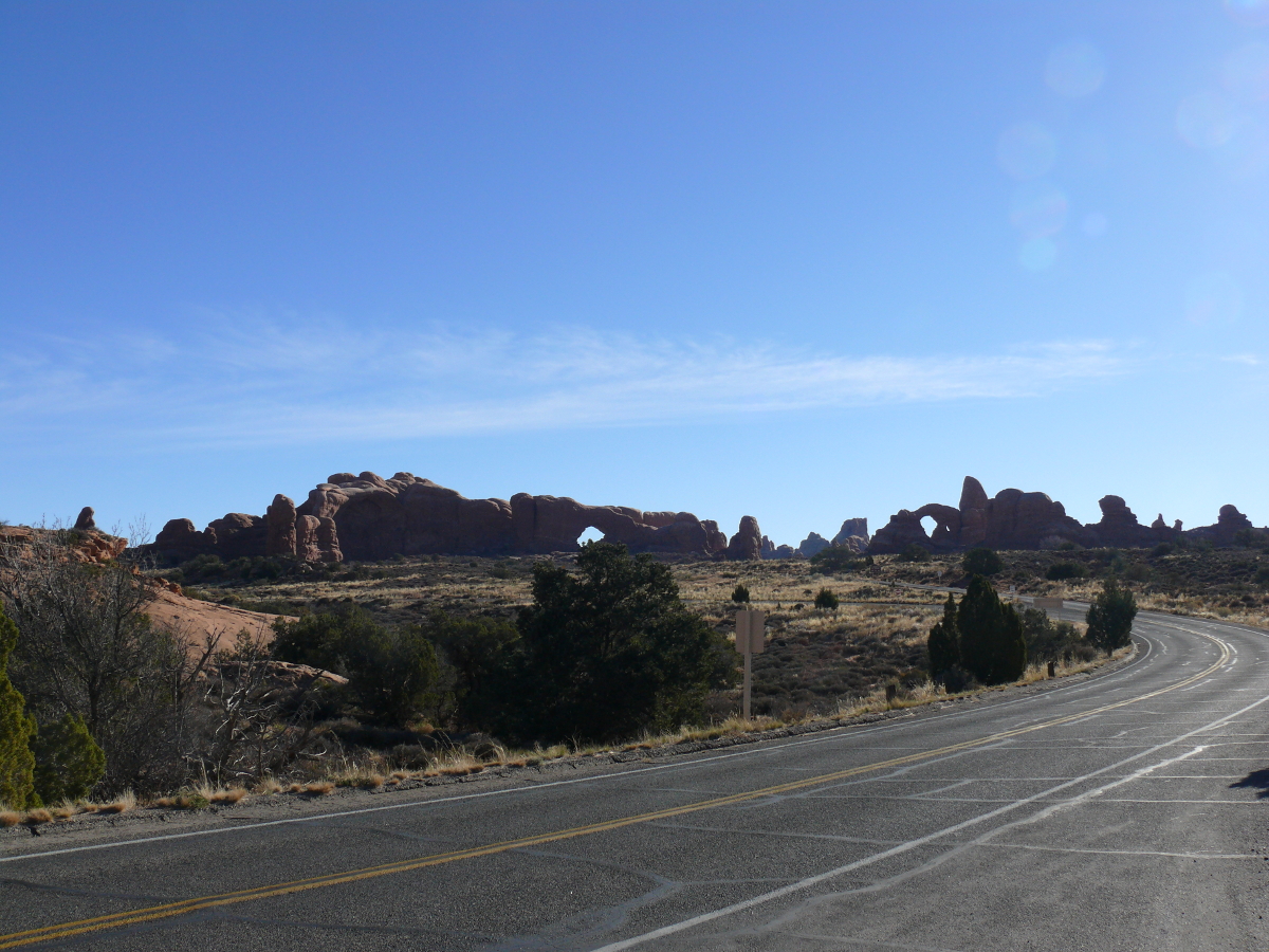
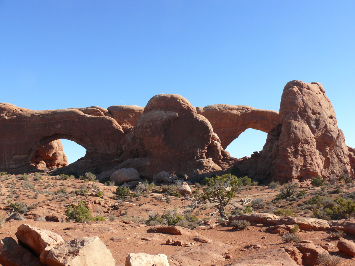
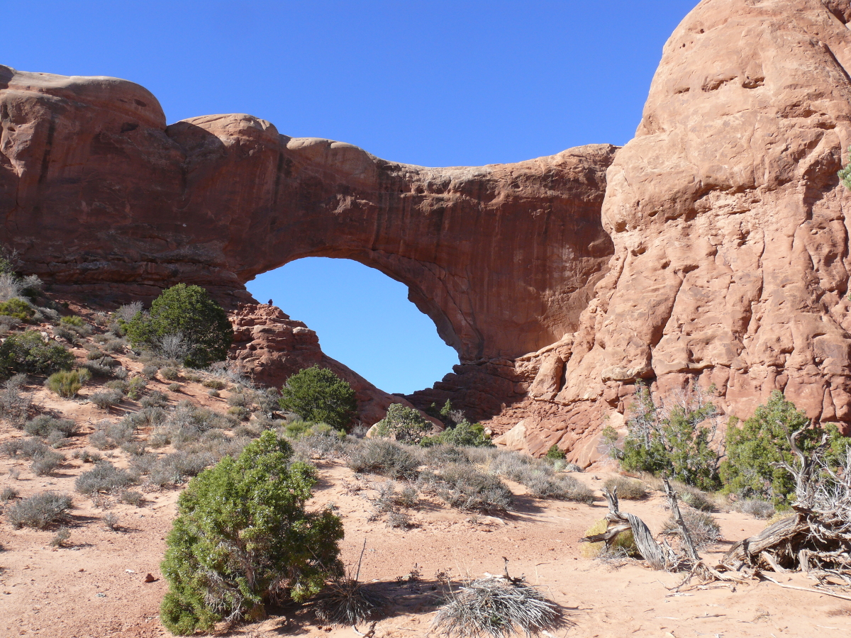
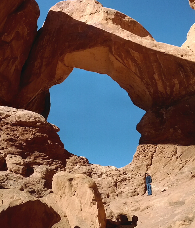
The next stop was The Windows. Click for a larger view.
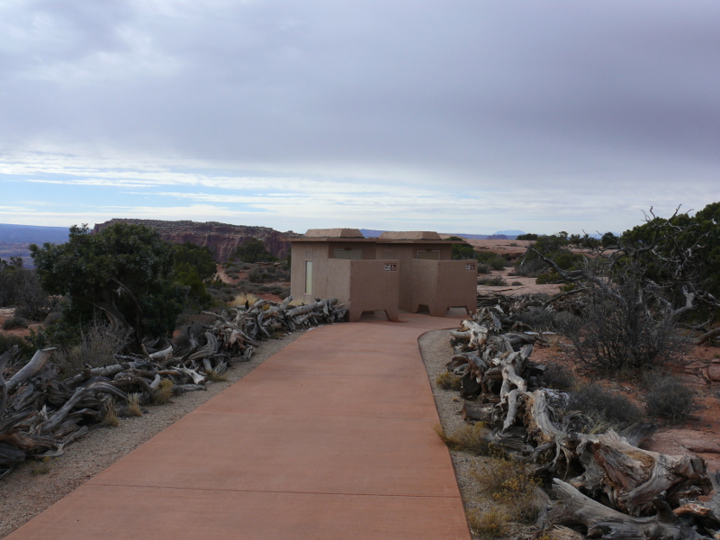
During the late '60s, the Windows area was a campground. (The pit toilet is the only remaining evidence.) That was back when Arches was just a National Monument. It's such a pity that waking up among the beauty of this land has been lost to all because a few idiots had to trash it.
Also, workers were in the midst of removing the steps. It looked like they were putting down a sand base, upon which would probably be laid concrete. So pensioners in motorized carts could visit the formations. "...and I didn't even see it coming!"
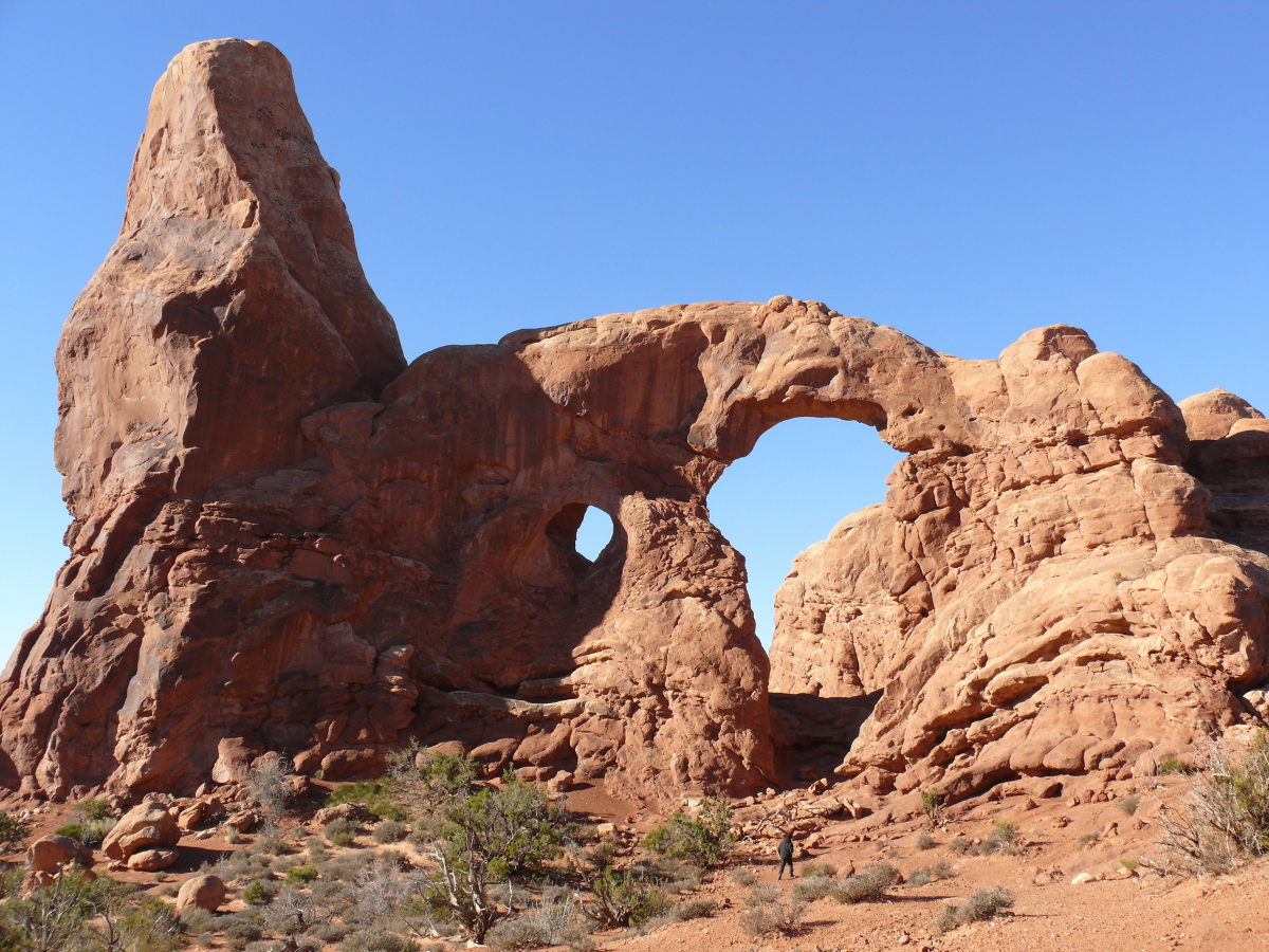
Above you can see Mike as he heads towards the Turret Arch. Click for a larger image.
 | 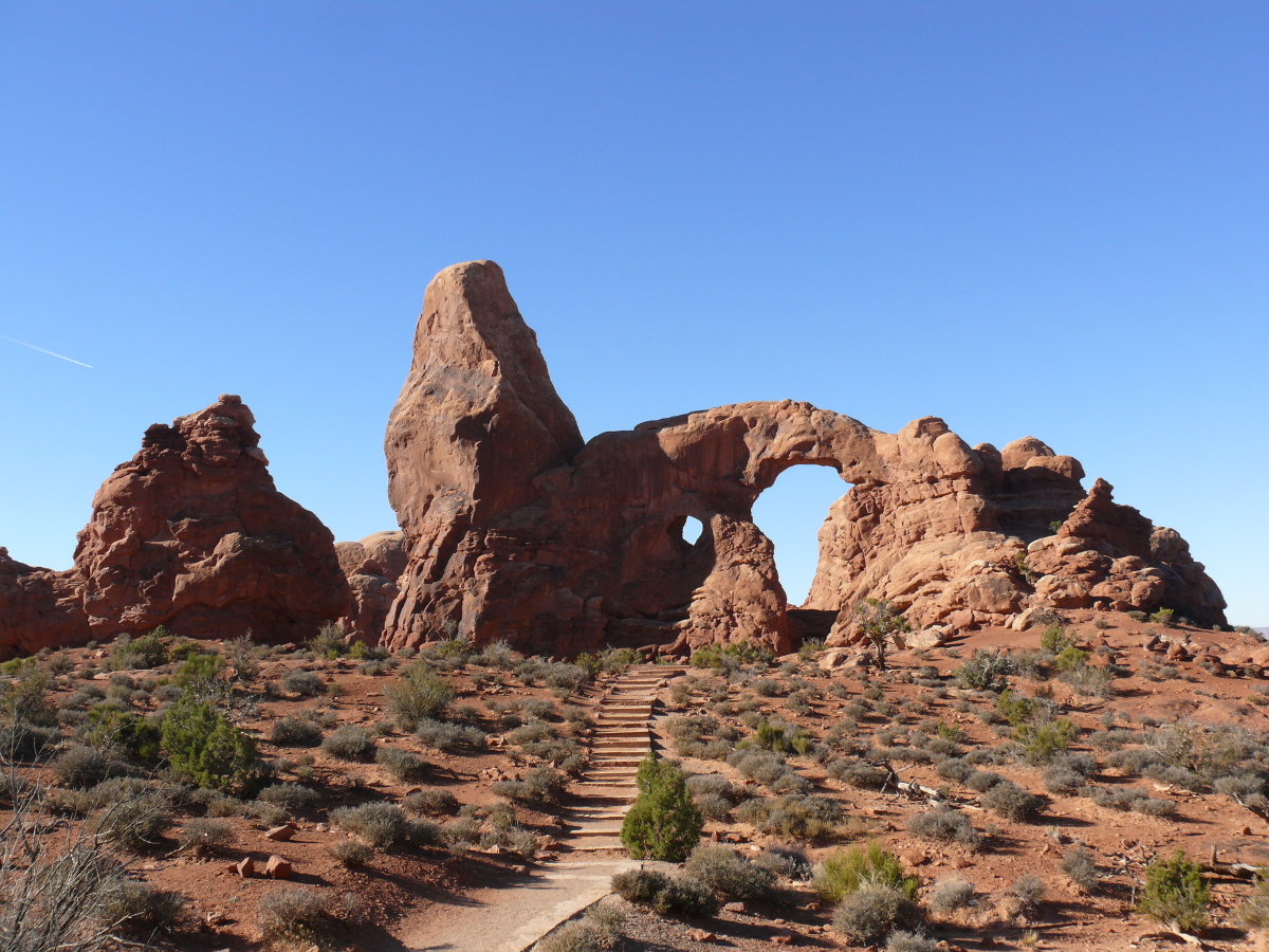 |  |  |
The opening scenes of Indiana Jones and the Last Crusade were filmed here.
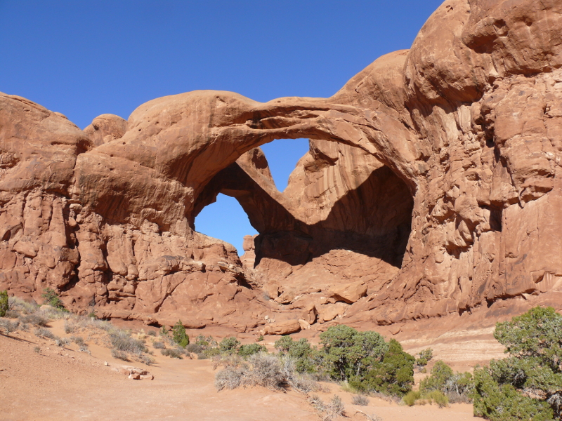
Before leaving The Windows Section, we climbed into the Double Arch, as you can see me doing so here. The view was worth the climb:
 |  |
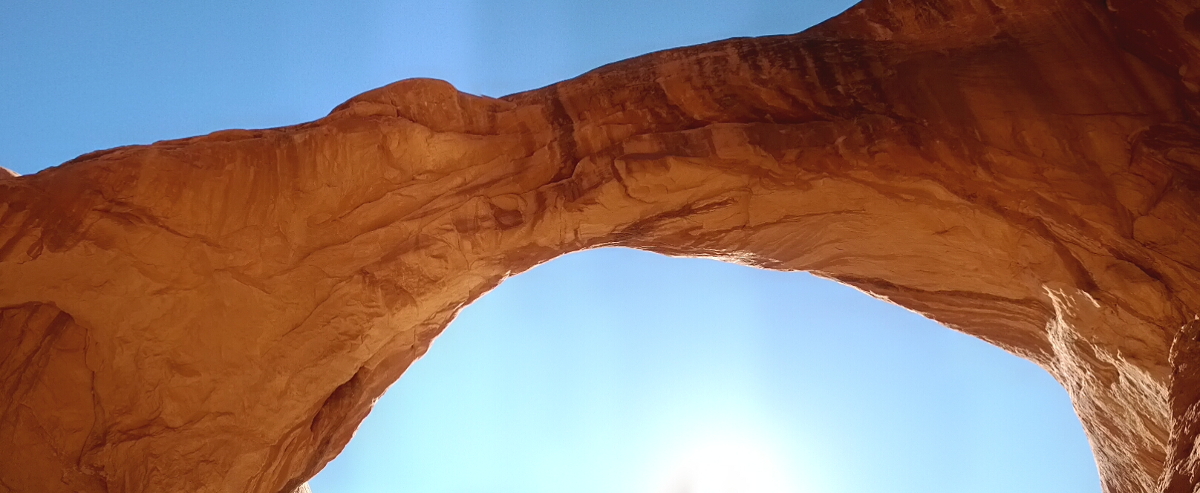 |  |
But we didn't dawdle long because other sights awaited us!
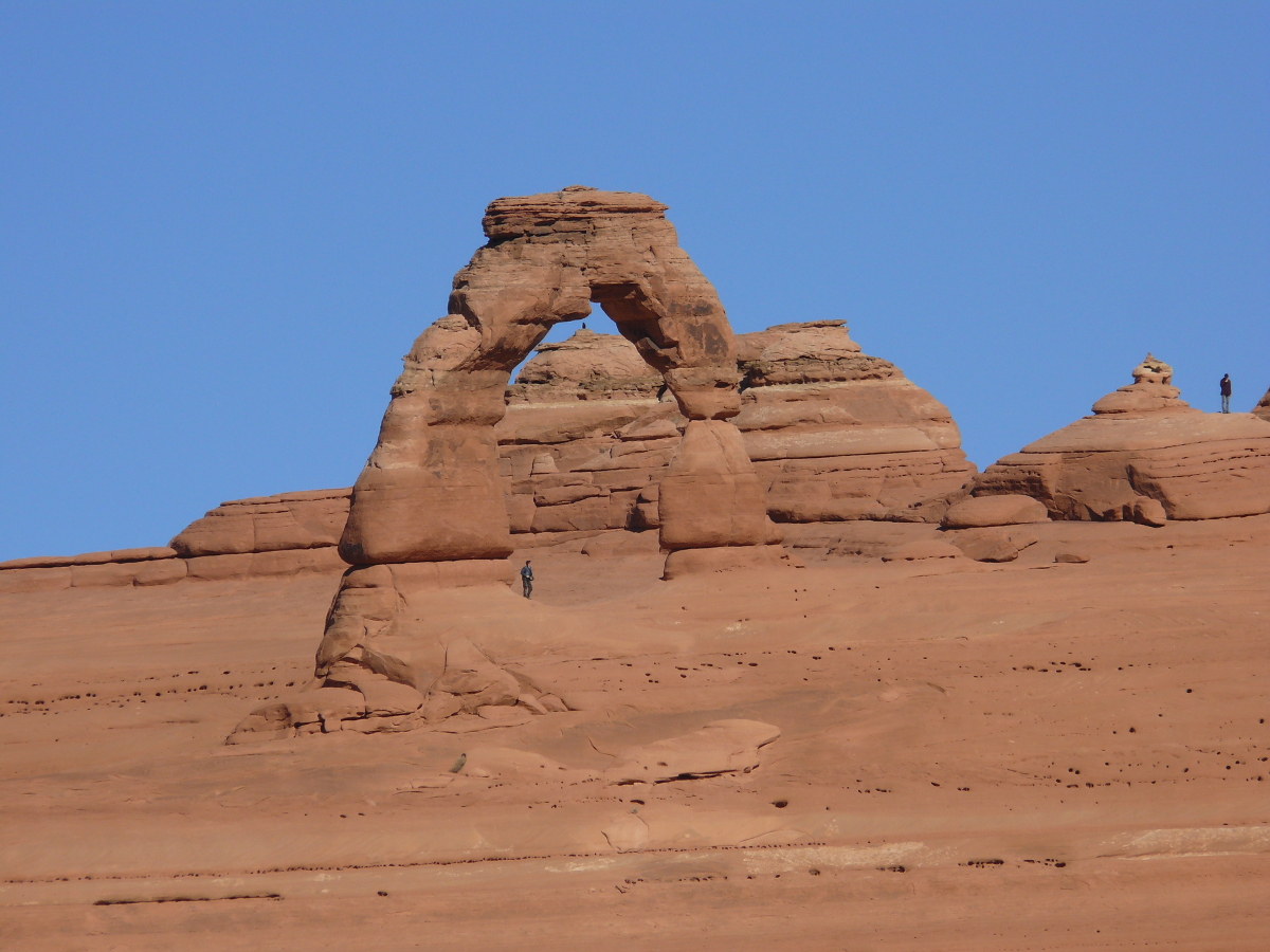
Instead of hiking the several miles to the Delicate Arch, we drove to the viewpoint. A convenient metal post acted as a tripod so I could zoom in and take a photo of this famous arch, the icon of Utah. Click to see the photo.
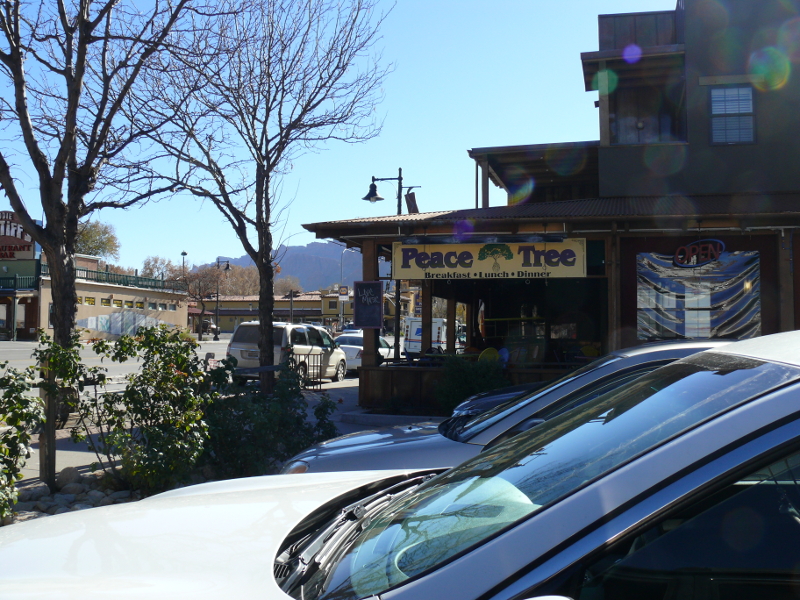
We headed back to Moab for lunch at Peace Tree. We enjoyed some wraps chock-full of vegetables and salads. Both included sprouts. It's been a few years since I had sprouts. Good stuff. Excellent restaurant.
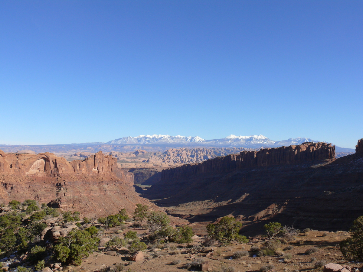
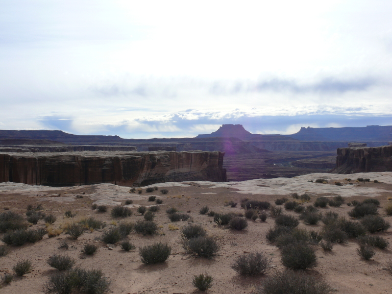
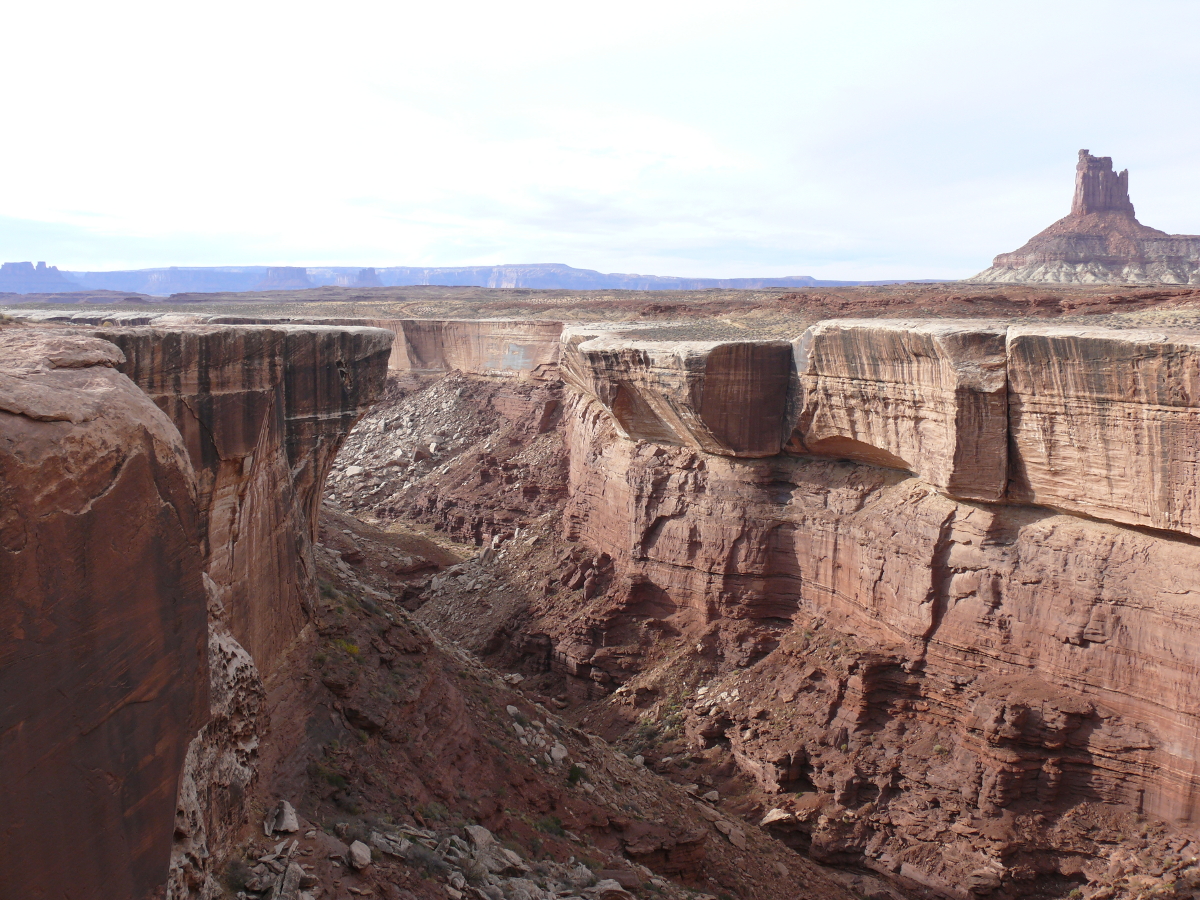
We took the scenic Route 279 along Meander Canyon (m24.avi - 6.7 MB). We saw a few people climbing the canyon walls. Then, we turned onto the Long Canyon trail as a shortcut. A large pickup truck was doing the same thing, only coming the other way: downhill. A sign informed us that no camping was allowed in the area because it is protected for the Bighorn Sheep lambs. The view near the top is impressive. Click for a larger photo.
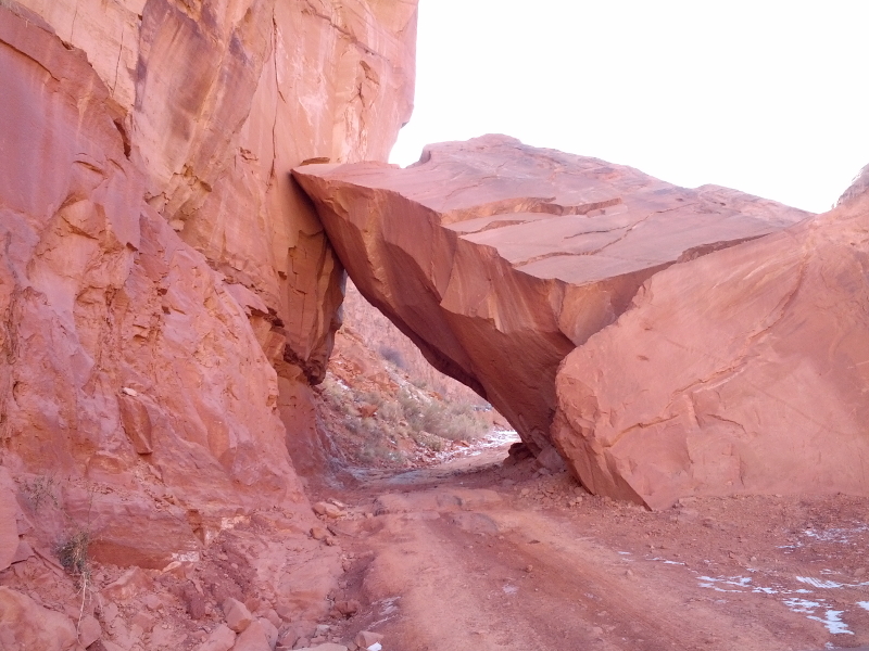
Along the trail is this landmark.
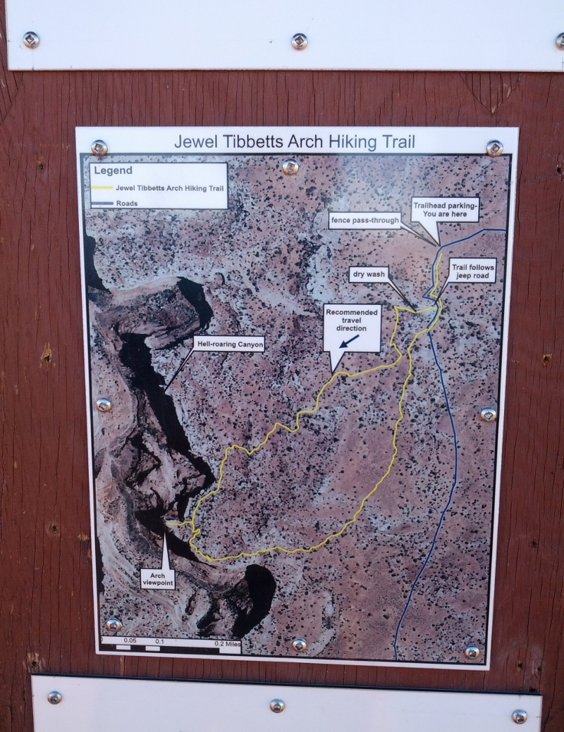
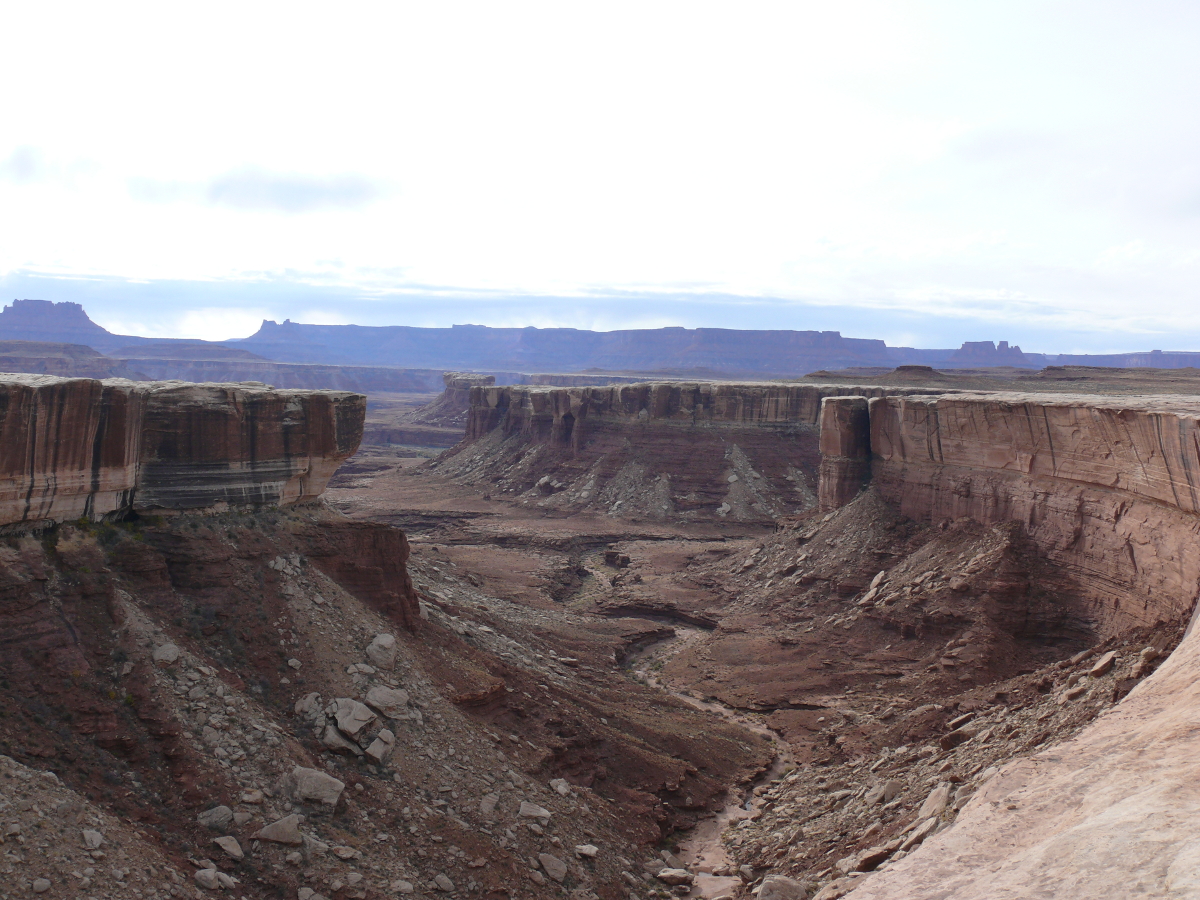
Trying to get into Hell Roaring Canyon, we mistakenly drove along a hiking trail. Only afterwards did we realize that this was no Jeep trail. We did find the canyon because we drove to within a few hundred feet of the edge. I kick myself now for not taking a photo because the drop was substantial. Above is the "hiking" trail map!
And here's a video: m26.avi (11 MB)
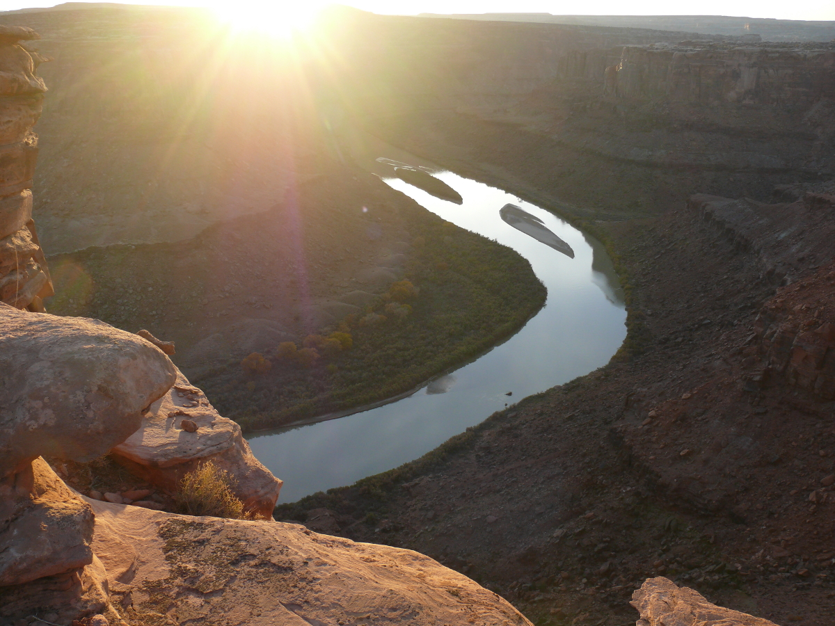
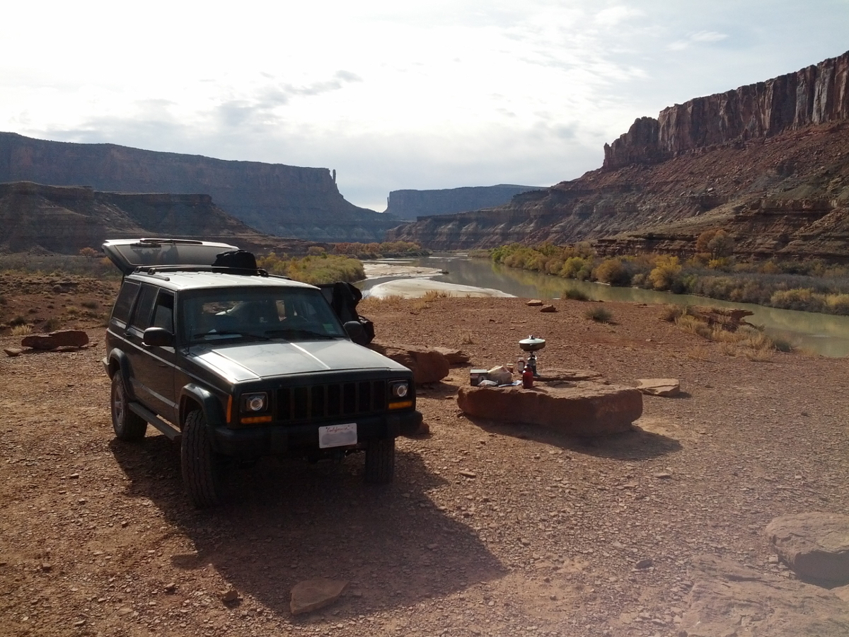
We found a very good camping spot high above the Green River on the other side of Hell Roaring Canyon. The view was spectacular, as you can see below:
 | 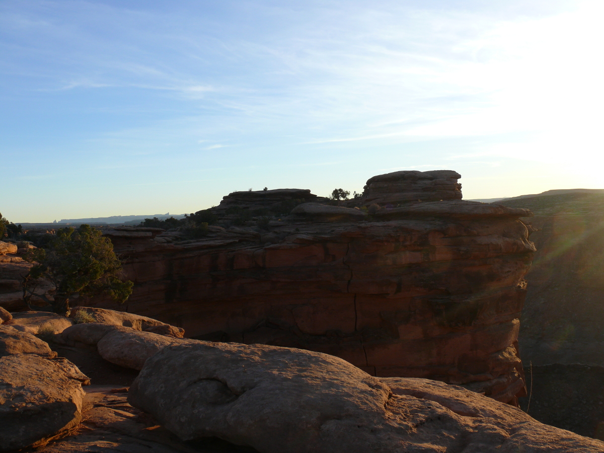 |
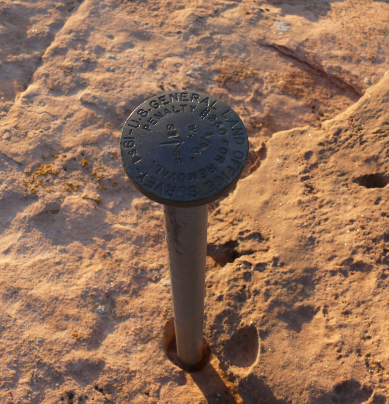
Nearby was a surveying marker from 1954. I would think that it would cost quite a bit more than the $250 penalty to remove the marker from the stone.
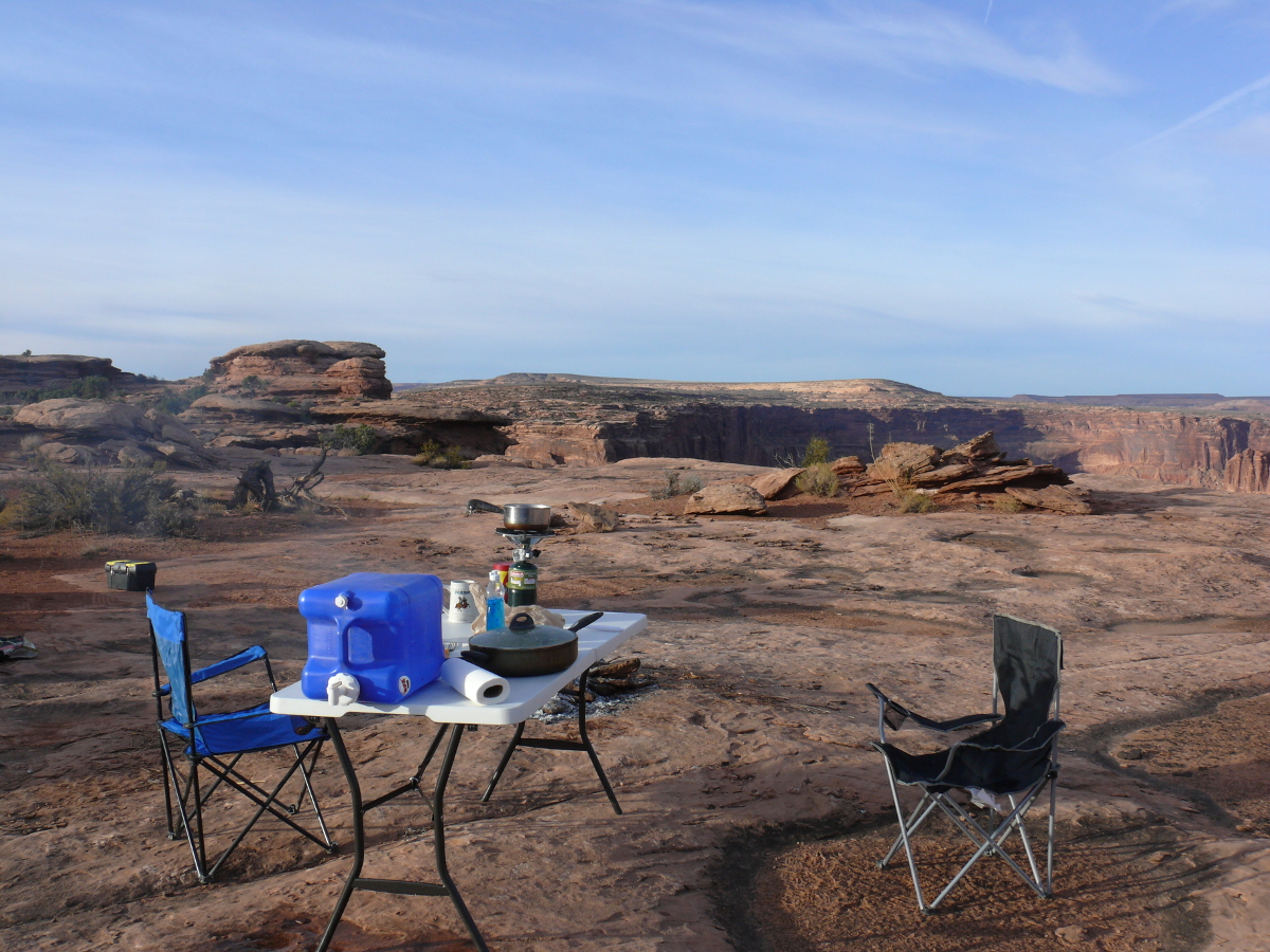 |  |
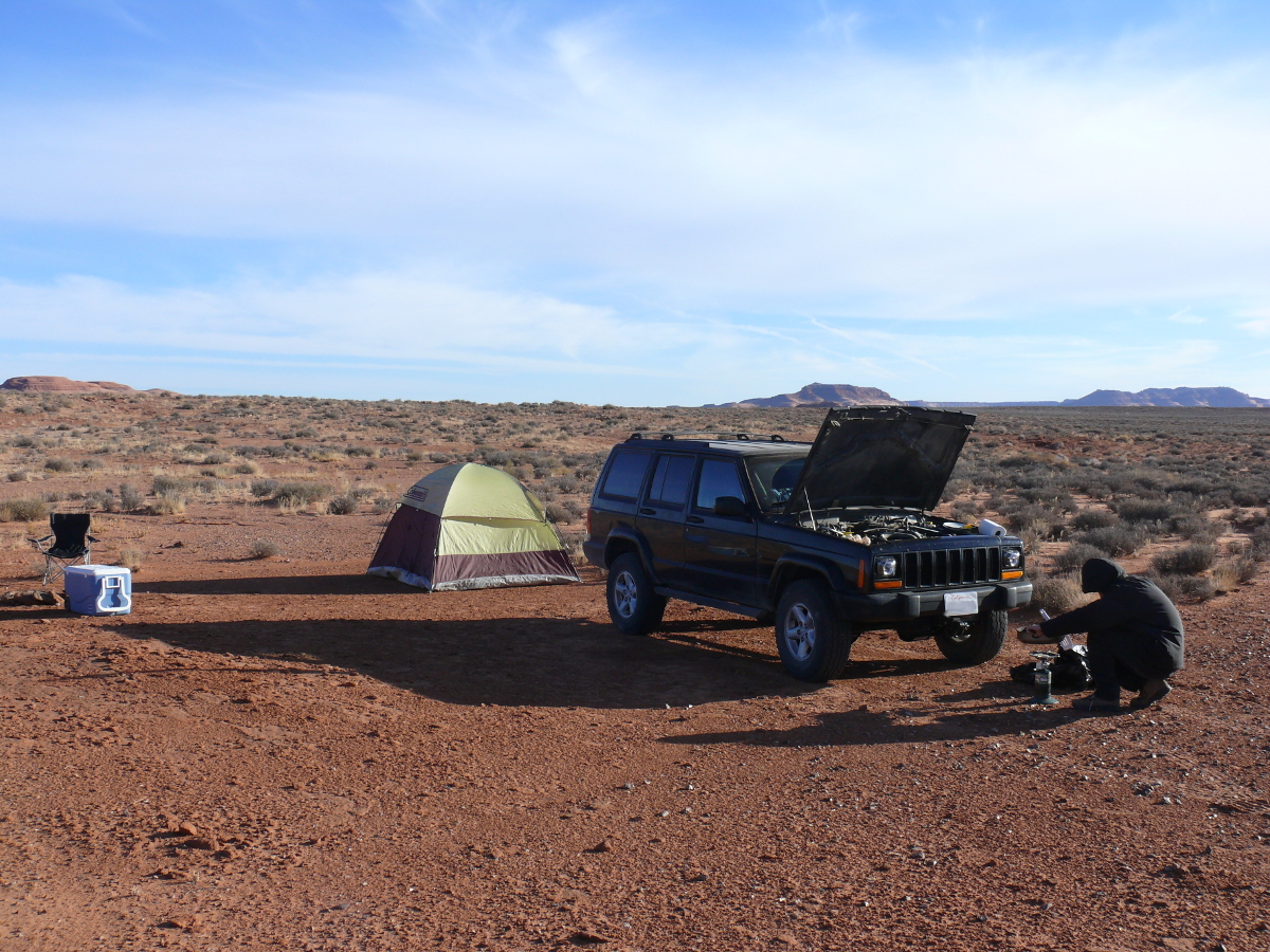
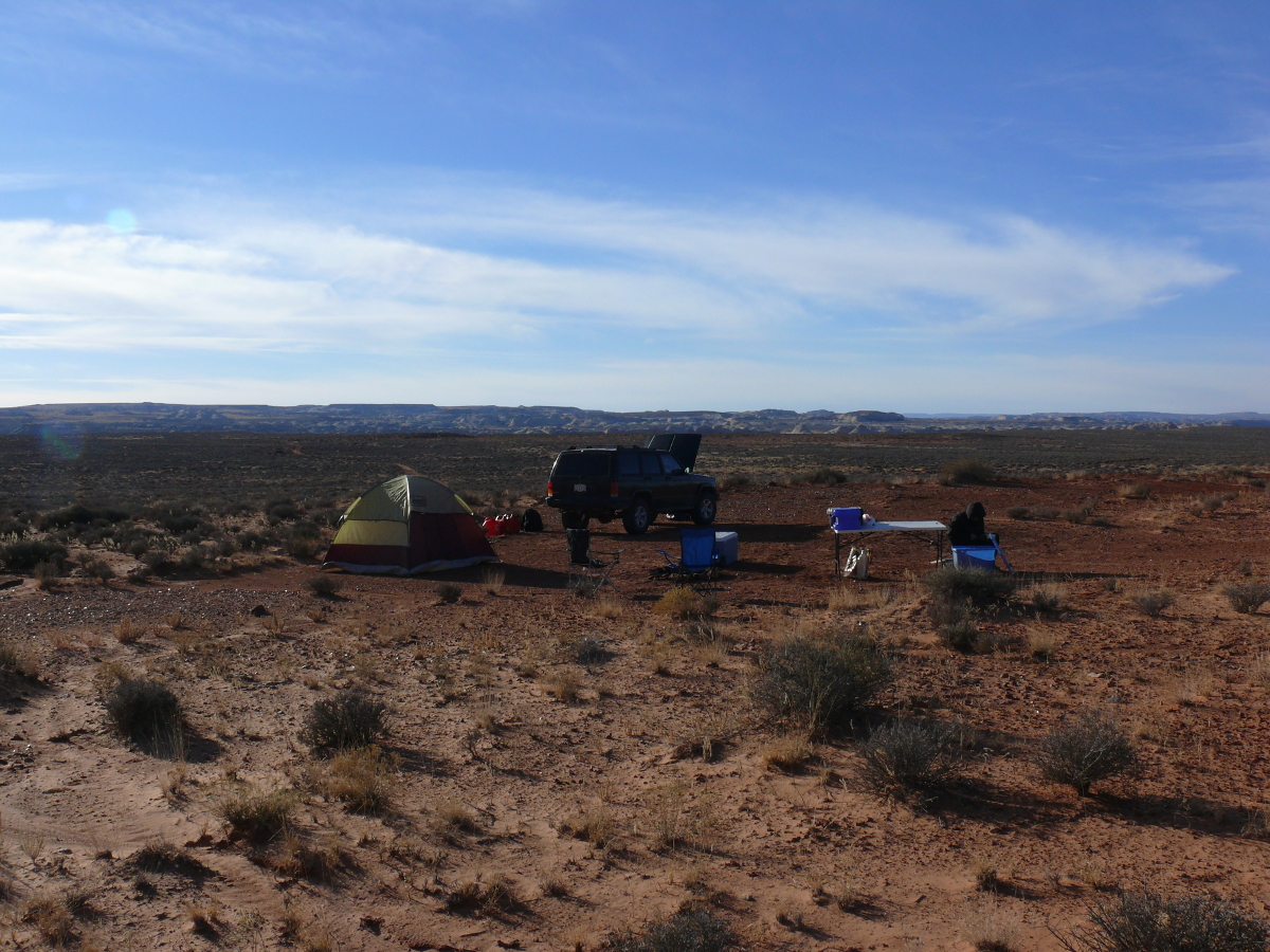
Since the last trip Mike had purchased a folding table. This small piece of furniture made a big difference, and in my opinion, is as civilized as we need to be while camping. The campsite was quite close to the 1,500-foot sheer drop. The joke was don't go too far in that direction to take a piss at night, or else! As you can see, the edge is within easy stumbling distance.
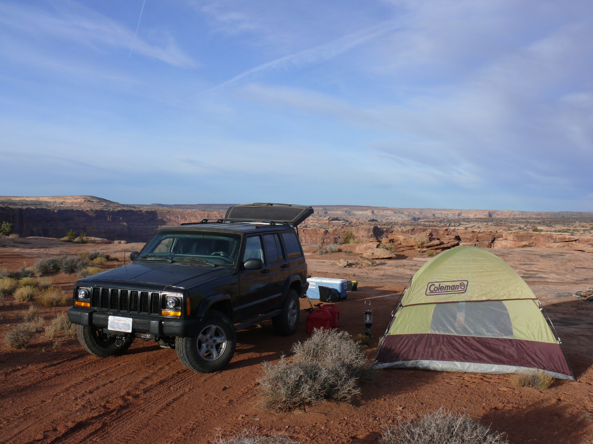
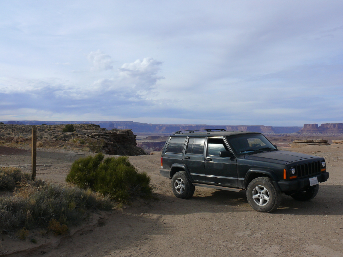
You might be wondering why the Jeep looks funny. It almost looks like it's wearing glasses. Mike fitted projector headlights in place of the sealed-beams. These newfangled devices proved to be far superior to the OEM units, as will be evident later in this trip!
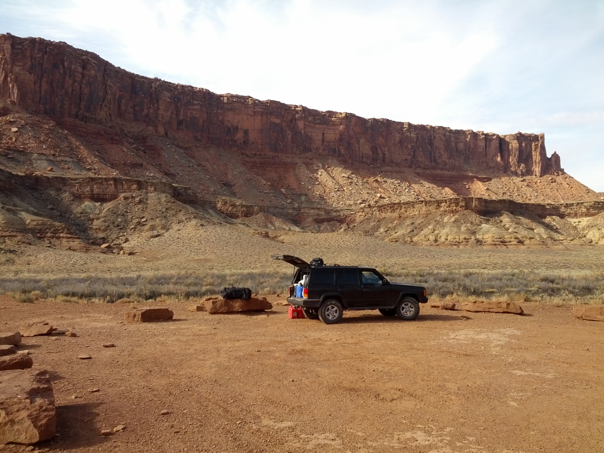
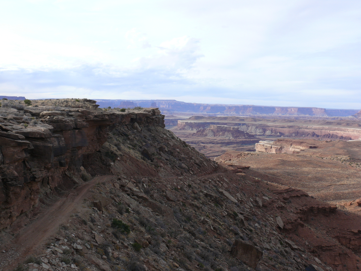
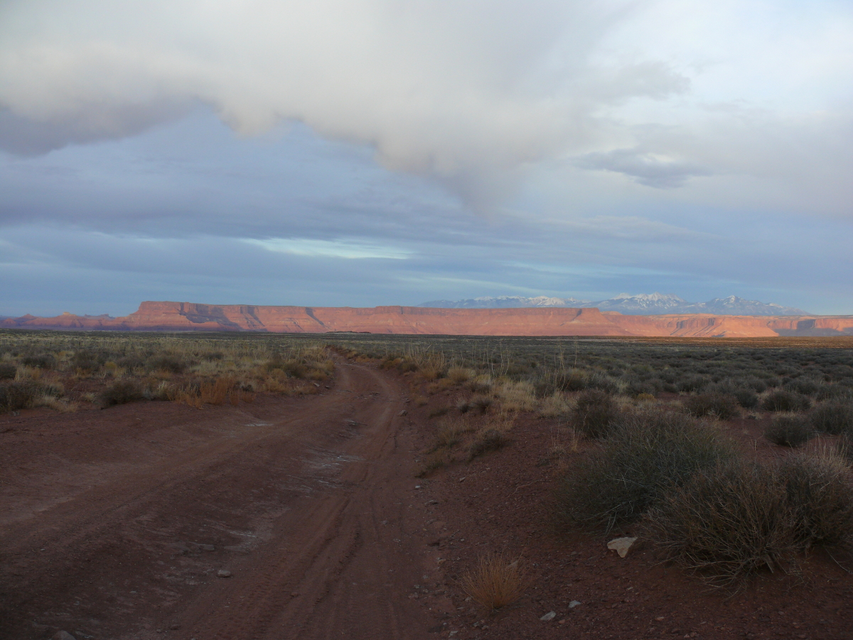
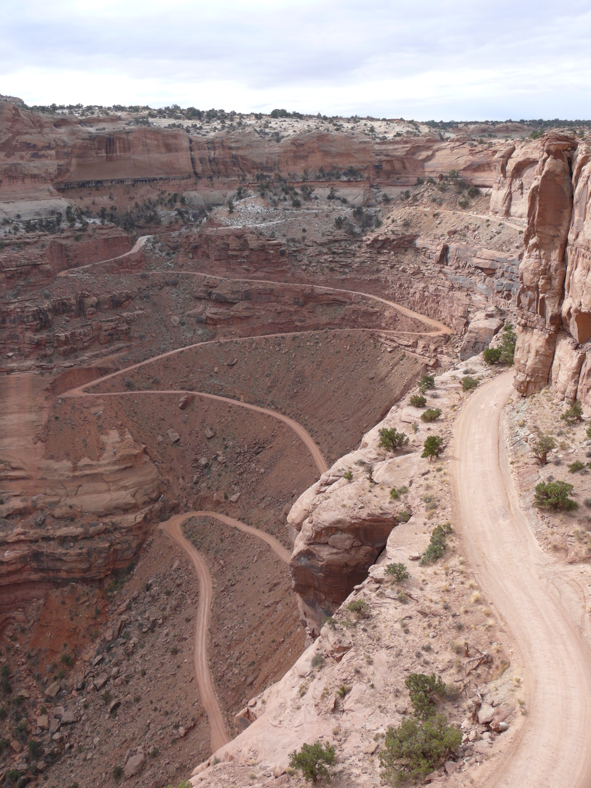
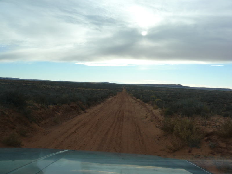
We set out for Canyonlands National Park. There were a fair number of maintained trails we could traverse to get there. This particular trail was so well-groomed that, by comparison, we thought it was paved!
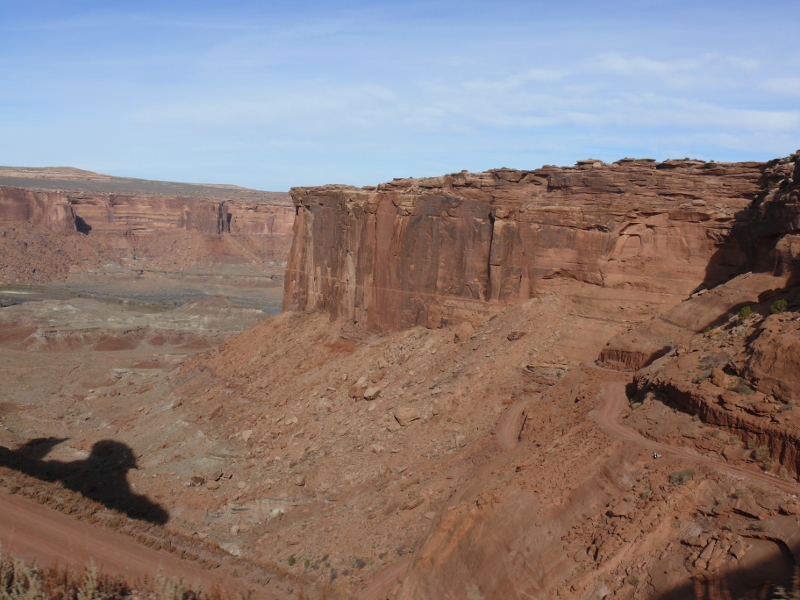
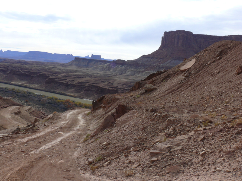
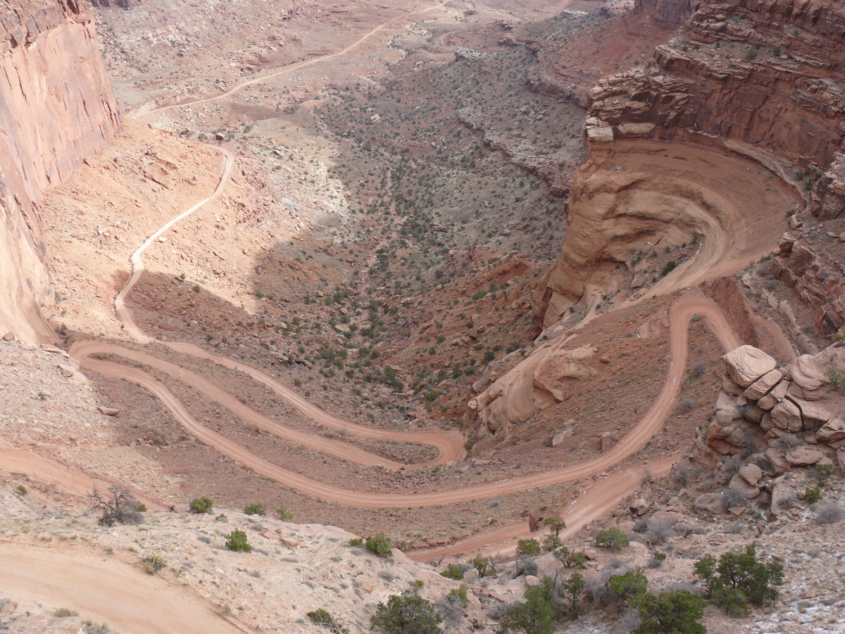
We started down Mineral Road (or Horsethief Trail) to Mineral Bottom. This includes a total drop of about one thousand feet, while driving along a road clinging to the side of a canyon wall.
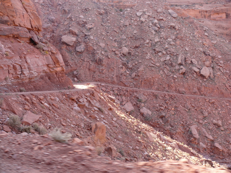
The drop became obvious as we descended. This photo helps to show the width of the trail. Little room for error. Here are two videos taken during the descent. In the second video you can see a repair job.
m34a.avi (12.6MB) & m34b.avi (19.6MB)
At the bottom of the trail, we were greeted by a soon-to-be arch quietly awaiting fame. This potential marvel will probably only ever have the Green River and future off-roaders as an audience. Will Jeep still be moving people around our primitive lands when this arch forms?
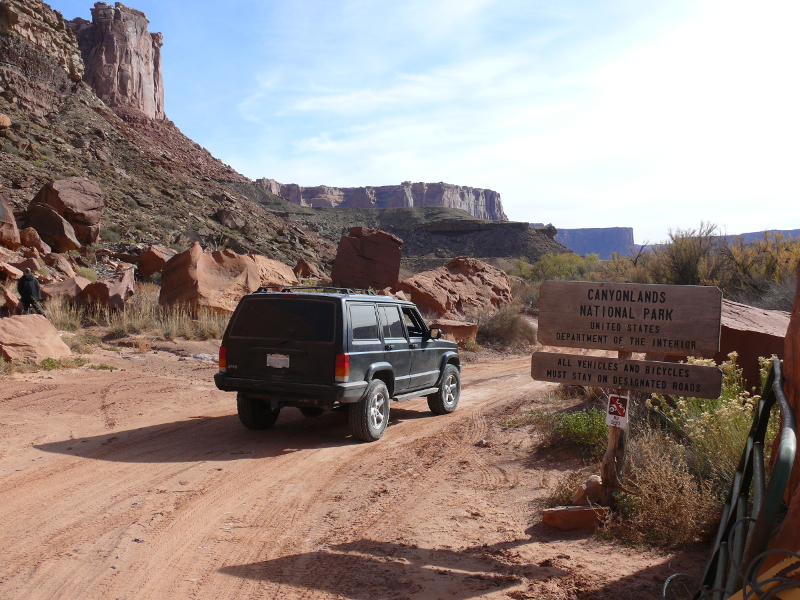
Welcome to Canyonlands National Park. I'm not one for signs, as you probably know by my history of speeding past them; but this one made an impact. Maybe it was the conclusion of an adrenalin rush from the descent or the realization that we were in a remote National Park.
 |  |  |  |
Here, we broke for a very welcomed lunch. Our meal of hamburgers may have been accentuated by the startlingly stunning surroundings, or maybe the store-bought ground-beef patties were just that good
We loitered for a good time in this campground. Yes, it was probably illegal. But it probably wouldn't have taken much more than a campground-fee drop-box to make it an early day for us! (Ahem, if the National Park Service is really looking to increase revenue, maybe it's time to build a small wooden box for each site? More later.)
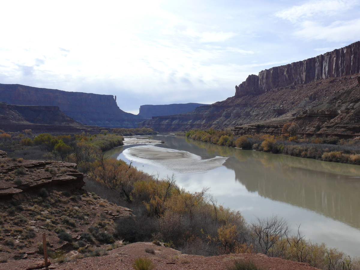
Rather grudglingly we set out again. As Mike navigated the twists and turns, I began to wonder why the Green River is called that. Not too much later, I was rewarded with photographic evidence.
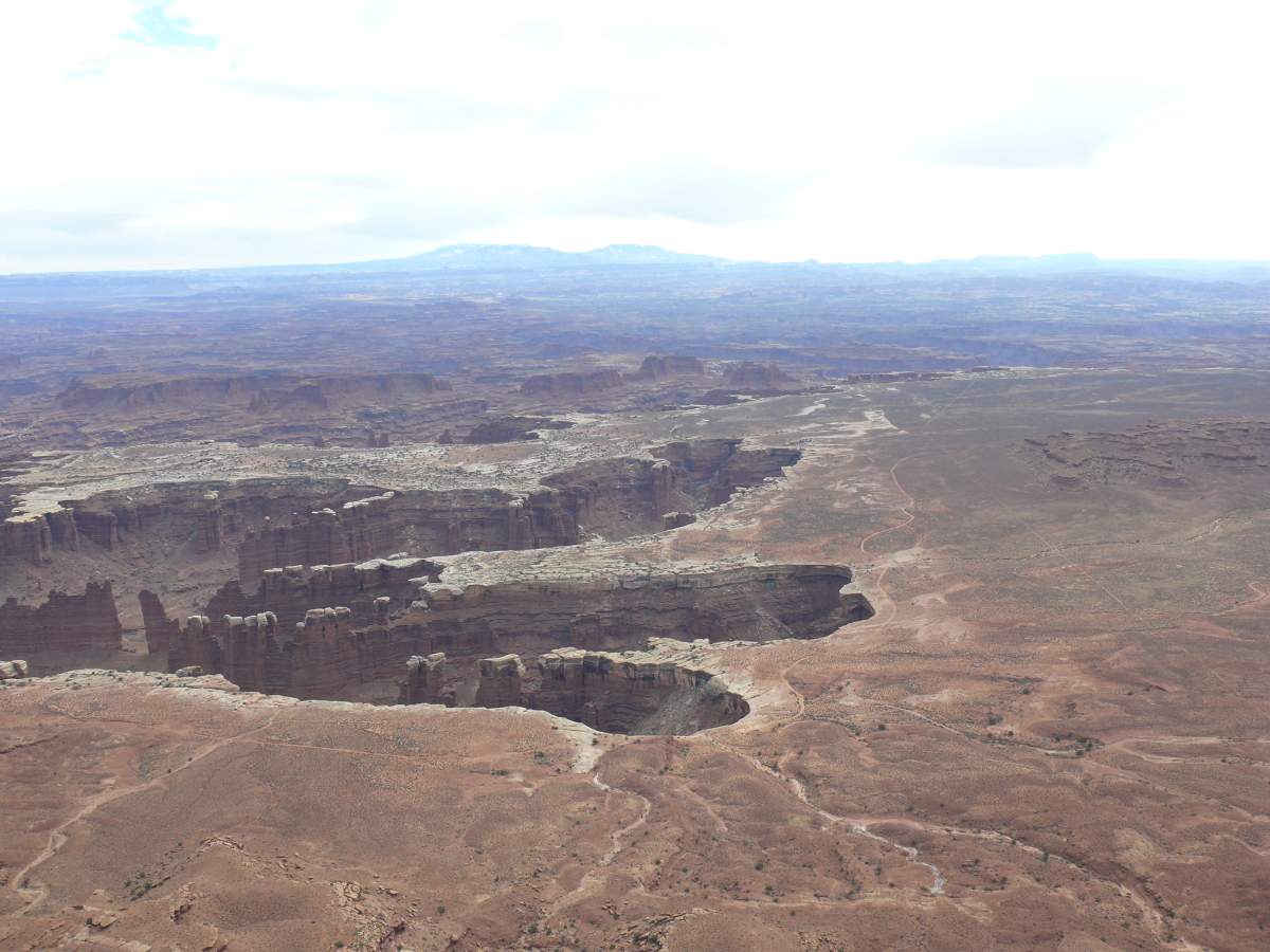
Welcome to Canyonlands! Click for a larger view.
This photo shows the typical condition of the trail.
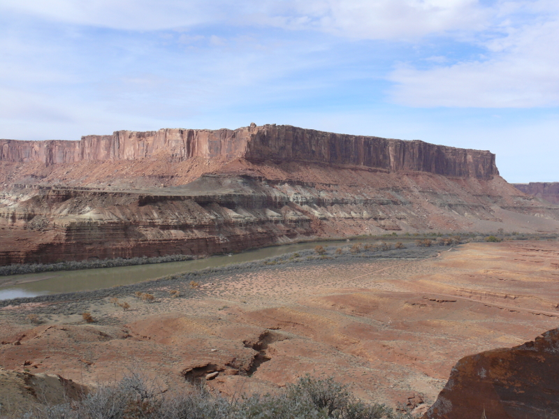
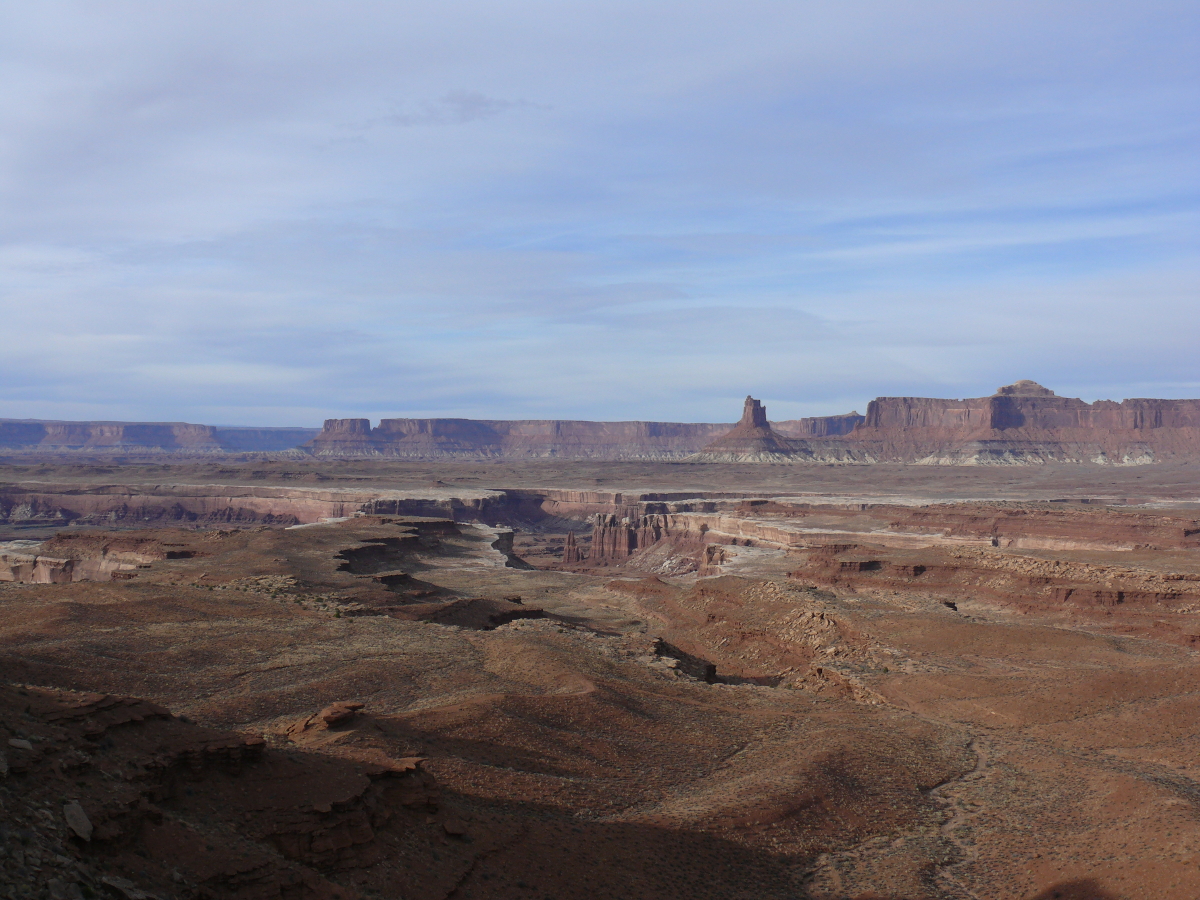
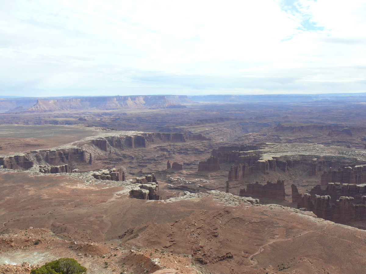
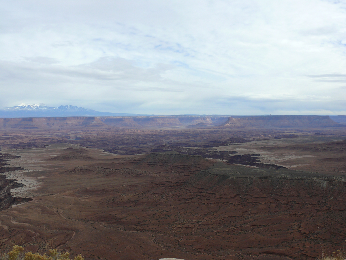
As I noted the mileage of the "primitive" campgrounds, we caught our first glimpse of the namesake of the White Rim Road. A long time ago--before George Lucas was even born-- there was a sea lapping this high plateau. Naturally, it left sand that became the landmark of this precarious four-wheel trail. Of course, since then the sun has shined quite a bit, and as expected, the white sand has become a white escarpment in many parts.
We stopped for a better look. I told you it was old. Now, you can see for yourself. Click for a larger view.
As we walked around floored by the primitive beauty, our loyal steed waited.
Oh, and that ancient sea was quite deep. We figured it was about 1,500 feet deep using the throw-a-rock-and-count method. Scientists all around the world use it. Click for a larger image.
We set out again and the trail got narrow. Take a look:
m47.avi (4.9MB)
Almost midway through the White Rim Trail is the Murphy Hogback. Here the trail became very steep and sheer. I think it frightened both of us, especially when the Jeep got stuck and then wobbled. Mike had to stop and change into 4WD low. Fortunately, there's a campground at the top with a toilet! Click for a slightly different view.
Here's the video: m48.avi (4.7 MB)
 |  |
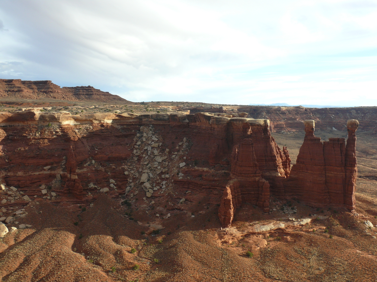
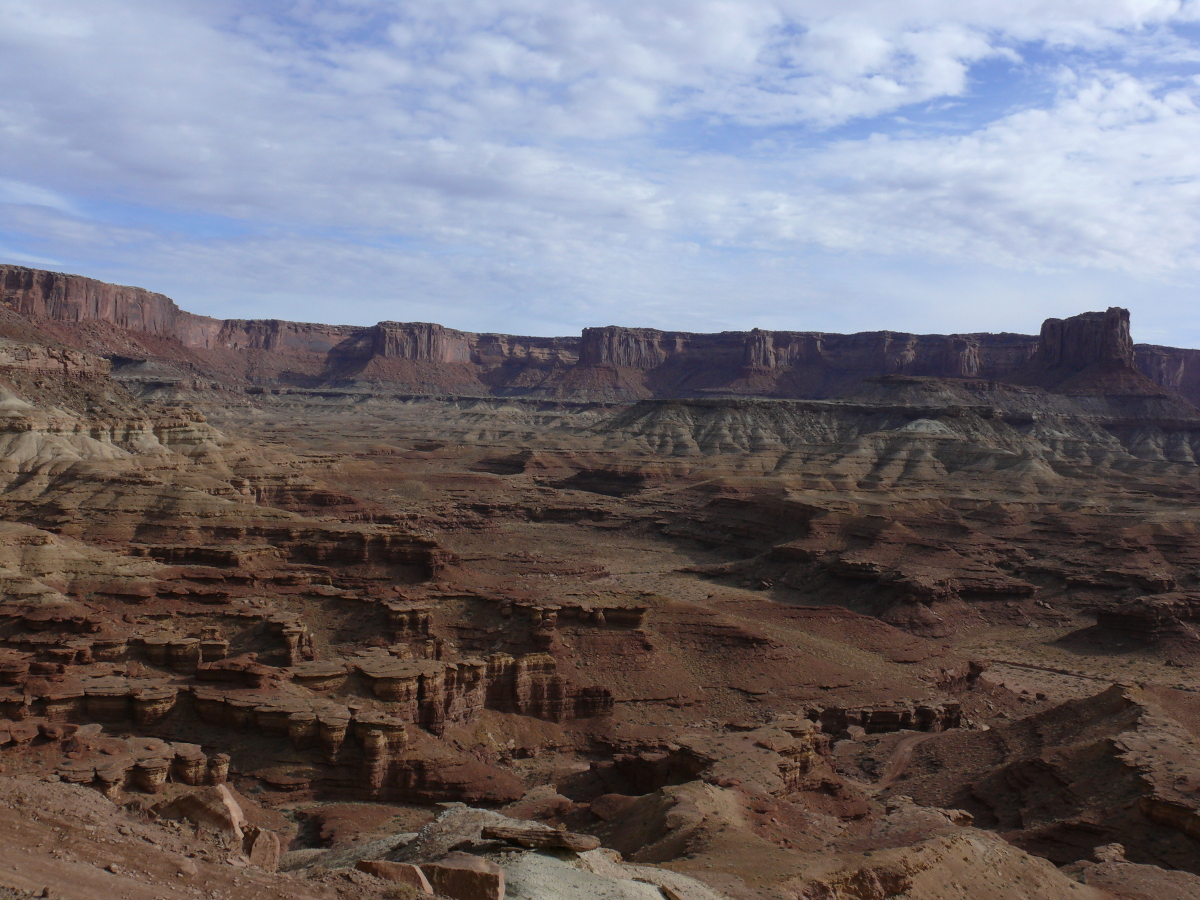
The scale of things in canyon country is tough to convey in a photograph. In the photo above, it looks like someone carelessly spilled some Pringle potato chips. In fact those "chips" are boulders. The little dots of green are trees. This formation is unlabeled in the National Park map. Click for larger view.
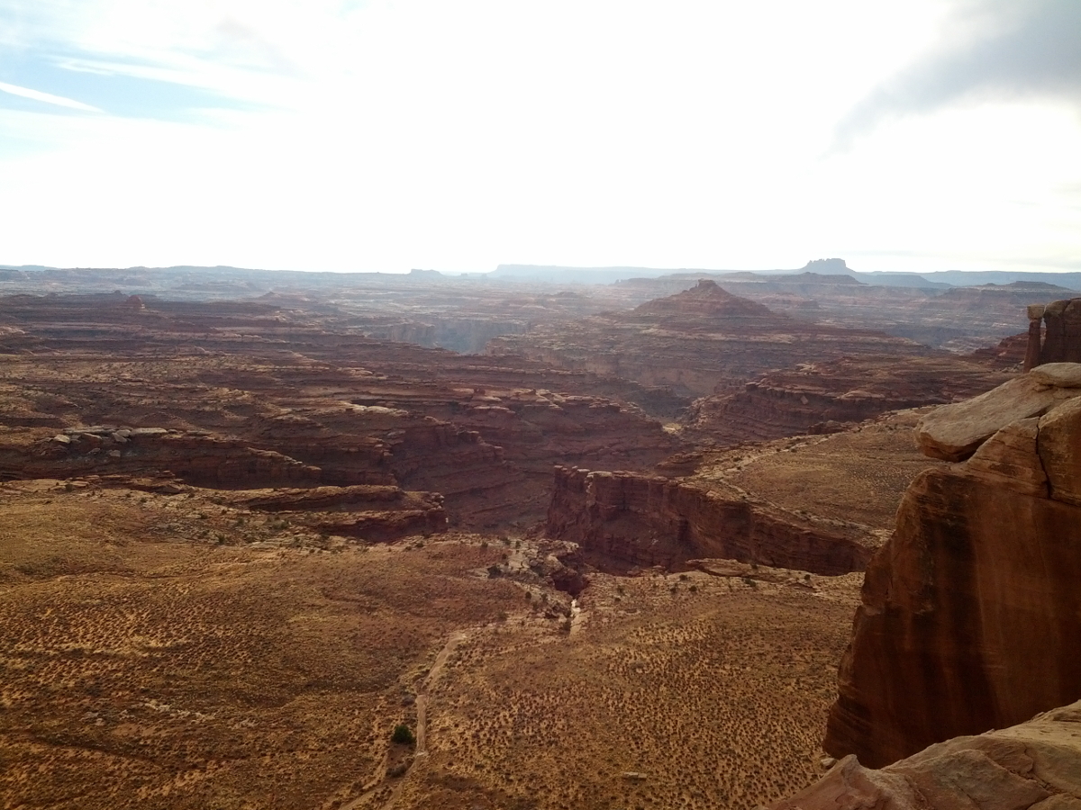
The camera in Mike's phone takes some pretty good photos. Click for a larger view.
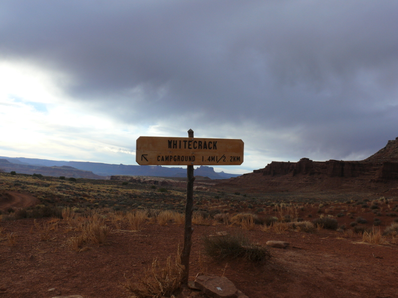
The sun was starting to set and we were only halfway around the Island in the Sky, as the mesa that the White Rim Trail clings to, is called. So we decided to drive to the White Crack campground with the intent of paying for a site.
Unfortunately, there was no pay box here either. I consulted the guide book, and it said reservations are made at least a month in advance. Mike called the office, which was closed. We decided to head out despite the total vacancy at the campsite. This didn't stop us from stealing some photos!
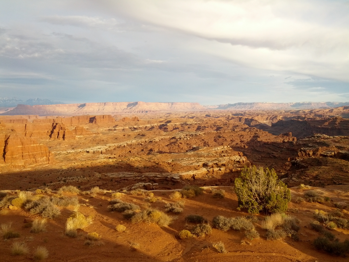 |  |  |
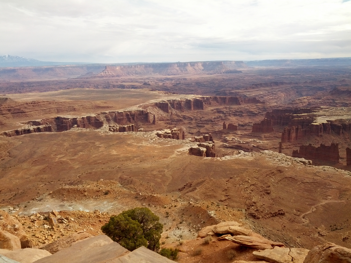
Back on the main trail, we stopped to admire the wide, open space. The vibrant colors and terrain are beautiful. Click for a larger view!
Around dusk we were only about two-thirds of the way around the Island mesa. The new headlights work well! Here's a video of driving even closer to the edge:
m58a.avi (1.7MB)
Since it was pitch black before we made it back to pavement, I navigated via the GPS. This was a godsend because the trail seemed to be treacherous. Take a look here. (m58b.avi - 1.7MB) We vowed to come back tomorrow and see it in the daytime.
But till then, we spent the night in luxury, in a Motel 6. (Don't laugh. Any motel is luxury!) Also, we learned from the girl at the check-in counter that all public buildings in Utah are smoke-free. Interesting.
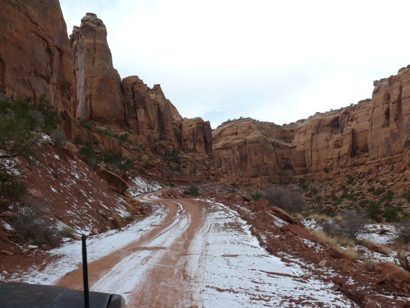
The next day we set out along our favorite shortcut, Long Canyon.
We entered Canyonlands N.P. like normal, two-wheel-drive folks through the main gate. We stopped in the visitor center where we purchased souvenirs including an excellent road/topographic map of this area.
Our first stop was the Shafer Canyon Trail. Click for a larger view.
Shafer Canyon is the trail we went up in the darkness. Ahem, that's a drop of 1,400 feet. I'll admit dropping did cross my mind a few times last night! Click for a larger image, if somewhat different view.
We did go down the trail. By this time, Mike was quite adept and we cooked along. Unfortunately. the road was closed below so we had to turn around and follow an amateur in a SUV back up. Patience is a virtue, right?
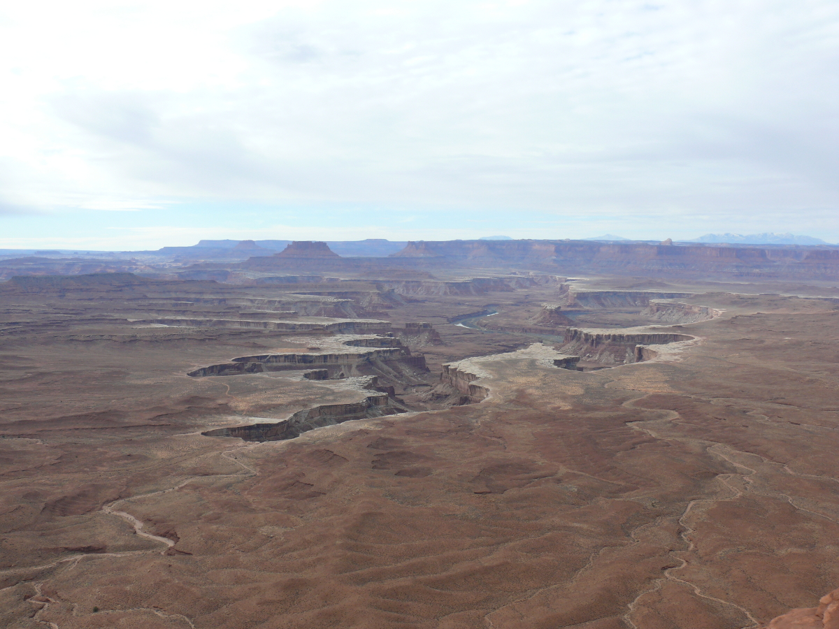
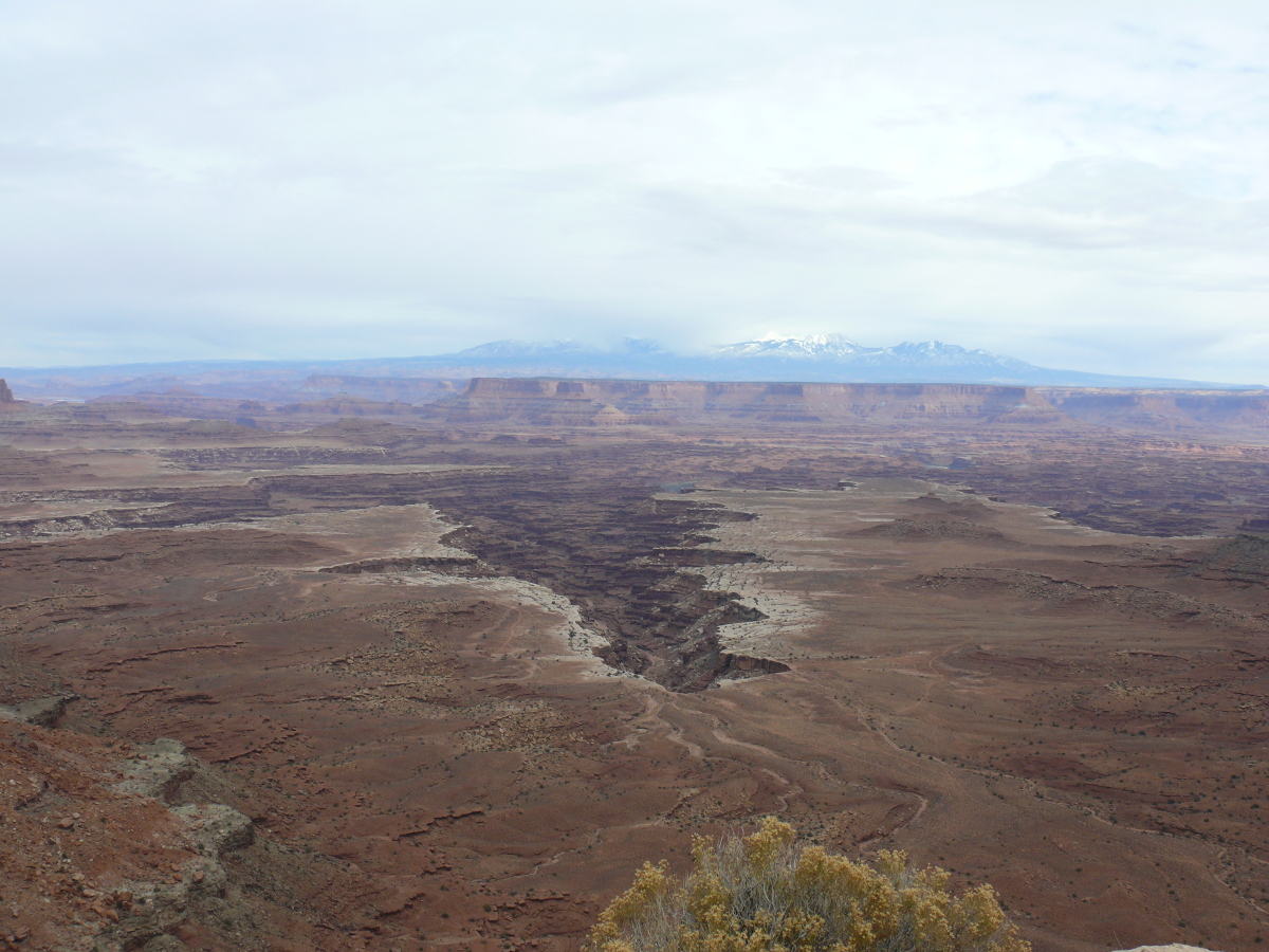
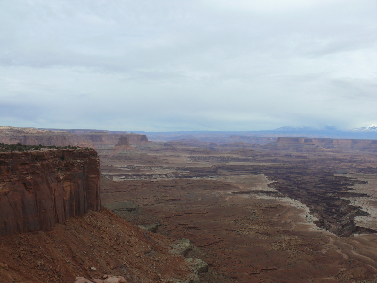
Back on the paved road we drove on. At the Green River Overlook--I always think of Chevy Chase singing "Green River"--we saw where we first entered the National Park yesterday. Here the White Rim is clearly seen. Imagine an inland sea lapping those canyon walls. Amazing. Beautiful. Stunning. Click for a larger view.
We're at 6,000 feet above sea level at this point. This trip is turning out to be the opposite of last year's , which was around sea level!
John Wesley Powell, a retired, crippled major from the Civil War, made an expedition down the Green River, past the Confluence (where the Green River meets the Colorado) and on to the future site of the Hoover Dam. The Park Service plaque said that people can enjoy the same scenery, only from the total security of a rubber inner-tube.
This is incorrect because in '66 the Glen Canyon Dam flooded a lot of the area that was dry during Powell's journey. Of course, the downstream Hoover (or Boulder) Dam also contributed to this submersion of the general area in the '30s.
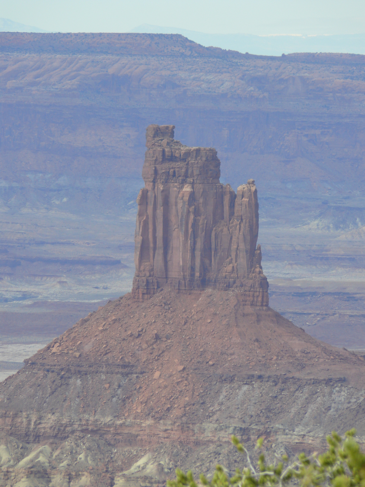
This is the Candlestick Tower. We saw it from 1,400 feet down. Still impressive. Click for a zoomed in photo.
Since Mike was used to the near trepidation of off-road travel, he went a bit crazy on the predictable pavement!
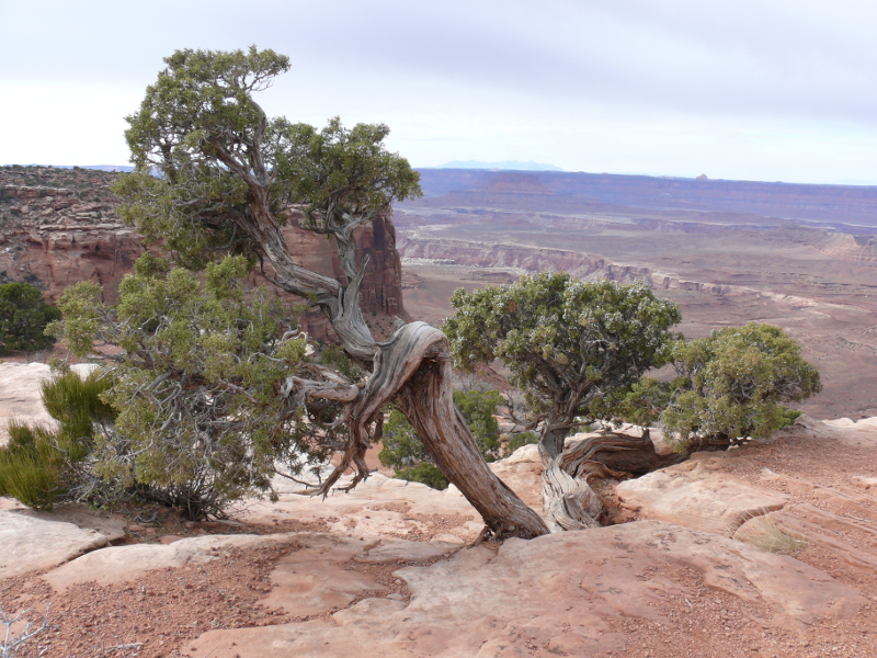
By this time, we were bored. So, at the next stop, I took a photo of a gnarly juniper. Rad!
We parked. One of the first things I noticed were the paved sidewalks. (I do love the natively red cement.) Watch out for old women in motorized carts!
And then I noticed the poor use of firewood. I'm sure those junipers died wanting to line the path to the loo. "When I grow up and die, can I show idiot tourists where to relieve themselves?" This example of civilization made me wonder when are the flush toilets coming?
We continued on, along the "handi-capable" ramps made of that lovely red cement, to the Grand View Point Overlook.
The view is impressive. Take a look:
 |  |  |
 |  |  |
I think we were both happy to show the Tarmac our backside. Canyonlands isn't just a few views or checking off a box in a to-see list. It is camping, four-wheeling, companionship, and solitude.
Solitude doesn't necessarily mean loneliness because I had the best companion. Solitude is a state of being without the rest of the confusion and fear that we call civilization.
In the above photo, we're quickly heading towards the Green River near the Tenmile Canyon. This photo reminds me that no matter what people may say, or want to believe; this country is not overpopulated. Thus, obtaining the necessity of solitude is easy to do. One just must want it!
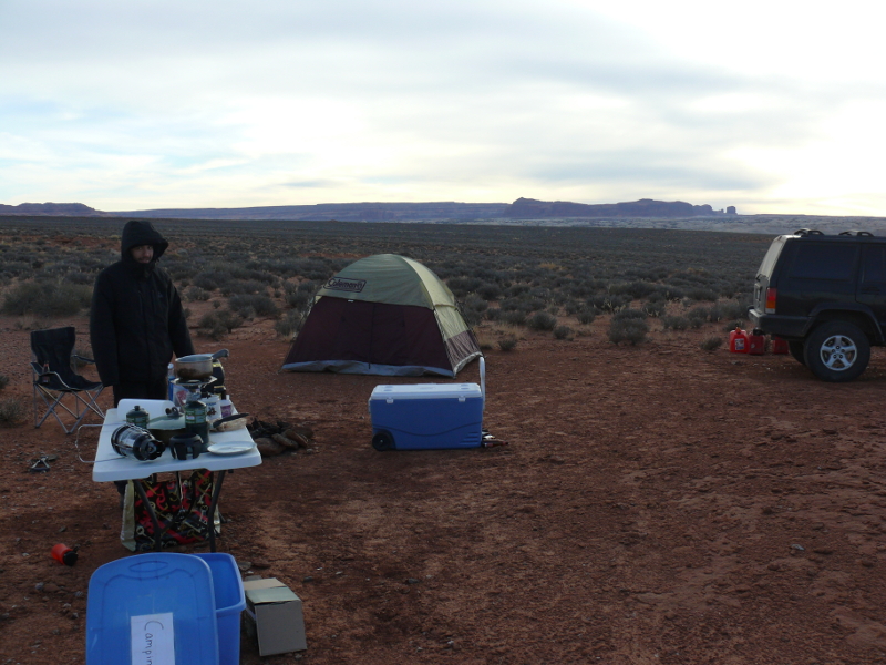
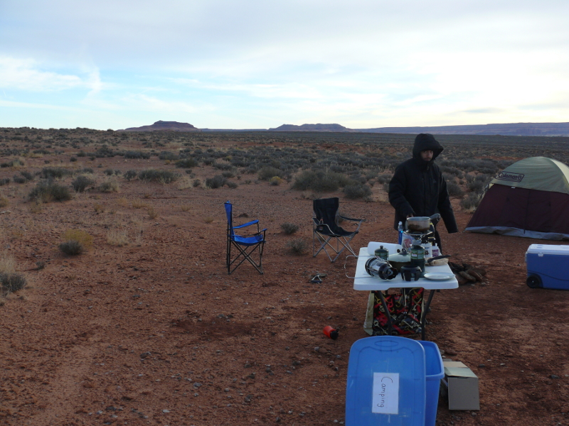
Anxious to find another campsite like our first night, we four-wheeled up and down this trail. If the Jeep wasn't blocked by trail conditions, it was petrified cow shit that stopped us from bedding down. Eventually, we found a good spot along a side trail.
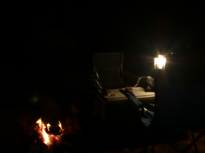
Being good campers, we made a fire ring. Unfortunately, we couldn't dig down more than a couple of inches so it took a lot to get a fire going. The campsite was on a large ledge that supported little life. Not even the hardy juniper attempted to expand into this region of dust-covered ledge-rock. So, we relied to desperate measures to start a lasting fire: m75.avi (8.7MB)
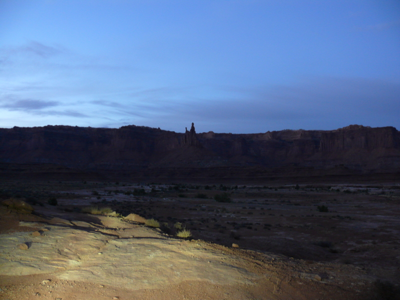
Mike and I played a game that is peculiar to where I went to high school. It is a very enjoyable game, but we both took a few minutes off to enjoy our peaceful surroundings. That's when I snapped a night shot! Life at its best.
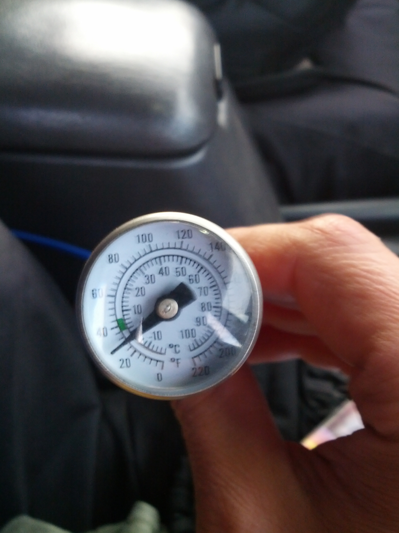
The night was cold. I had prepared by putting three sets of socks inside my coat, to pre-warm them. These, I donned as I slid into my new sleeping bag (provided by Mike). The warm socks helped. Still, it was colder than our other night of camping, which was cold. Mike recorded the temperature.
When we did finally rise, it was damned chilly. The water jug had a decent amount of ice in it. See, plastic isn't all bad! In this photo Mike is probably wondering: are you taking a picture of me?
Oh shit, he is! I'd best look busy...
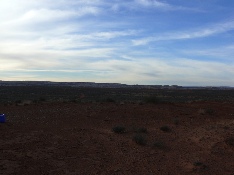
The view was expansive in all directions. As you can see, there is no dead juniper hanging around. It's a good thing we brought some firewood!
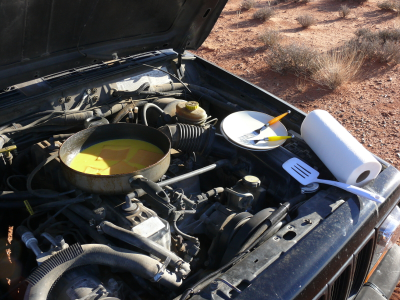
Because we couldn't find any more firewood and the remaining propane tank was filled with a questionable amount of fuel, we resorted to our Jeep. Breakfast sur-le-Jeep is cuisine. Don't believe it? Ask the American soldiers what they were cooking in the winter of 1944.
Pictured above, Mike is following the recipe that calls for specific heating over a propane camp burner, after le Jeep. Why question our motives? Don't you know we are connaisseurs? Beautiful setting for sure. Click for a larger view.
Could a more pleasant campsite be expected? Sure, it may be very cold but it is a bit too picturesque to complain.
And for the record my tent was not full of smoke last night. It was very pleasant
We broke camp and set out towards the interstate highway. This meant we luxuriated along groomed trails. But what happens when you accidentally follow a "trail" because it goes the direction you need? You land yourself in trouble, as Mike pictured above.
Our trek back to the main road wasn't easy. We found a "kiddie" dirt-bike trail. It was challenging in a Jeep. Take a look: m83.avi (2.9 MB)
 |  |
The trip back to Orange County was uneventful. We played the guess-the-gas-mileage game using Mike's mobile phone and www.fueleconomy.gov.
We decided that we'd be coming back to Canyonlands. Even with all the off-roading we'd done, we'd still only seen a third of the park!
I'd like to thank Mike for going through all the video we took with the Go-Pro. If he hadn't taken the time to call-out the highlights, this page would have far fewer videos!
 |
Copyright © 2002 - 2024 Billsuniverse.com